Good evening, folks. Our cold front continues to slowly work into the region and will bring gusty showers to the region later tonight and Tuesday. That front then slows down to our south and allows for another wave of low pressure to develop along it. Several models are now making it a pretty close call for some winter weather in the southeast.
First things first, let’s track the showers moving in from the northwest…

Those showers become pretty widespread on Tuesday as winds gust up. Temps remain mild, but begin to crash behind the front from northwest to southeast.
That sets the stage for a seasonal brand of chill on Wednesday as skies go mostly sunny.
The European Model now brushes far southeastern Kentucky with a little bit of a mix of some light snow by Thursday…
 The NAM goes the same route…
 The GFS is a bit north as well…
 The ICON is most aggressive…
![]()
![]() As we head into the weekend, we find our next system rolling our way by Sunday. Nice weather will be noted ahead of this, but things change quickly as a bowling ball of a low pressure works in. The Euro has rain and snow with this and follows it up with another system a few days later…
As we head into the weekend, we find our next system rolling our way by Sunday. Nice weather will be noted ahead of this, but things change quickly as a bowling ball of a low pressure works in. The Euro has rain and snow with this and follows it up with another system a few days later…
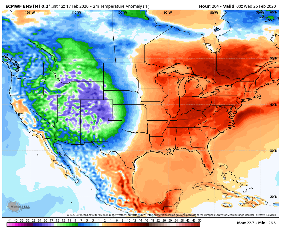
 You can see the cold coming in at the end of that run and this is something the Ensembles continue to point to as we end the month and begin March…
 Make it a great evening and take care.
