Good afternoon, folks. Snow showers and flurries are finally winding down across the region as we turn our attention toward another light snow maker for Friday. Once we get rid of this, it’s full steam ahead toward a busy first week of March. Spring temps, the potential for strong storms and heavy rainfall will dominate the the opening of the third month of the year.
Snow showers and squalls last night caused travel issues this morning, but conditions are improving. Flurries and snow showers continue to decrease this afternoon…

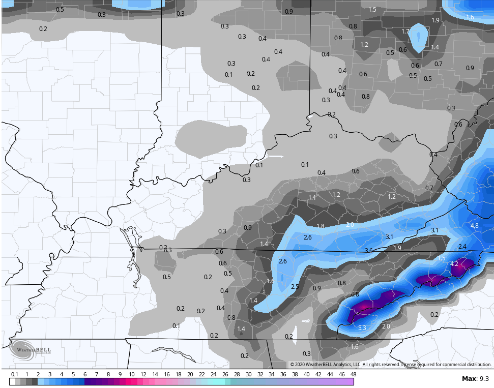
The light snow maker coming Friday is looking even lighter. One round comes in the morning with another round in the evening. Snowfall totals of coatings to 1″ show up in areas of central Kentucky, with a couple inches possible across southeastern Kentucky. Here’s the GFS:
 Saturday continues to look better as temps climb into the upper 30s and low 40s across the central and east, with mid 40s west.
Sunday is the absolute best day of the next week. Highs jump deep into the 60s with a partly sunny sky.
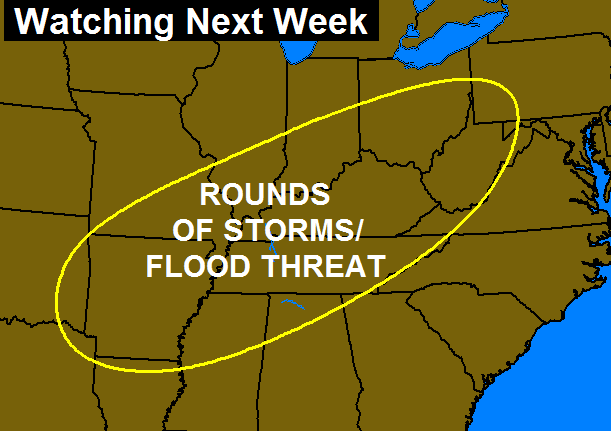
This brings us to the interesting part of the weather story. Showers move in for Monday with temps again making a run into the low 60s. This is ahead of a potent looking setup that could throw waves of thunderstorms and heavy rain at us. Strong storms are possible and rainfall could be excessive. Here’s the area I’m initially highlighting…
 I will have the latest on WKYT-TV starting at 4pm today with another KWC update this evening. Have a good one and take care.
