Good afternoon, everyone. I wanted to drop by for a quick update on the quick hitting shot of winter weather coming in later tonight and Friday. The longer range for the weekend continues to look great, with a warm and stormy pattern next week.
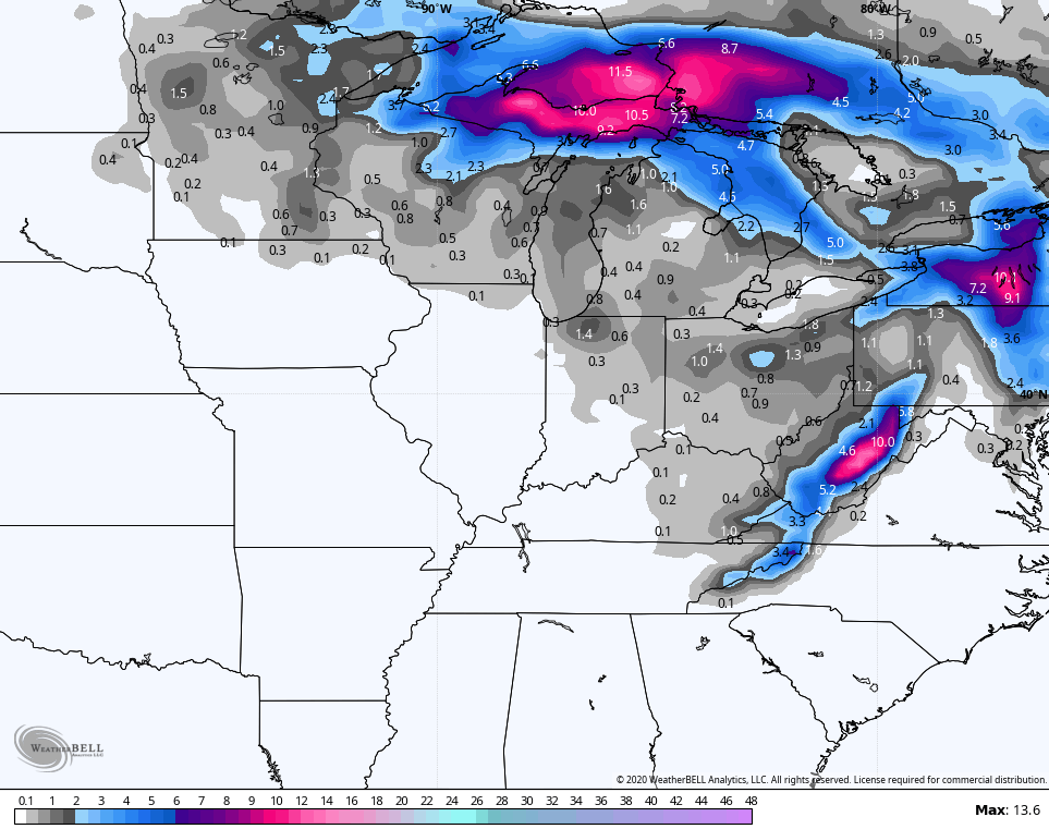
Let’s start with a cold front dropping in tonight. This may spawn a gusty band of showers and it works through here…

As the cold air surges in behind our front, winter weather shows up late tonight into Friday. Rounds of flurries and snow showers will be likely on that strong northwest wind. Small accumulations will be possible across the east, and especially the southeast.
Hi Res NAM…
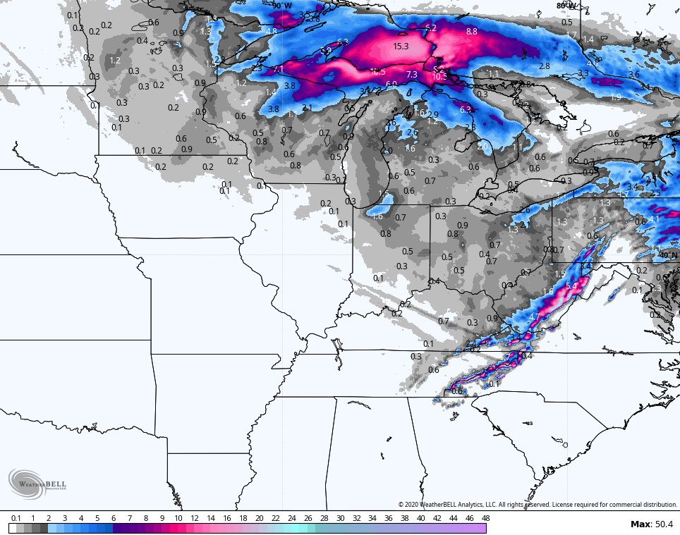
GFS
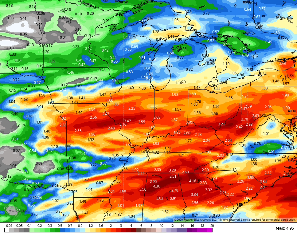
 The weekend looks amazing with 50 for Saturday and the 60s for Sunday. Both days feature quite a bit of sunshine. Beyond that, next week looks warm and stormy. These storms may be strong and put down heavy rains. The GFS rain numbers through this time…
 Folks, it can get VERY warm and stormy over the next few weeks.
I will have the latest on WKYT-TV starting at 4pm then again on KWC this evening.
Have a good one and take care.

For those who might be interested, the Meteorological Winter and February review for the Chicago area is available at http://weather.gov/lot/February2020Climate
The three months of meteorological winter wound up being the 14th warmest winter for Chicago since the 1880s! Only 18.6 inches of snow fell at O’Hare Airport during those three months, which is 9.5 inches below normal.
Snowfall for the season at O’Hare currently stands at 26.9 inches, while here in the SW suburbs at the NWS forecast office in Romeoville only 21.8 inches of snow has fallen thus far since late October.
I actually received a few inches of snow last week…very quick hitting/melting events but brought my season up 7 inches. I know 7 inches, lol, still better than most locations in KY and I live in the valley. I am under an Advisory for tomorrow but it is for over 2,000ft up, so I doubt I see accumulation unless the snow showers hang tough past dark tomorrow as I live down low at around 1200ft elevation with temps expected in the upper 30s.
I think I gave Jimbo a run for who received the most (or least) this season. I think he has had about the same as me. Still, I beat out 2019, 2012 and 2017 seasons with about a tie, so far, for 2018. Bad year for snow but not my worst ever.
I climbed up to 8 inches after a little half inch dusting last Friday night. Less than an inch more than last year. Really sad for the last 4 Winters, I don’t think I have hit double digits any of those years if so it was barely at 10 or 11. If not for that one big storm in January of “16”. I could add fifth year to that snow drought. So far you are still ahead on the race to the bottom.
Same here. 2016 was basically a blow torch winter with only a few tiny snows except for that late Jan arctic blast and decent snow. Harlan was on the edge of that one and received only 8 inches while many got a foot plus just a little to my north. Maybe, I get an inch tomorrow, although temps say otherwise, and I can tie you:)
Honestly, I am done and ready for spring and trying to get my poor palms through this soggy time.
I am closing in on 17 inches of rainfall for the year through March 5th. This is a tie with 2018, not good!
Terry, how much rain did you get for February? Did you break 12 inches for the month for the third straight year?