Good Tuesday, everyone. We have a cold front brushing the state today and it’s spitting out some early day showers for parts of the state. This is a prelude to a much more active pattern kicking in later this week into the weekend. It’s one that looks to continue to keep our temps averaging cooler than normal for the foreseeable future.
Let’s begin with today and roll forward. Gusty showers will be possible across the eastern half of the state into early afternoon…

Drying winds take control behind the departing front, but it’s also a much cooler wind. As skies clear overnight, readings drop into the frosty 30s across central and eastern Kentucky.
Clouds increase on Wednesday as a potent storm system rolls in from the west. Temps will be near normal before any shower or thunderstorm action shows up from west to east in the evening. That sets the stage for rounds of showers and storms Wednesday night through Thursday. Heavy rain will be possible.
Friday looks to be a pretty nice day as we are sandwiched between systems. That next one could fire up some strong storms Saturday as low pressure strengthens in our region. That one taps much colder air for Sunday and Monday.
Both systems show up well on the models…
GFS
 EURO
EURO
 Another system will likely drop in and follow a similar path early next week. Overall, the next week to 10 days could put down a lot of rain across our region.
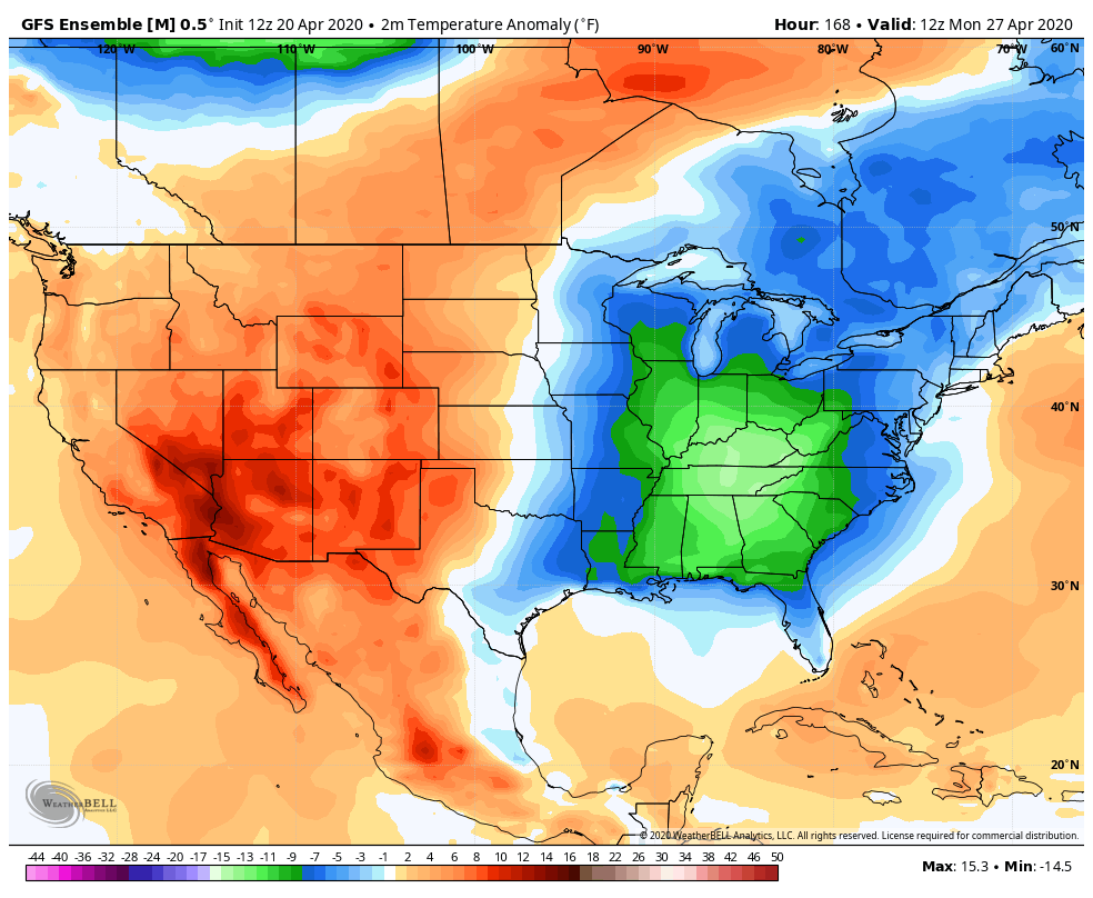
Unfortunately, temps look to average below normal as far as the weather eye can see. The Ensembles show this lasting through the first week of May, at least…
 Make it a great Tuesday and take care.

Sorry CB, but I bet the ensembles end up wrong.
That may be Jeff, but the current weather pattern seems to be holding strong. I like the temperatures as of lately especially with the lack of humidity and the cooler nights but, not the frosty mornings. Any day we don’t have “severe weather alerts” is a plus in my book. I can handle the “April Showers” as they bring May Flowers hopefully.
I love the temps.
Maybe temps could be a tad warmer at night.
I’d be happy with mid 50s at night, 70s daytime with current humidity levels and maybe a 10mph sw breeze.
I love the temps.
Maybe the temps could be a tad warmer at night.
I love these temps!
About 4pm yesterday, I opened up my window (I have this big window fan) and I turned it onto exhaust, opened up the storm door on the other side of the house and it created a great cross breeze. At the time it was in the 50s outside. It felt great, but it wasn’t able to drop the temp in the house to below 70F. Why? I don’t know. Around sunset, I closed everything up and although it felt comfortable inside, I got up around 330am and it was still 70 in the house (LOL)