Good Friday, folks. It’s another very warm and humid day, but a cold front will help us out a bit later in the weekend. This “help” will be short-lived as temps surge early next week ahead of Tropical Storm Cristobal. That system will impact our weather by the middle of next week as temps come crashing down behind it.
Let’s talk about the weekend before we get into all that. Our Friday is featuring a few more rounds of showers and storms going up. One or two could be on the strong side as temps are back into the muggy 80s.
A cold front drops in for Saturday and may still fire up a storm or two, especially in the south and east. Temps are still toasty, but start to drop from north to south late in the day. That leads to pleasant weather for Sunday across the eastern half of the state. A few spots may stay in the upper 70s with much lower humidity.
Tropical Storm Cristobal continues to strengthen and move to the north in the Gulf of Mexico…

Here’s the forecast from the National Hurricane Center, bringing the cone of uncertainty into parts of Kentucky…

Cristobal may become a weak Hurricane before coming ashore in Louisiana late Sunday or early Monday. The remnant low from this is likely to lift northward through the Mississippi Valley early next week. That should then get picked up by an approaching trough…
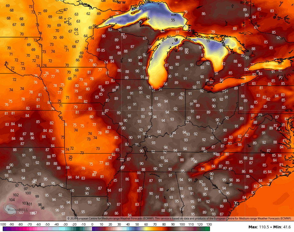
 You can clearly see how this does bring some rain into the area by late Tuesday and Wednesday. Temps ahead of tropical systems can really take off and there’s a chance we get into the low 90s on Tuesday. The Euro is seeing this…
As the trough swings through here, the numbers come way down by the end of the week into next weekend. That same Euro shows highs in the 70s…
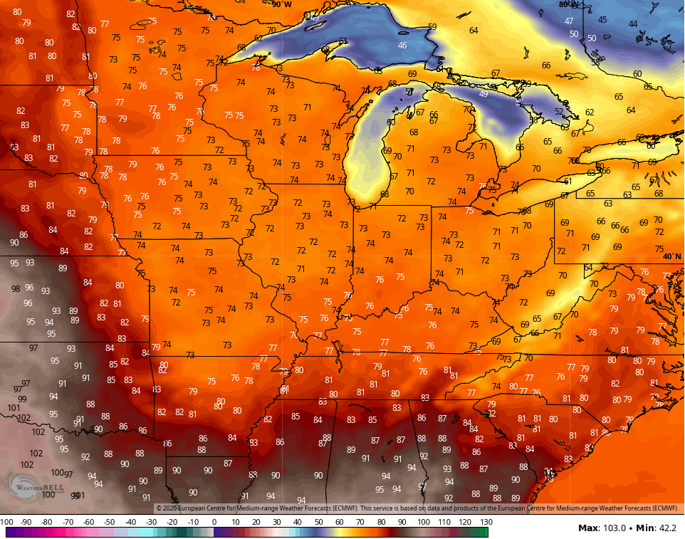
Lows could even dip into the 40s. Yes, please!
Here are your Friday storm tracking toys…


Make it a great day and take care.
