Good Thursday, everyone. The much talked about upper level low is back into the region today, bringing an increased threat for showers and thunderstorms. This action kicks off what looks to be a much more active setup that turns wetter than normal in the coming weeks.
Temps will be running cooler than normal today with highs mainly in the 70s. The threat for showers and storms is across the entire state, an indication of how far west this upper low is getting. This is something we have talked about for a long time here on KWC. According to weather twitter, this appears to be a shock to many other weather outlets.
Here are your radars for the day…


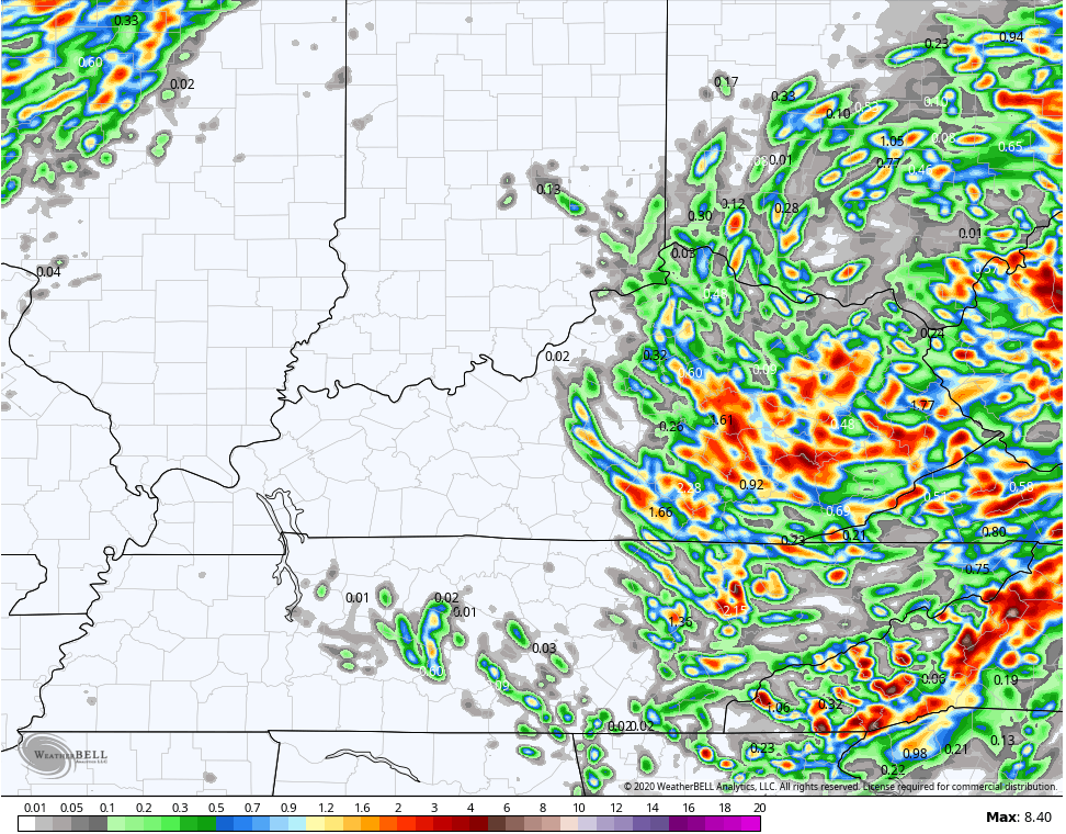
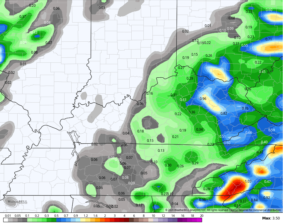
Additional showers and storms will flare up on Friday as the upper low starts to finally pull away. Locally heavy rains are possible today and tomorrow, with the greatest concentration across the east. Check out some of the forecast totals…
HI RES NAM
NAM
Friday temps will soar into the upper 80s west, but may stay below 80 in the east.
Those numbers jump this weekend across the board with a 90 possible in the north and west, especially. Humidity levels will also climb and there’s the daily threat for a few showers and storms going up during the afternoon hours.
Showers and storms will then increase Monday and Tuesday as a front works into the region. Another system then follows that up with cooler air for the middle and end of next week. You can see the increased threat for showers and storms on the GFS…

Enjoy the day and take care.

Thanks Chris, With the upper level low slowly moving to the west, I am hoping for showers to increase throughout the state today as rain is needed now for the crops before the “real deal” heat of Summer gets here.