Good Wednesday, everyone. It’s a very comfortable feeling day across the area as another deep trough slides in from the northwest. This will keep the pleasant air rolling into Thursday, but we can’t seem to shake the scattered storms. Once into the weekend, the storms threat will increase as more typical summertime temps return.
Highs out there today are generally in the 70s for many. Humidity levels are down with a nice breeze blowing from the northwest. With a cold pocket of air aloft, watch for a few scattered showers and storms popping this afternoon and early evening.
Here are the radars to keep you company for the day…

Thursday looks very similar to today with highs in the upper 70s and low 80s. Once into the afternoon, a storm or two looks to blow up and show up.
Temps surge back into the 80s on Friday as humidity levels inch up. This is when we will start watching for clusters of storms to impact the region. That action may crank up even more for the weekend and early next week…

Temps are steamy during this time, but the core of the heat continues to stay away from Kentucky. The setup for the first week of July finds a big heat ridge developing well to our north…
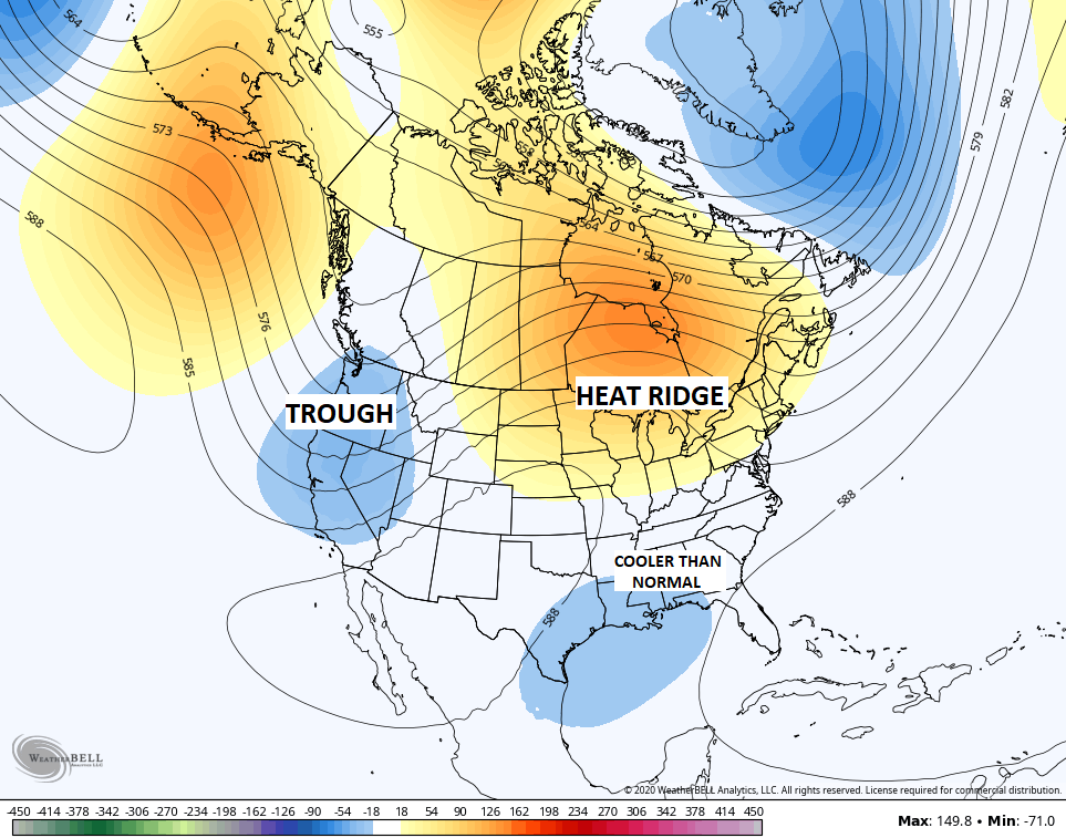
That’s a heat wave for areas of the Great Lakes into New England and southern Canada. You notice the lower heights across the south and southeast. That leads to unsettled weather and cooler than normal temps. Kentucky is sandwiched in between those and that’s usually a good place for near normal temps and above normal rainfall.
Enjoy the day and take care.

Thanks Chris, the projected heat wave for the lakes states and into Canada looks odd versus the below normal temperatures along the Gulf coast. It could be that the models are factoring in the “dust from the Sahara Desert”? Meteorologist are saying that the dust in the upper levels of the atmosphere could delay tropical storm development in the Atlantic in the coming weeks, which is a good thing.
With Kentucky “sandwich” between the hot air to our north and the cooler air along the Gulf, I just hope it doesn’t “rain mud” here in the Ohio Valley due to the dust added to the atmosphere. I saw this happen once in the Spring of 1965. A lot of cars needed a wash. lol
The fact that the dust could be picked up and become the monster entity that can travel across the entire Atlantic ocean and still be in the air 1000’s of feet up is crazy!