Good afternoon, everyone. I wanted to drop by for a quick update on the flash flood situation across parts of the bluegrass state. A lot of rain has fallen and we have a lot more rain to come over the next few days, if not longer.
Let’s start by looking at the tremendous amounts of rain since Saturday. Here are the Kentucky Mesonet numbers through 2:30pm Sunday…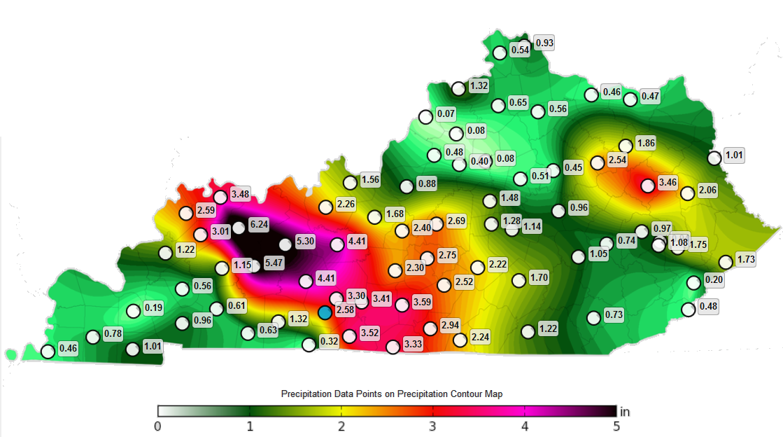 Some areas have actually picked up close to 8″ of rain during this time. Obviously, lots of flooding issues are ongoing. Here’s a look at the current warnings…

The Flash Flood Watch needs to be expanded to include more counties in eastern Kentucky and probably across the west…

Rounds of showers and storms will keep developing and rolling in from northwest to southeast as our boundary remains stalled. This front will oscillate a bit, so the heaviest corridors of rain will change a bit with each complex of storms. Here are the threat areas just through Tuesday…
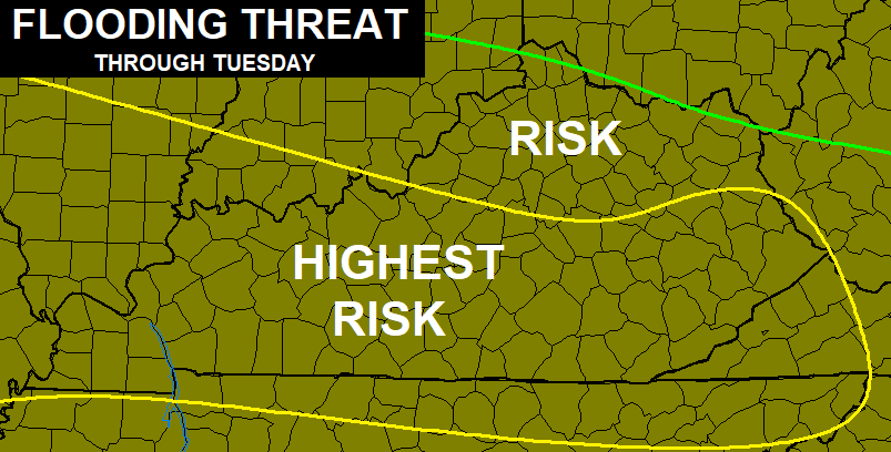 We may have to extend that deeper into the week as more clusters of storms carry us into the opening of July.
Some of the storms out there today may be strong or locally severe. Here’s the current Severe Weather Outlook from the Storm Prediction Center…

I will have updates as needed. As always, I have your tracking tools for the day…

Current watches

Possible Watch Areas

Enjoy the rest of your Sunday and take care.

I wonder when the next wave will come out of the northwest?