Good Tuesday, everyone. It’s a brand new day, but the weather pattern looks a lot like the one we had on Monday. Rounds of showers and thunderstorms will once again target the region and this looks to be the trend for the foreseeable future. These storms can be on the strong side and put down a lot of rain in a short amount of time.
We find much of the region back into the low-end risk for scattered severe storms out there today. Here’s the current Severe Weather Outlook from the Storm Prediction Center…

Guess what? That threat also holds tough into Wednesday…

Damaging wind is the primary threat from any severe storm that blows up anywhere across the region. Some large hail also can’t be ruled out.
With such a water loaded atmosphere, local flash flooding issues should return both today and into Wednesday. As a matter of fact, rounds of thunderstorms will keep coming at us through the rest of the week, into the weekend, and likely into next week.
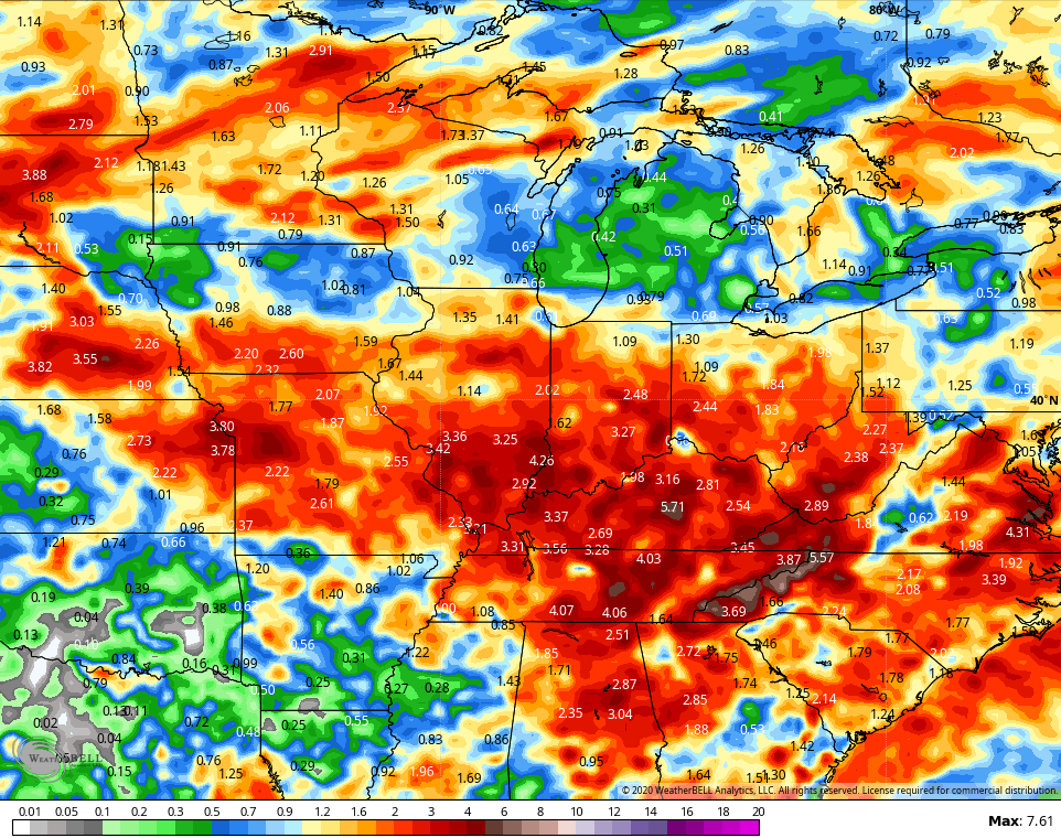
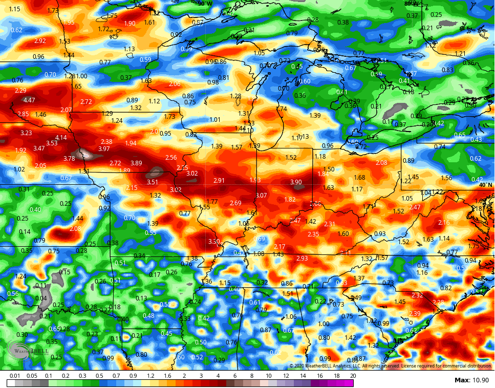
Much of the storm action will be dropping in from the northwest during this time and that shows up in the rainfall forecast from the models…
GFS
CANADIAN
This is a stormy look as we move into the closing days of July and that should continue into early August.
I’ve also been highlighting the increased potential for tropical action. The NHC now shows this potential…

Here are your storm and heavy rain trackers for the day…


Current watches

Possible Watch Areas

Have a great Tuesday and take care.

Thanks Chris, more interesting to study the Tropics while we are in this “rinse and repeat” Summer weather pattern.
Zero rainfall yesterday here in my county of Taylor while areas to my north and west were drenched. This situation can be aggravating if you farm for a living.