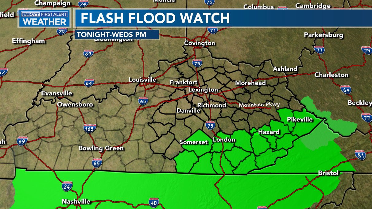
Good afternoon, everyone. A Flash Flood Watch is out for the same areas hard hit by flooding over the weekend. Areas of southeastern Kentucky are in line for another heavy rain event tonight into Wednesday, leading to the potential for more flash flooding.
Here’s the Flash Flood Watch…
The models are spitting out some healthy totals for many…
GFS

NAM

CANADIAN

Much colder air crashes in behind this Wednesday into Wednesday night and could change the rain to a period of snow, especially across eastern Kentucky. The models are spitting out some light accumulations…
NAM

CANADIAN

GFS

In addition to the winter weather, record lows are possible Thursday night into Friday morning…

Temps will quickly rebound Easter Weekend with readings nearing 70 by Sunday.
I will have the latest on WKYT-TV starting at 4pm. I leave you with your radars to track the rain and storm action in from the west…

Make it a great day and take care.

going from 81 degrees today in pikeville to cold and some snow is about as depressing as it can be. absolutely awful. thankfully it rebounds by easter.