Good afternoon, folks. Our Winter Storm ALERT continues as we track a developing system working our way for Thursday and Thursday night. This promises to bring a widespread snowfall with much of the state picking up on several inches of the white stuff.
First things first, Kentucky Weather Center is slowly getting back to normal. I can once again post images so that’s a plus. You’re still going to experience some downtime, but this site is getting the same amount of hits as WKYT.COM is getting and that’s run by one of the biggest TV companies in the world. So, ya gotta cut me a little slack. 😁
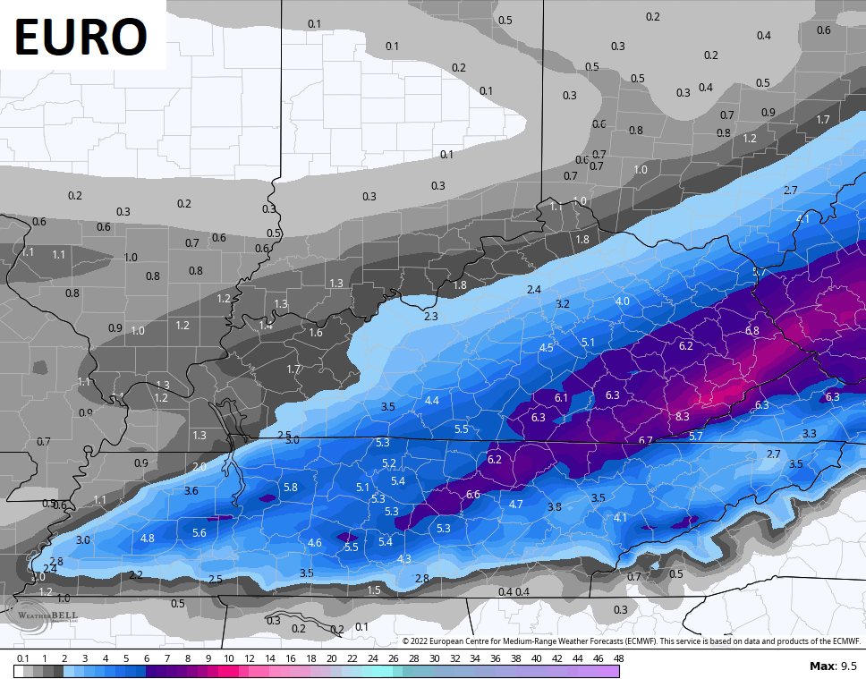
I’ve had a chance to look over the latest data and I’m not seeing anything to change my current thoughts. Here’s a look at the First Call For Snowfall…

I will update that map at some point this afternoon as things come into a little better focus.
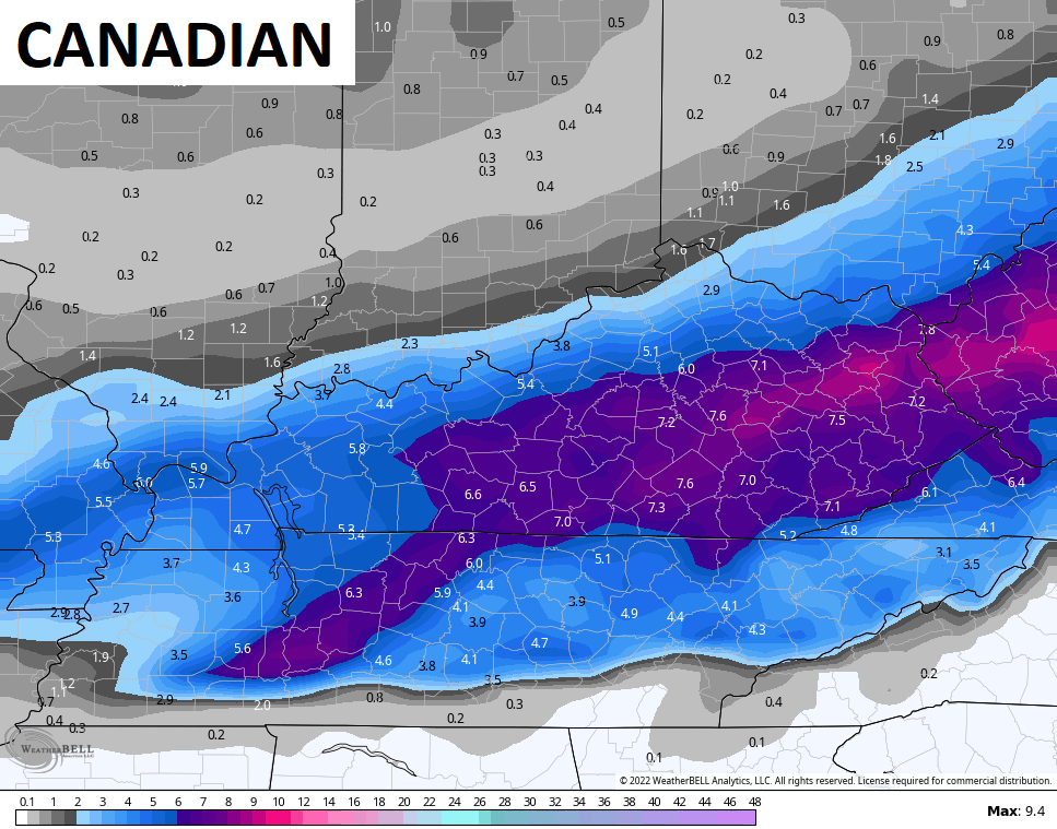
Here’s what the models are looking like at the midday hour…
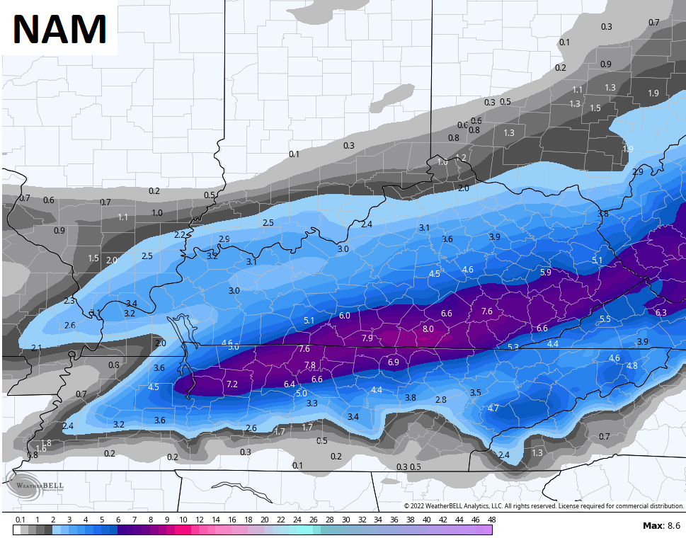
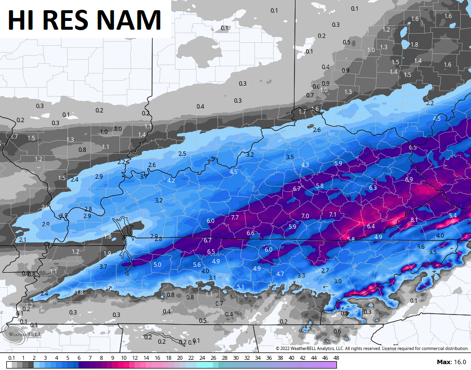
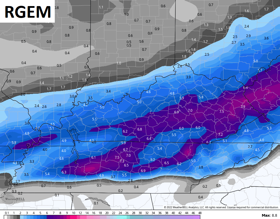
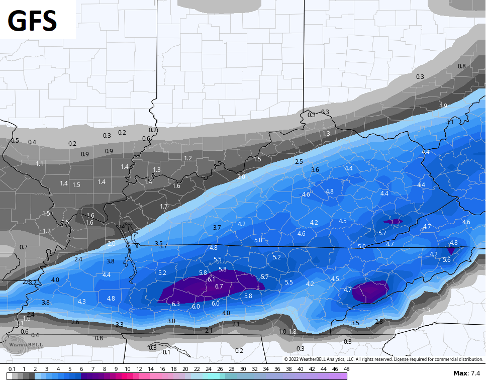
That’s actually some pretty good agreement and you’ve even seeing the GFS correcting farther north and west.
The Short Range Ensembles are the farthest north and west…

I will have updates later today and will have the latest on WKYT-TV starting at 4pm. Until then, take the interactive radar for a drive west to track the approaching snows…

Enjoy the day and take care.
