Good afternoon once again. I’m dropping by to show the Winter Storm Warning that’s now out for much of central and eastern Kentucky. Here’s a look…
/cloudfront-us-east-1.images.arcpublishing.com/gray/X4FYOXPA2VA4ZJZMFTYC2IFJ7M.jpg)
The new Hi Res NAM shows one amazing snowfall line across central Kentucky…
/cloudfront-us-east-1.images.arcpublishing.com/gray/2RDVJFUGMRFTTE2MQTWMSZSV6U.png)
The late day GFS corrected toward what most of the other models are showing…
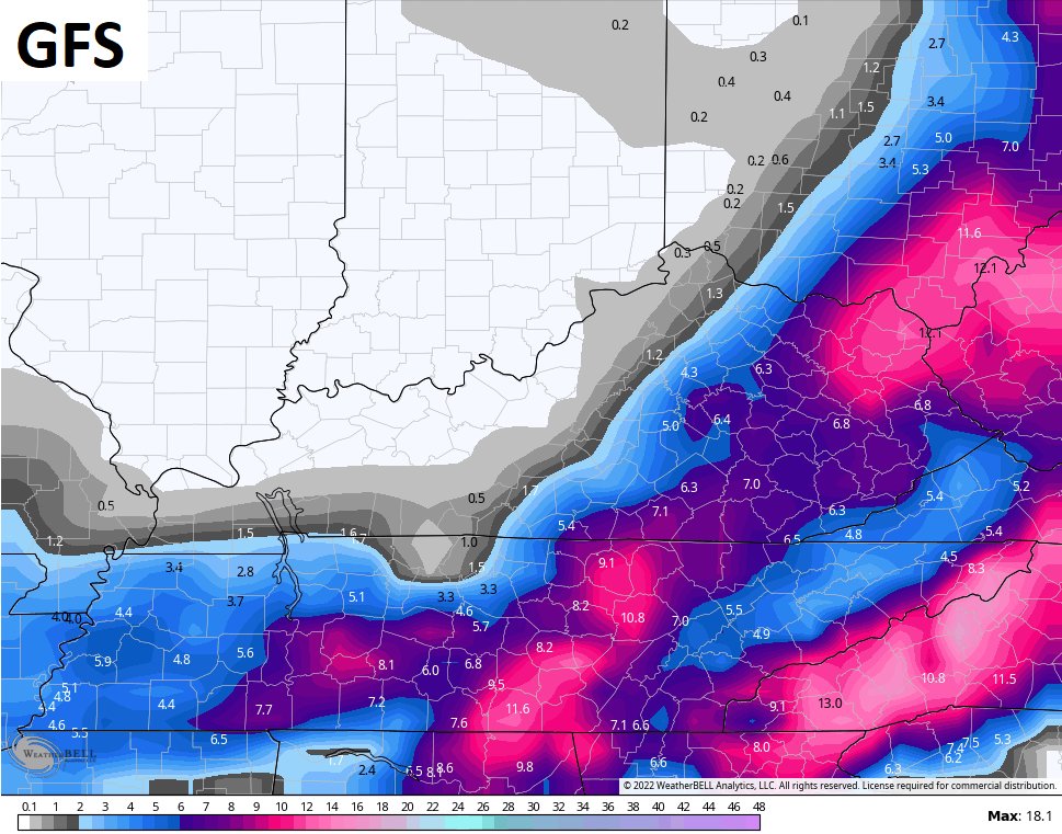
That matches my latest Call For Snowfall…
/cloudfront-us-east-1.images.arcpublishing.com/gray/KE35KZNFKFH4DAJS5CZ2Q5WG4I.png)
I will have another update this evening on KWC and over on WKYT.COM. I leave you with your light snow tracking tools …

Enjoy the rest of the evening and take care.

Can’t remember ever seeing such a tight snow/no snow gradient. Temperatures are pretty consistent from one end of the commonwealth to the other, so it’s probably not a rain/snow line. The way that 2022 so far has been throwing a little bit of everything our way, it makes me a little nervous about what we’ll be facing when severe weather season arrives.