Good Tuesday, folks. Rain is rolling across the region today and this is part of a super-duper active setup across our region. We have severe thunderstorms and snow showers on the way over the next few days. That might be the most Kentucky weather sentence I’ve ever typed.
Today’s showers will be accompanied by a few thunderstorms but the severe threat is well to our south. Here are your radars to follow the action…
A strong cold front will then rumble into the area late Wednesday and should fire up a line of strong to severe storms along it. This line looks to develop on top of central Kentucky and increase the farther east it gets. Overall, this is a severe threat for a lot of people…
The Storm Prediction Center is showing the potential for severe weather in our region and points south…

Damaging wind is the main threat as this line rolls through here. There could also be just enough spin for a weak tornado or two to pop along the line, especially in the southeast.
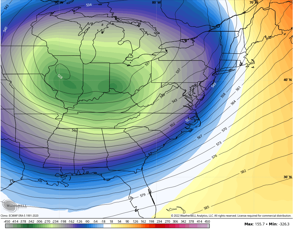
All of this is being pushed by a HIGHLY anomalous upper level system dropping in here from the northwest. Look at this beast…
That’s a very cold look with temps averaging 20-30 degrees below normal and it’s one that will cause widespread rain and snow showers/squalls to develop. I’ve seen similar setups produce thunder and lightning. ⚡❄️
Flakes may fly all the way into the southern Appalachian Mountains during this time…
Some quick-hitting, light accumulations can’t be ruled out.
Winds are a major player for Friday and Saturday and wind chills are going to be way down there. The afternoons will feel like the upper 20s and low 30s for many. Here’s the wind chill forecast for Friday…
And for Saturday afternoon…
That’s just absolutely brutal. This same setup in the winter would have taken our temps below zero with arctic snows for days.
That pulls away quickly on Sunday with temps rebounding into the upper 50s to low 60s. From there, we crank up thermometers next week with a few days making a run at 80 degrees…
That could be complete with a few rounds of strong to severe storms.
Don’t worry… Another cold shot or two is likely after that.
Enjoy your day and take care.


I’m not worried about another cold shot, Chris. The year is barely 3 months old and we’ve had nearly every kind of weather anomaly thrown at us, with the exception of a hurricane! Weather extremes have become the norm, which is why I’m worried about what our traditional severe weather season (late April/early May) holds in store.
Here is the link for the March climatic summary for Chicago, which featured slightly above normal temperatures, above normal rainfall, and below normal snowfall. https://weather.gov/lot/March2022
Snowfall was a very disappointing 3.8 inches for the month. Heck, most of you guys in Kentucky saw more snow than that for the month.
Illinois Mike I live in KY I didn’t see it. Lol