Good Tuesday, everyone. Rounds of showers and thunderstorms will impact the region over the next few days, and will bring beneficial rains to the Bluegrass state. There’s even the chance for a few strong storms to come along for the wet ride.
We will see the chance for scattered showers and storms going up today, but many stay dry. Highs range from the upper 70s to low 80s for most of the area.
Low pressure slowly drops into the region from the northwest Wednesday and Thursday. This brings rounds of showers and storms across Kentucky and surrounding areas during this time. Leftover showers will be noted into Friday as the overall coverage comes down.
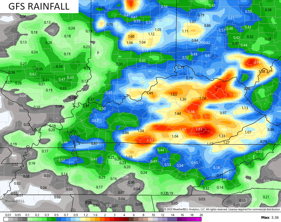
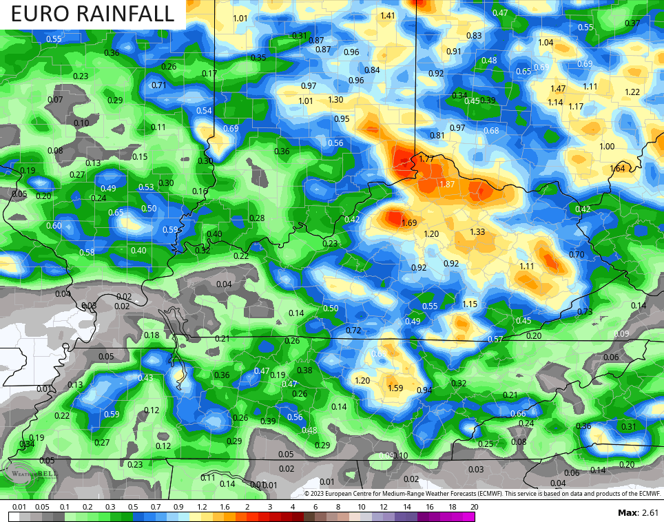
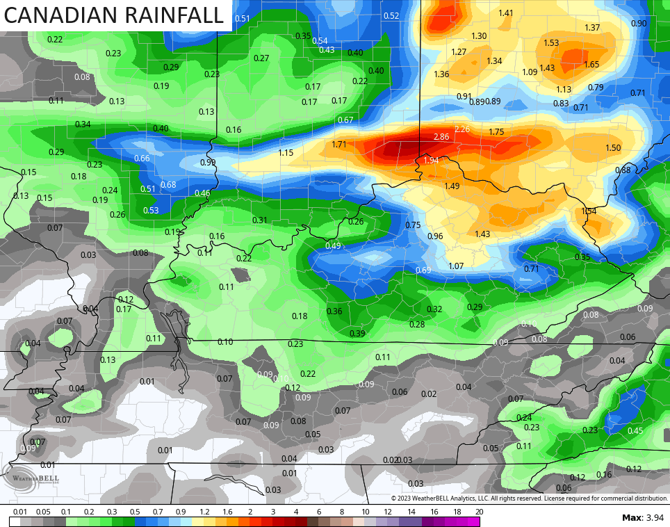
This setup can bring some hefty rainfall across central and eastern Kentucky and the models are seeing this potential much better as we get closer. 1″-2″ of rain, with locally higher amounts, will be possible.
The GFS continues to show the highest totals…
The EURO is right behind it…
The Canadian sees similar totals but is skewed a bit too far north…
Given the potential for thunderstorms, there’s even the chance for some local high water issues. Weird, right?
There’s also the chance for some of these storms to pack large hail and damaging winds. For this reason the Storm Prediction Center has a low-end risk for severe storms on Wednesday…

This may carry over into Thursday for some…

Before we get to the longer term part of the discussion, here are your radars to follow any scattered stuff out there today…

The weekend weather looks really nice across our region as we focus on what, if anything, happens off the east coast. The pattern is ripe for another big storm system to spin up and there’s a chance this becomes tropical once again.
This pattern is one that will give models an absolute fit as we head into fall. Why? Because we are seeing a lot of blocking going up and that means medium and long range models are gonna struggle, especially the EURO which is awful with blocks.
Still, I can say with some confidence that the first week of October is likely above normal temperature wise as we find ourselves between this system off the east coast and a slow-moving trough in the west…
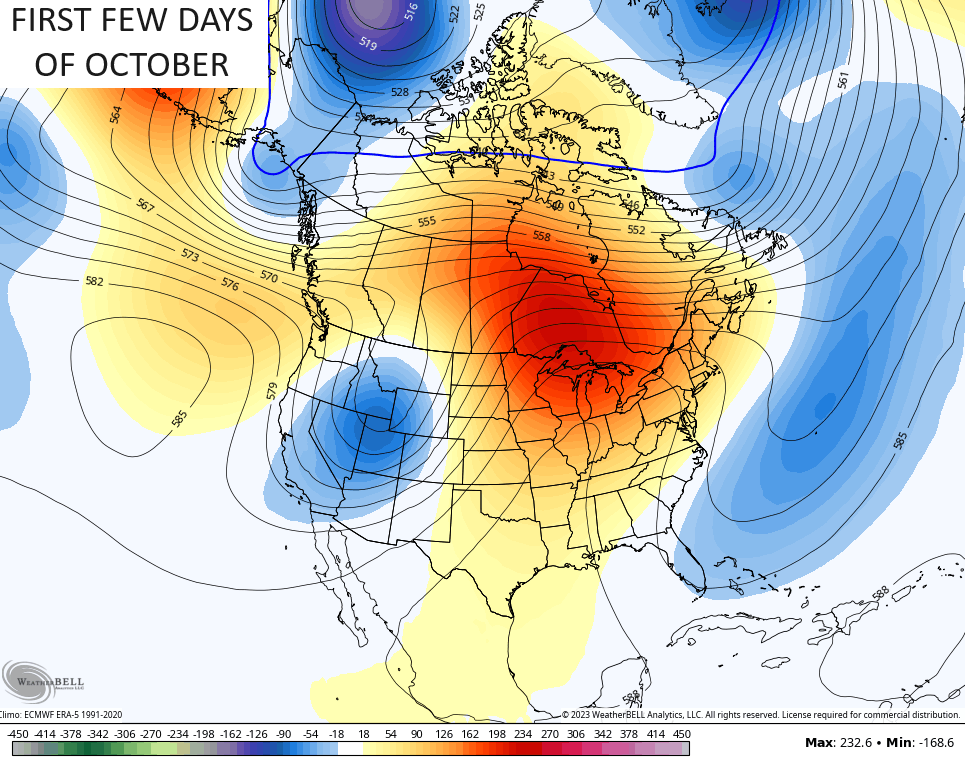
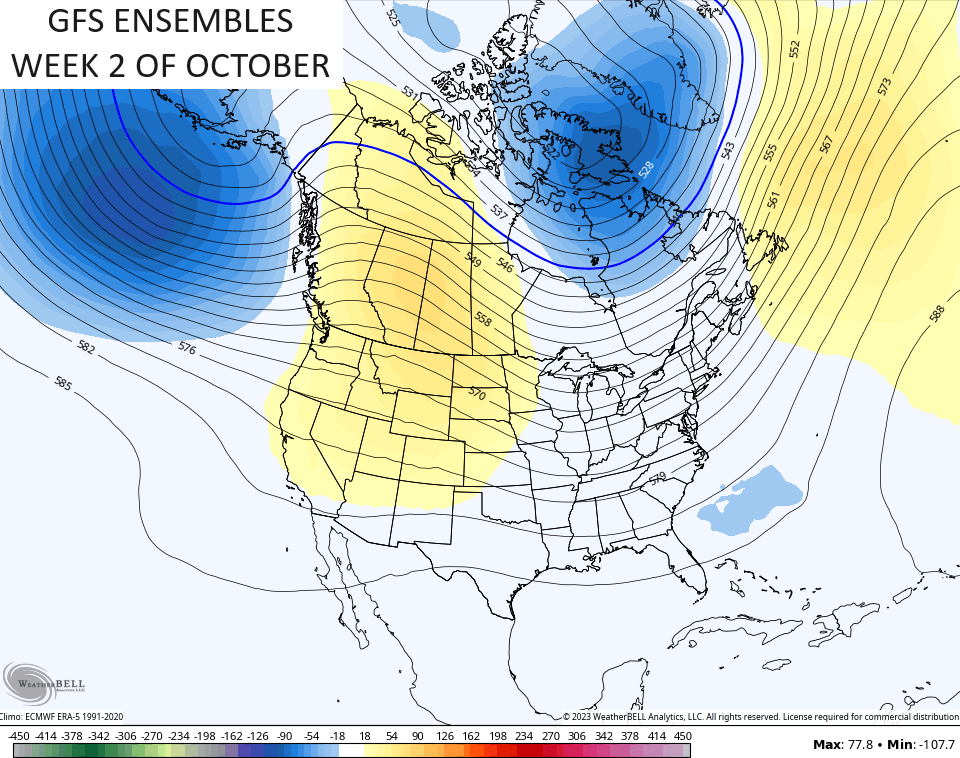
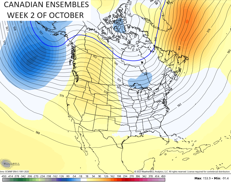
Watch how the ENSEMBLES are trying to reverse this trend duriong the second week of October as they go toward a ridge in the west and a trough in the east…
As I look at the emerging pattern heading into fall, I’m wondering if we can’t get some early season flake action out if it. Things that make me go, hmm. 🤔
Have a great Tuesday and take care.

I’m not biting on flake potential yet.
A lot of changes in the atmosphere have to take place before that happens. I’m more concerned about the on going drought.