Good Friday, folks. We have a storm system ready to bring snow and rain into the region late tonight and into Saturday. This will bring a slushy snowfall to parts of the state with a bigger storm system waiting in the wings for early next week.
Here are a few quick thoughts on this systme moving in:
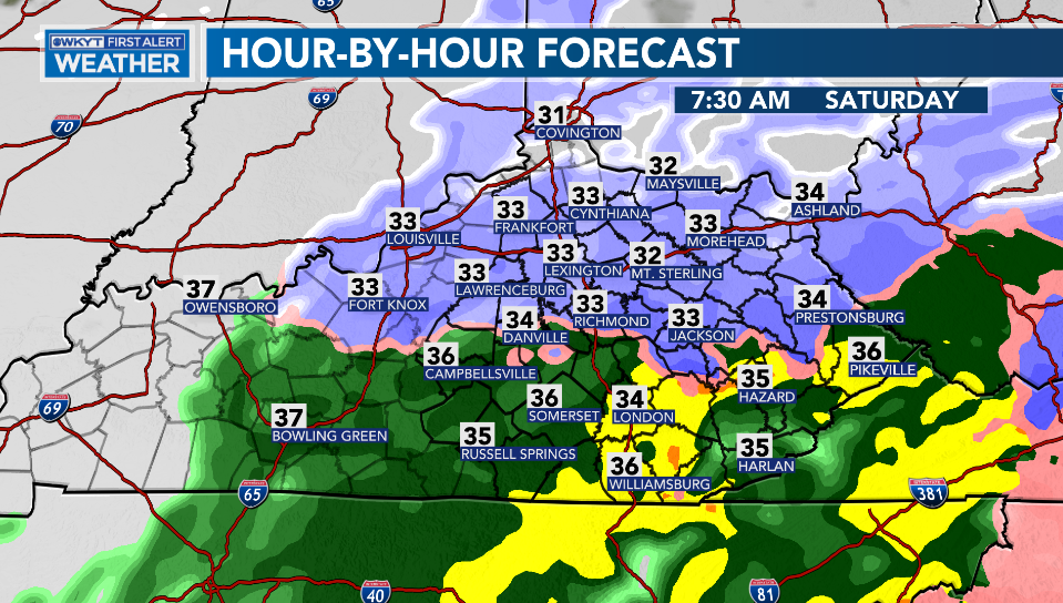
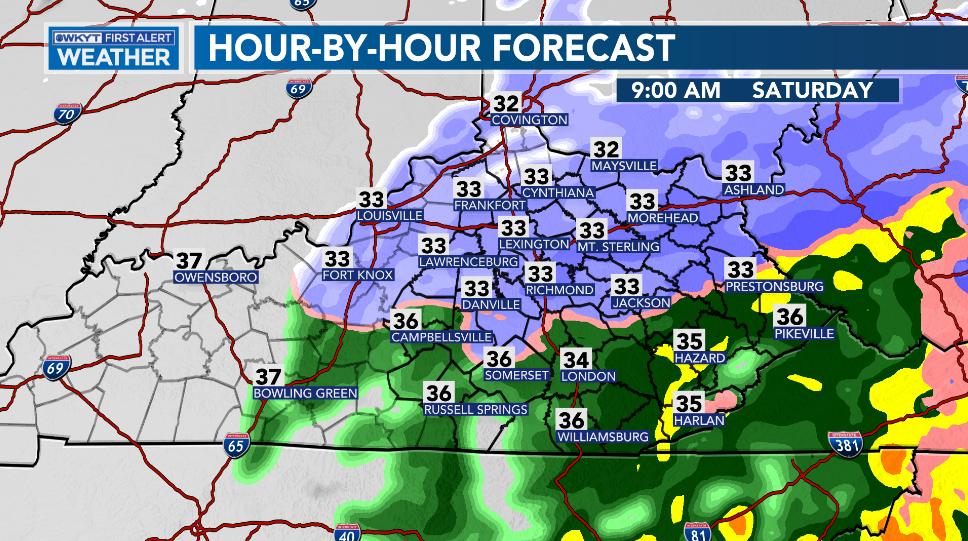
- The prime time for any wintry precipitation is from Midnight-Noon.
- Within that time frame, any one location has about a 6 hour window for sticking snow.
- The best chance continues to be across the northern half of the state.
- One degree can make the difference between a few slushy inches of snow or just a miserable rain.
- Whatever snow you get won’t be around long and should gradually fade away Saturday afternoon and evening as a few showers continue.
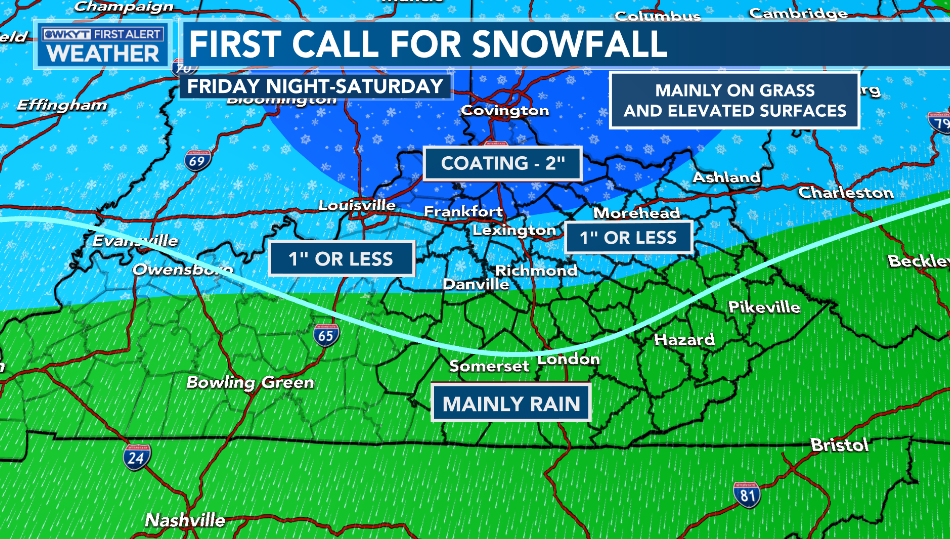
I made an Updated Call For Snowfall for WKYT last nigth. In true CB fashion, I forgot to upload it here to KWC. I made slight changes to drop the lines a bit farther south compared to the first call. Here’s a roundabout location of that…
Grrr.
Updates today may very well have to bump up totals in a few spots as I get a better handle on the rain/snow lines.
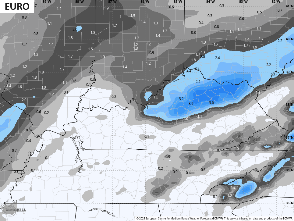
The WKYT in house computer forecast model from IBM came in much colder and farther south with the rain snow line compared to earlier runs of the model…
That’s REALLY close to what the EURO has been saying for most runs over the past few days and continues to suggest with the latest run…
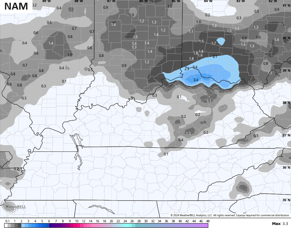
The NAM has been absolutely all over the place, but is trying to get to what the EURO is showing…
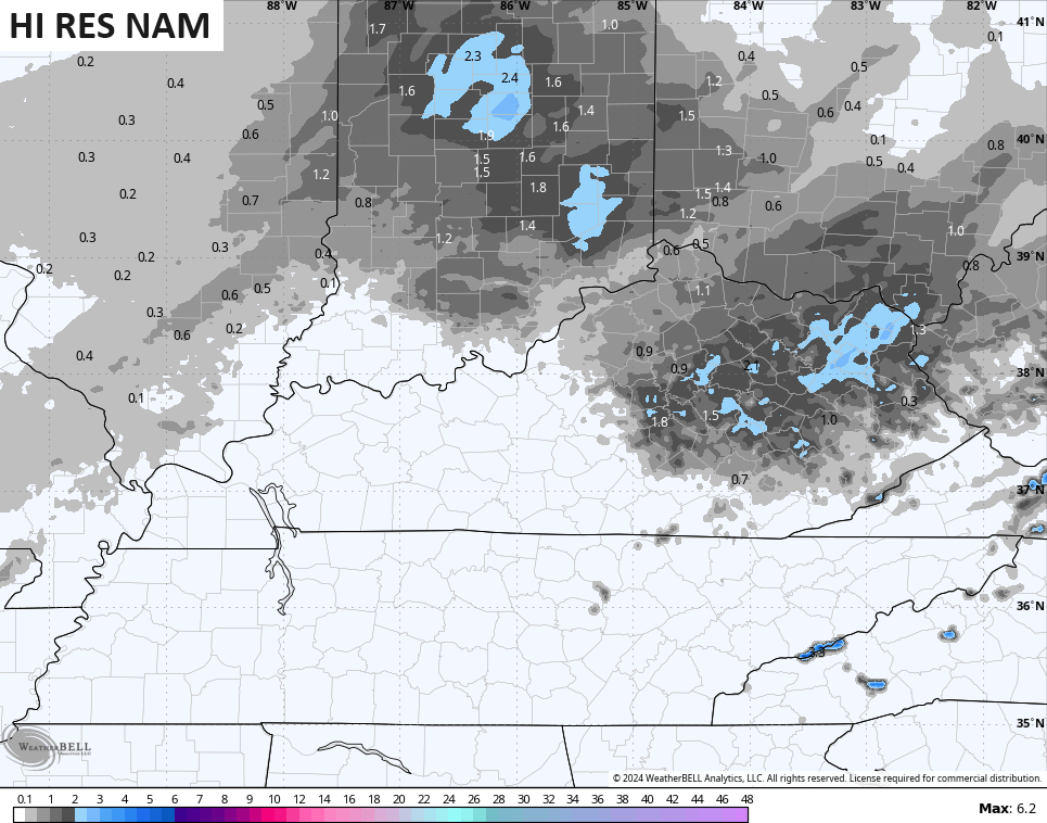
The Hi Res NAM hasn’t been very consistent either…
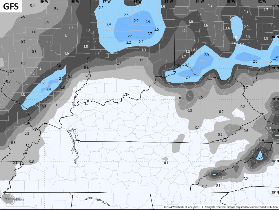
The GFS is also trying to get to what the EURO is showing…
Light rain and light snow showers will then be noted for Sunday as another weak system zips across the region.
This gets pushed out very quickly by a big storm system rolling in here from Late Monday through Wednesday. The models continue to slowly trend farther east with this storm system, but the end result for our region goes something like this:
- Precipitation moves in Monday night and may start as a wintry mix, especially in the north.
- The low moves overhead Tuesday with heavy rain a good bet. 1″-2″ rains are possible.
- Temps spike briefly ahead of the low and then crash from the west during the evening and overnight hours.
- As temps crash, snow is likely to develop with some accumulations a good bet Tuesday night and early Wednesday.
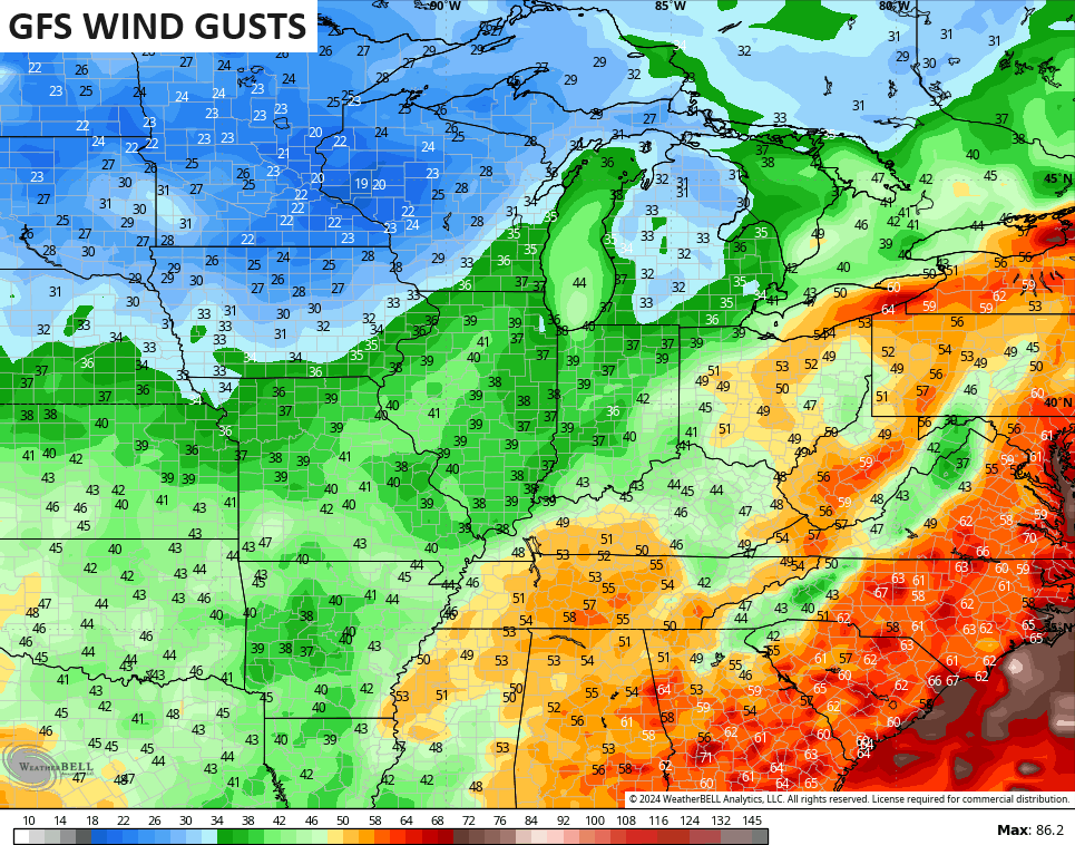
- Winds may gust to 40mph+ with this storm.
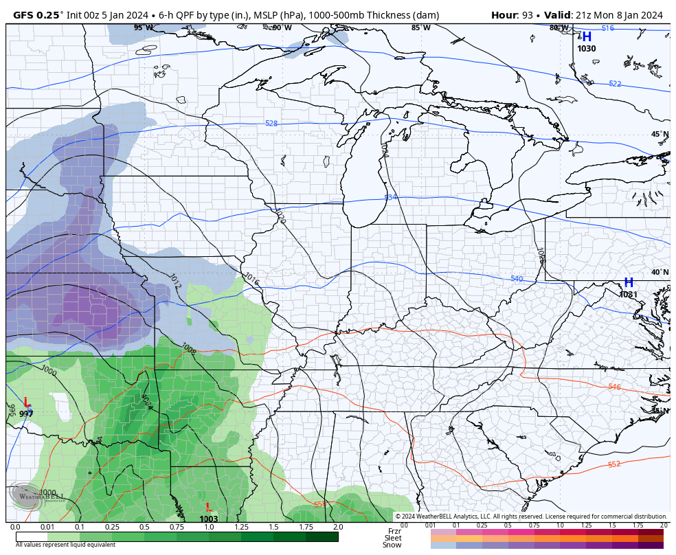
The GFS is now bringing this low across western Kentucky and through the Ohio Valley into the Great Lakes…
The Canadian is even farther east across central Kentucky and into Ohio. That track from this run of the Canadian brings a heavier band of snow into the region…
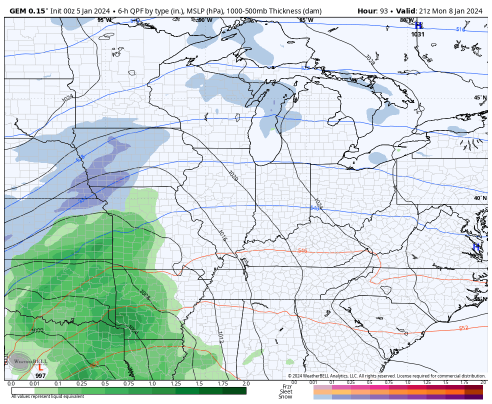
You can also see another snow maker diving in behind that.
I mentioned winds becoming a major player and this is certainly the case. Check out those peak wind gusts…
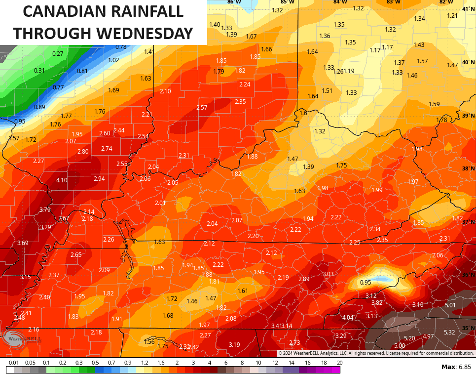
A lot of rain is likely to fall around here over the next 5 days…

A true arctic front looks to follow all this by late next week and it’s likely to have another storm system along it. With such an extreme pattern taking shape and bitter arctic air spilling into the country, get ready for some ridiculous model runs in the days to come because they’re not designed to handle such extremes.
I’ll see you back here for the midday update. Have a good one and take care.

Not sure about others here…. but I can’t get excited about these types of storms there’s no staying power… even if it surprises us and snows 6 inches…it doesn’t matter when it’s going to be gone the next day…If the forecast is for above freezing temps or rain just following the storm….then I don’t even focus on it at all.
A March storm in January.
The snow is dependent on dynamic cooling.
One positive I see in the future forecast is that the drought might be coming to an end in many areas.
Betting this is typical for the winter and if really cold air, not much moisture. Seems ice is more a shot than a nice big snow. Key word is “seems”, since you never know. Last winter was a very low bar, so would not take much to top that for totals.
I’ll bet the opposite.
Thanks for the updates Chris and all your hard work. I hoping for a good Soaking Rain. The chances are there through next week. Hoping the Arctic Air stays in the Arctic. Snows in our area that actually accumulate have always been few and far between. Check out Kentucky’s Climate.
Enjoy the Day ! Suppose to be Sunny and Warmer.
https://www.bestplaces.net/climate/state/kentucky
ummmmm still warm (as I’ve been saying for a few weeks) until the week of the 15th when the bottom falls out and high temps don’t reach 20.
That November & December forecast for colder temps didn’t come close to panning out.
Say it with me……POLAR VORTEX is coming
You’re a foolish clown who lies.
NO NAME CALLING ON THE BLOG JEFF PLEASE. I HAD ENOUGH OF THAT ON THE OLDER BLOG !!!
At some point you just have to laugh about our winter weather patterns of late in Kentucky.