Good Saturday to one and all. The first weekend of June is off and running on a seasonably warm note. Once into Sunday, a few storms show up with an increase in the storminess showing up by early next week.
Temps today range from the mid and upper 80s with mainly dry skies as showers and storms generally stay to our north and northwest. This is where the Storm Prediction Center is monitoring on today’s Severe Weather Outlook…

One or two of those may sneak into far northern Kentucky at some point later today or tonight.
Scattered showers and storms work in on Sunday, but the day isn’t a washout by any means. The Storm Prediction Center isn’t overly concerned about much of a severe threat for Sunday…

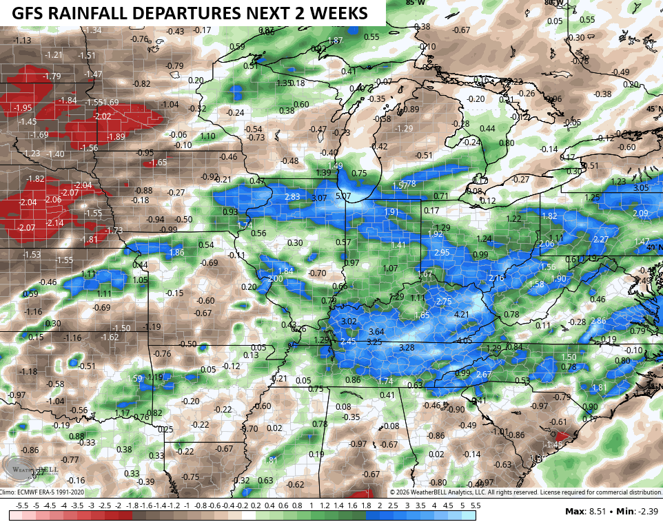
Rounds of showers and storms ramp it up a notch for Monday and Tuesday, kicking off a setup that will feature periods of storms over the next few weeks. Check out the how much above normal the GFS thinks our region will be for rainfall during the next 2 weeks…
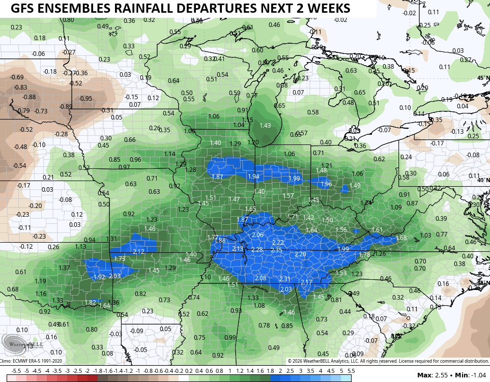
The average of the GFS Ensembles is also well above normal…
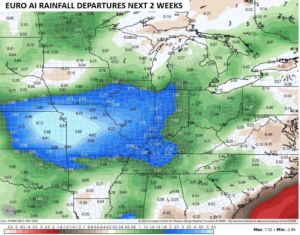
The EURO AI deviates from the script a bit as it puts a bullseye on the Plains States then fades the heavier rains into our region…
I would be surprised if we aren’t dealing with a few days with flash flooding showing up.
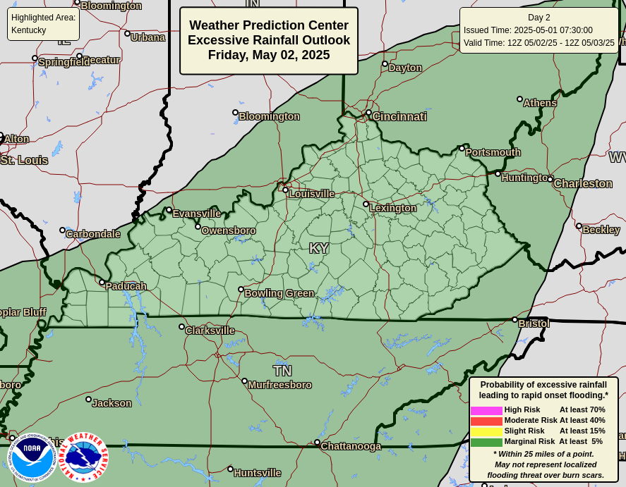
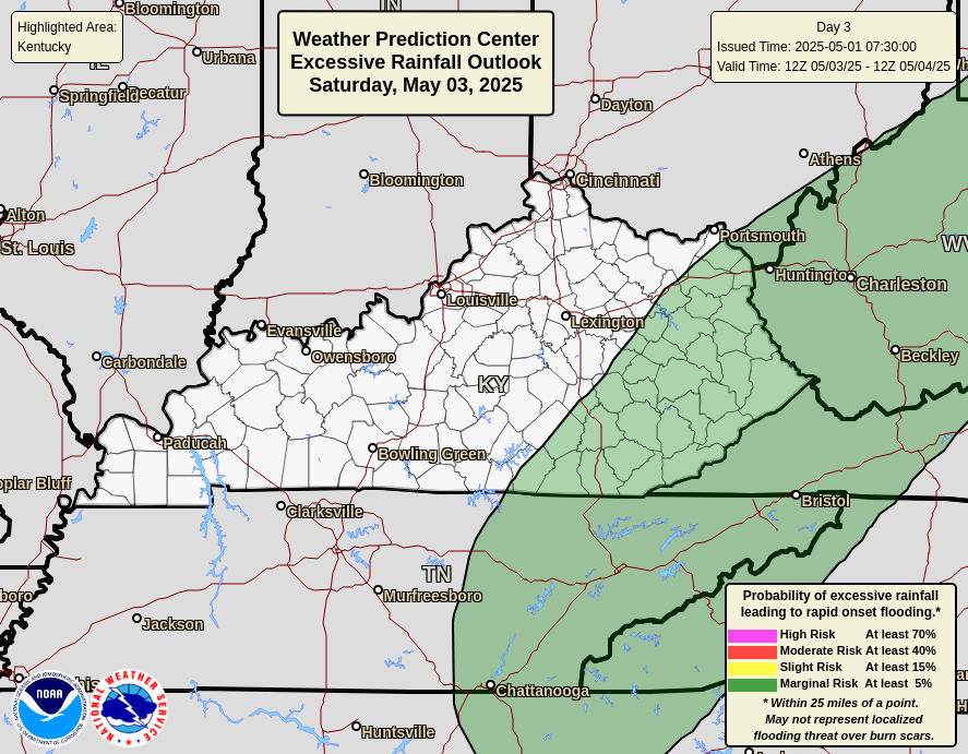
The Weather Prediction Center is keeping an eye on the Excessive Rainfall potential for our region over the next several days…

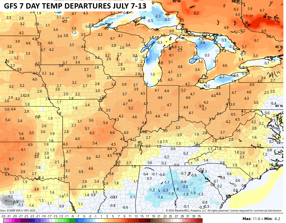
Temps in the next week will likely skew above normal…
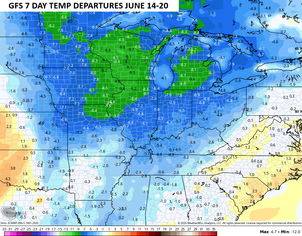
Cooler than normal air tries to fight back in for the following 7 day period…
As always, I leave you with your daily rain and storm tracking tools…


Current watches

Possible Watch Areas

Make it a sensational Saturday and take care.

As always, we shall see.