Good Monday, everyone. Rounds of strong to severe storms continue to target parts of the state today as our June pattern remains active. As a matter of fact, it’s a pattern that is more typical of spring than what we actually had back in the spring.
Severe storms are pushing across the region very early this morning and may be producing damaging winds and flooding rains. Don’t sleep on the local high water threat this morning across central Kentucky.
After a bit of a break, our boundary gets active once again as it slides farther to the south. A few strong or severe storms may fire up this afternoon and evening, mainly across the south and east. Here’s a look at today’s Severe Weather Outlook from the Storm Prediction Center…

The tornado risk is much lower today…

Pockets of damaging winds may show up, with a low-end risk for areas of large hail…


Cool and calm weather moves in behind this mess for Tuesday and Wednesday with lows that can drop deep into the 50s again…
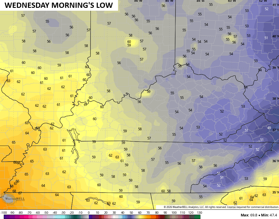
This is part of another well below normal temperature week across the entire region…

More in the way of showers and storms build Thursday into the start of the upcoming weekend…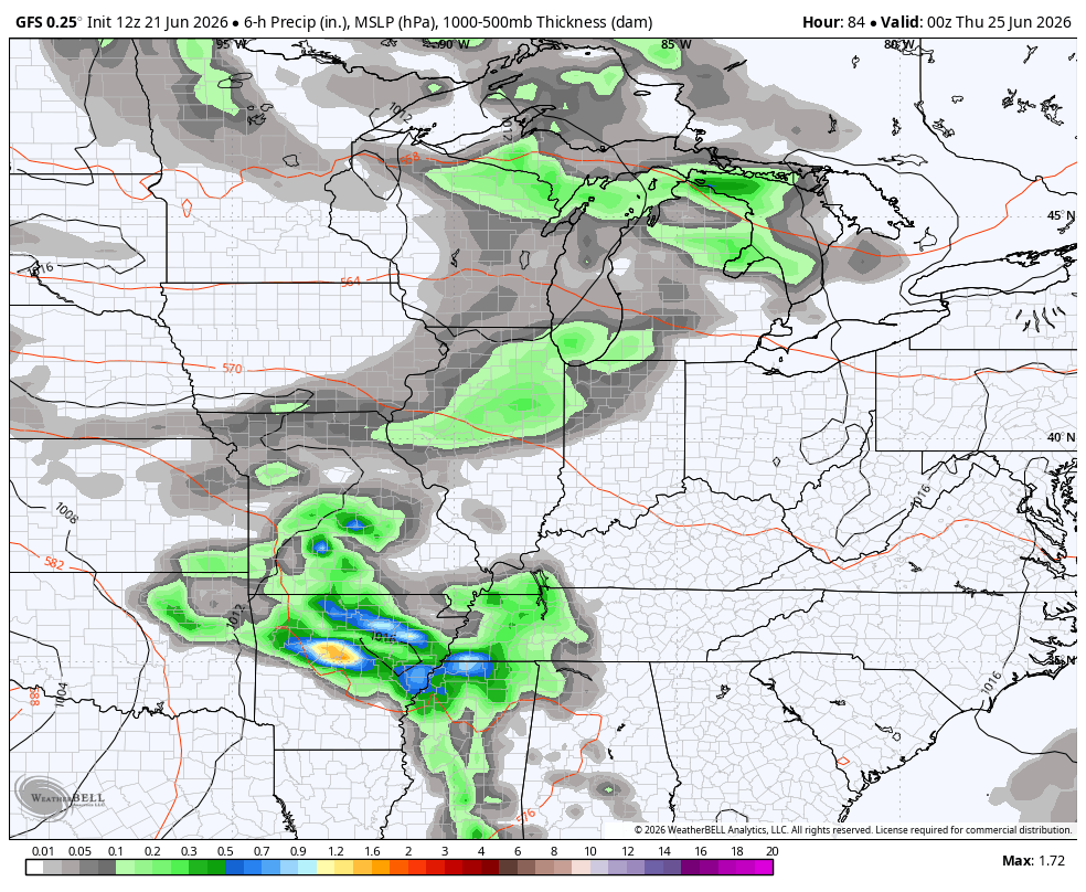
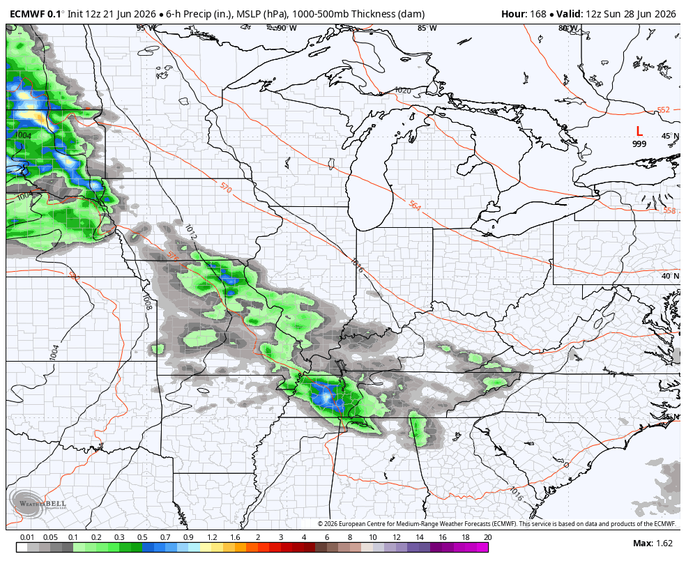
Temps do try to toast up a bit later in the weekend but additional waves of thunderstorms look top drop in here from the northwest through the long 4th of July weekend…
As always, I leave you with your daily tracking toys…


Current watches

Possible Watch Areas

Make it a magnificent Monday and take care.

It’s not “well below normal” at all.
Thanks Chris. I found out that this current weather pattern, involving a very unusually strong High Pressure System over Greenland along with a negative NAO is continuing. Unheard of for our Summer months. This happens in ( December January and February ) The weather patterns are all wacked out globally.
Adding to the above, the atmosphere is behaving in ways that often make historical analogs less reliable than they once were.