Good Monday, everyone. Our flood filled weekend certainly left a mark on Kentucky with devastation for many communities. As we close out June and hit July, heat and humidity look to steal the weather show with the heat index being the main player for a few days.
Some areas are still dealing with flooding from the historic weekend rains. A few Flood Warnings still remain…

The heat and humidity take center stage for the week ahead. Here’s a breakdown of how things are looking:
- As you know, our ground is waterlogged and is as wet as you will ever find it in the summertime and our grass and vegetation are green and lush. All of this works to help us out just a bit in the temp department as our actual high temps won’t be as high as surrounding states.
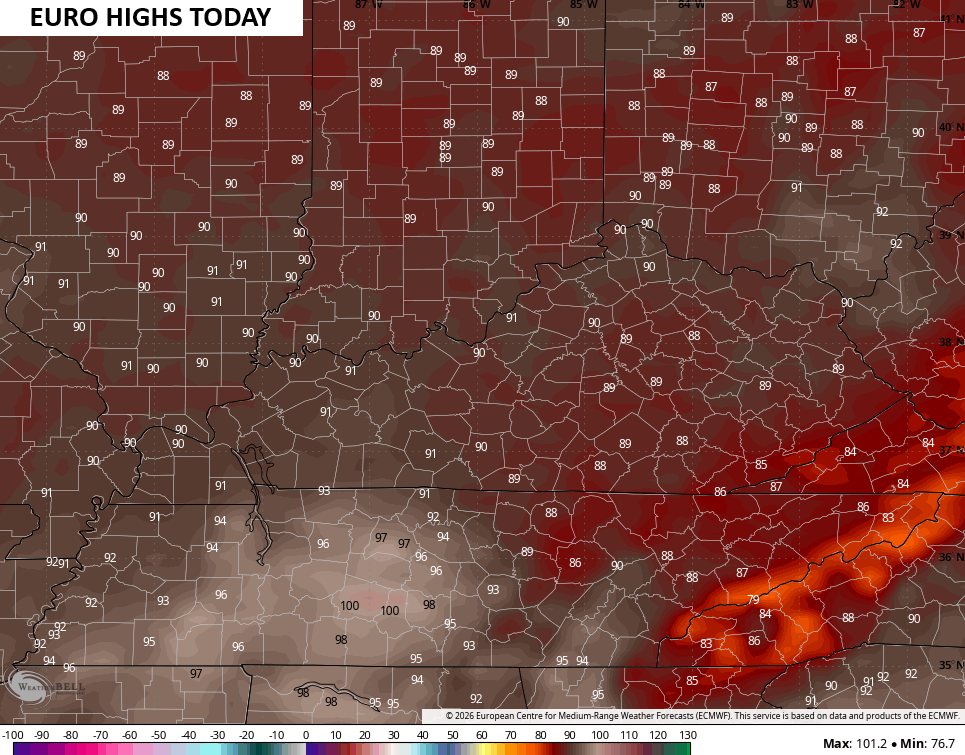
- Highs of 90-95 will be common across Kentucky. For reference, we reach 90 or greater approximately 20-50 times a summer on average, depending on which part of the Commonwealth you live in.
- What’s uncommon is the amount of humidity moving in, with our soaked ground adding more water to the atmosphere.
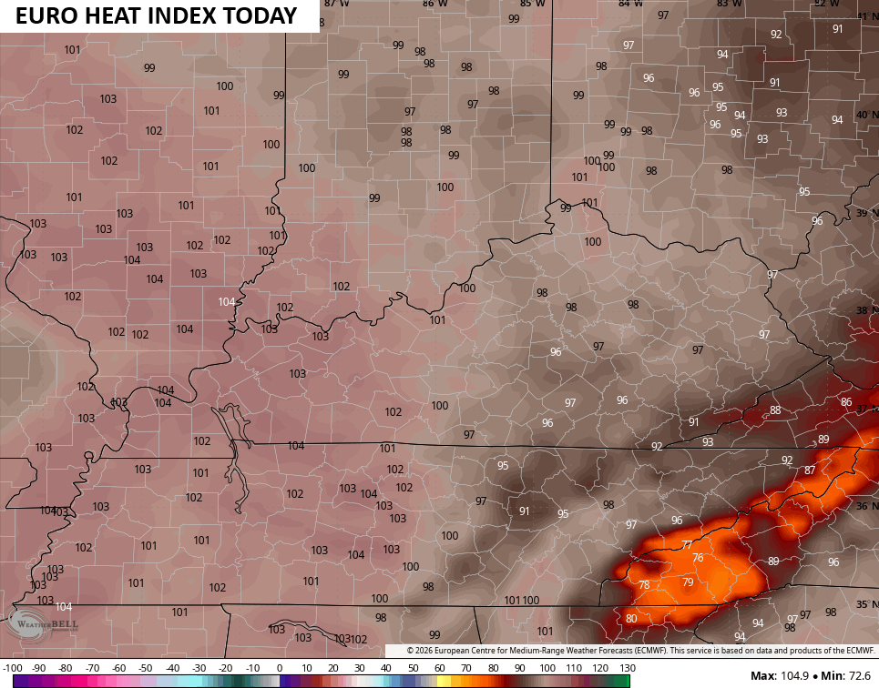
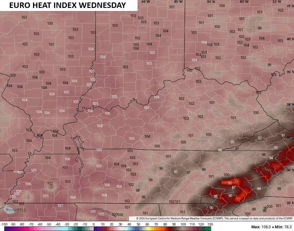
- Heat index numbers each afternoon will generally range from 100-105 through Thursday. Far western Kentucky may see numbers topping 105 at times.
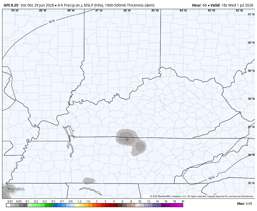
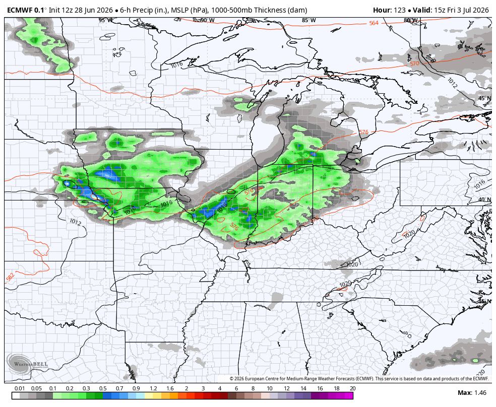
- Popup thunderstorms may be noted each of the next few afternoons with a greater threat for some storms going up Wednesday and Thursday. Any storm that goes up can be a pulse severe storm and produce local flash flooding.
- The potential for showers and storms will increase Friday through the 4th of July holiday weekend as a boundary drops in from the northwest. This will knock the temps down some but could also bring a few booming storms that also pack torrential rains.
As is usually the case, temps come down some on the models are you get closer to these types of setups. I also think they’re trying to see the soaked ground we have out there. Here’s a look at today’s upper 80s and low 90s on the EURO…
Throw in the tropical humidity and heat index numbers really soar, especially across the west…
Highs for Tuesday come up a few more degrees with many areas reaching 90 or a little better…
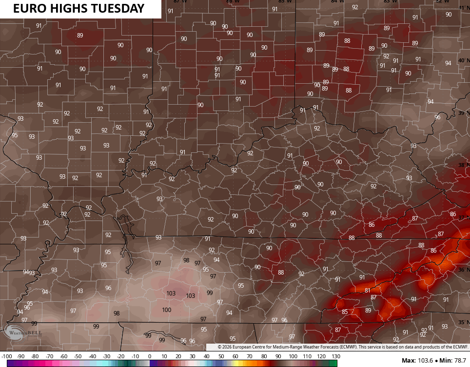
You can really see areas with a drier ground, especially down in Tennessee. Heat index numbers are upper 90s to around 100 in the east with the highest numbers in the west…
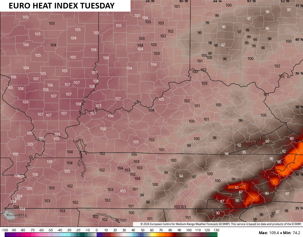
Wednesday should be the hottest of the bunch if we don’t get storms to go up in the afternoon…
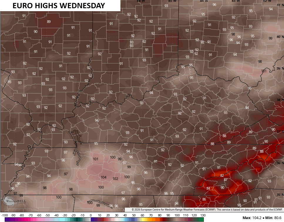
Humidity levels make it feel 100-105 now for most of the state…
The threat for a storm or two is there on Wednesday with a greater chance Thursday into the upcoming 4th of July weekend…
As always, I leave you with your daily tracking toys…


Current watches

Possible Watch Areas

Make it a great Monday and take care.

Thanks Chris. Yesterday’s rains were the good soaking type slow and steady. Good thing that my soil is well drained and not that heavy clay. I don’t remember too many Summers where it doesn’t get hot and humid. The hottest was July 4th, 1976 ( 105 degrees ) and the coolest was July 4th, 1967 ( 65 degrees ) we were all wearing sweaters and jackets at our Family picnic.
It’s going to be well above normal this week. 😉