Good Sunday to one and all. This massive September heat wave is finally about to end as we go into a much more typical late September look and feel. This setup includes temps going below normal and periods of much-needed rains.
Let’s begin with today and roll forward.
It’s hot… Very hot. Highs are 90-95 for central and eastern Kentucky with mid and upper 90s in the west. We also run the risk for a few storms going up, but much of this may very well be to our north. This is where the Storm Prediction Center has the low-end risk for a few severe storms today…

A strong fall cold front FINALLY crashes in here from north to south on Monday. This boundary will have a few showers and storms along it as it sinks through here into Monday night and Tuesday morning…
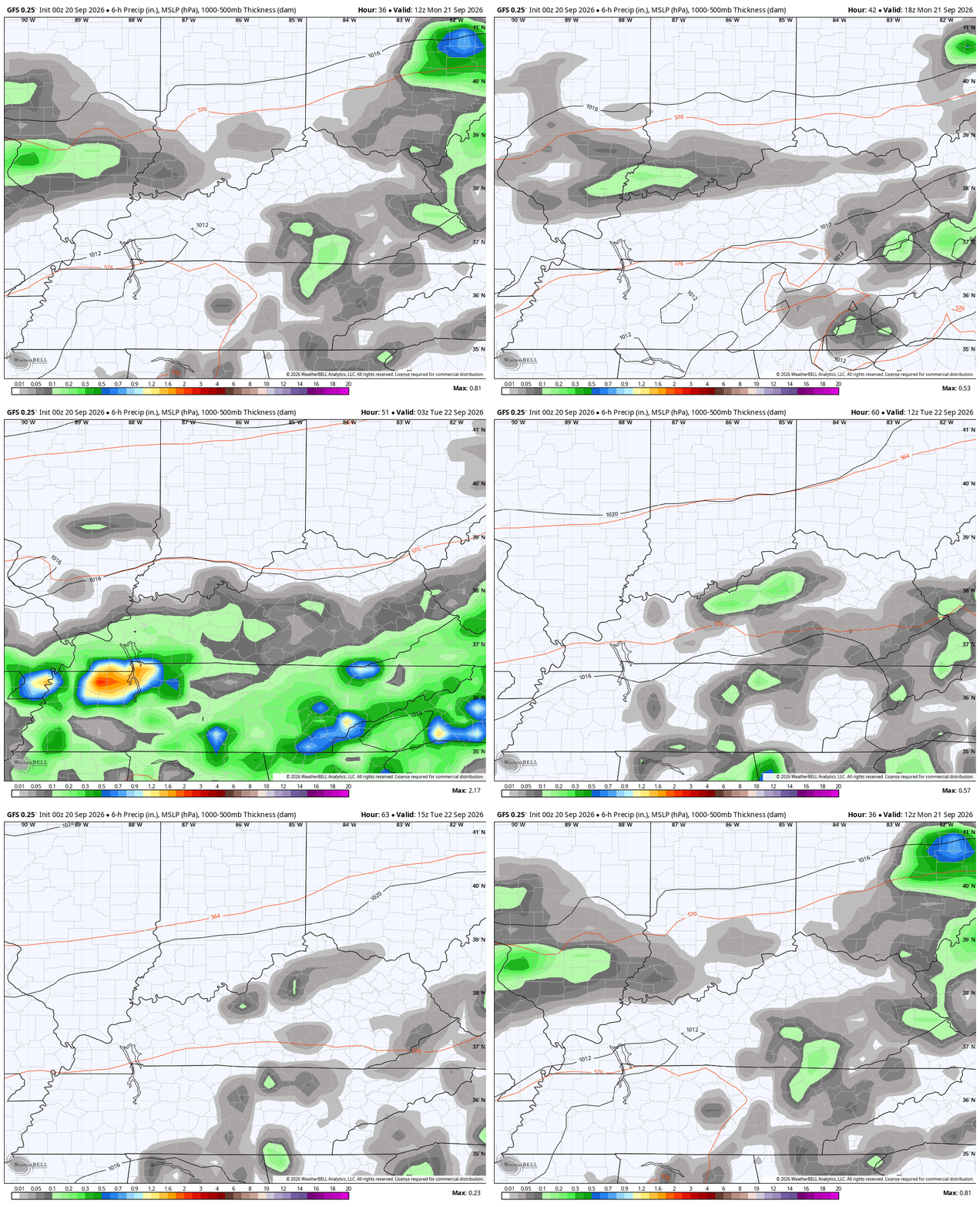
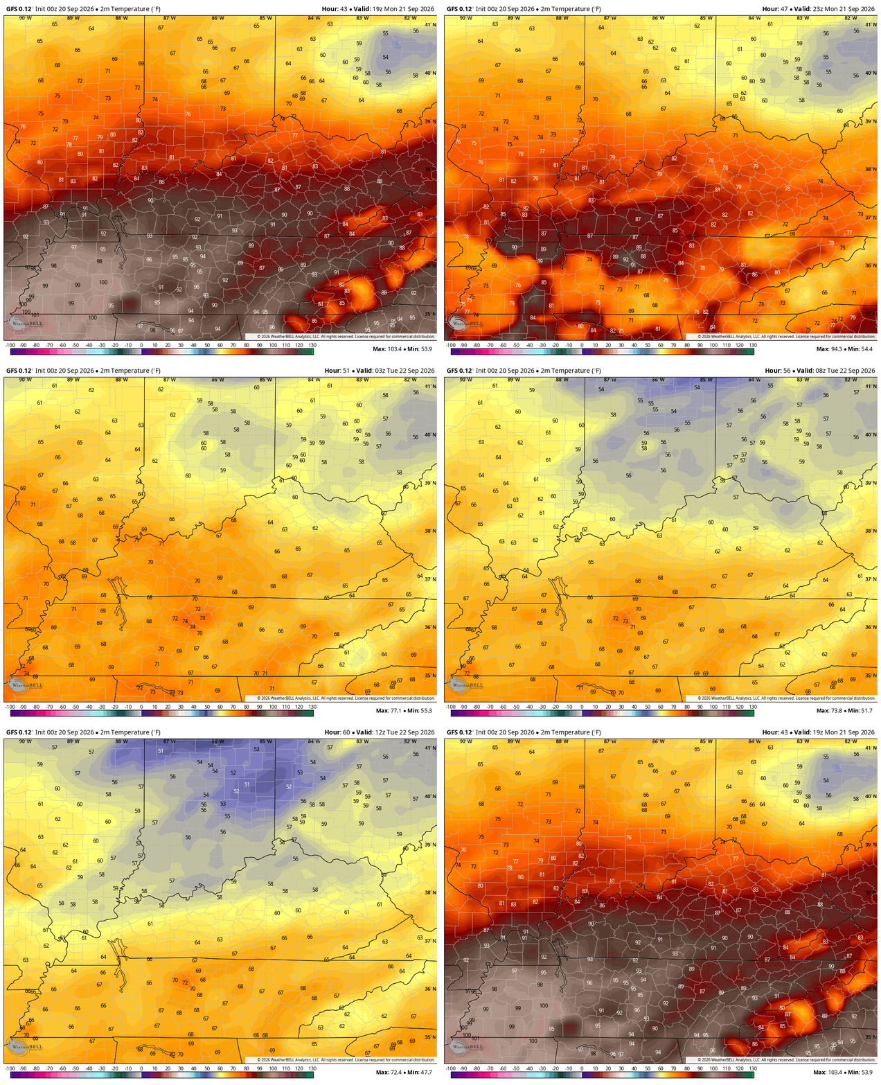
Temps along and ahead of this front will likely reach the low 90s across southern Kentucky with the 70s in the north. Watch how quick the temps turn cooler from north to south on this animation from Monday afternoon through Tuesday morning…
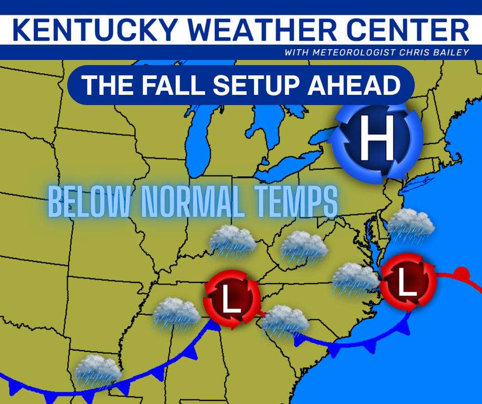
A surface low pressure then develops along this boundary as it sags into Tennessee Tuesday. As that’s happening, another low pops off the east coast with a huge high pressure to the north of that. The end result for us is cooler winds and a few showers, especially in the east Tuesday into Wednesday…
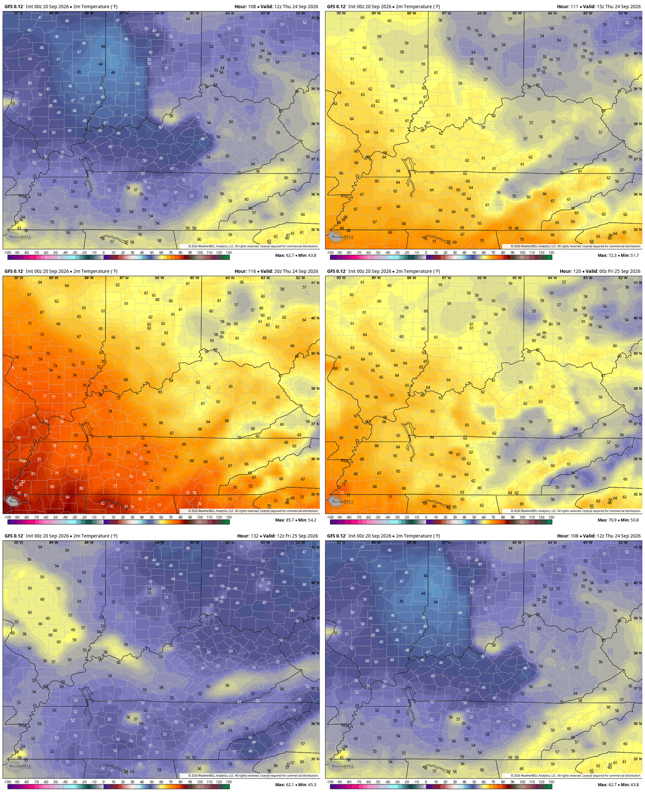
As the southern Appalachians low spins slowly to our northeast Wednesday night and Thursday, even cooler air kicks in. This temp animation goes from 8pm Wednesday to 8am Thursday…
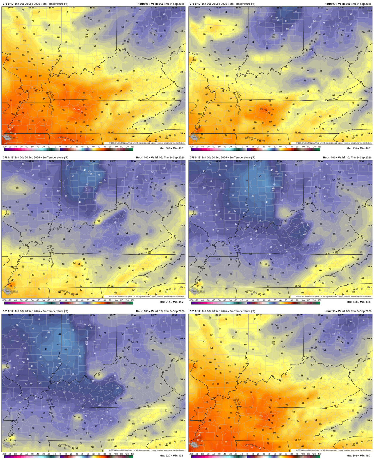
The rest of Thursday into Friday morning on that same run…
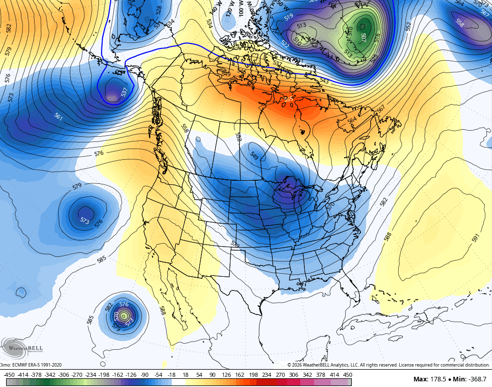
Another deep trough is likely to move into the eastern half of the region in the closing days of the month…
Another factor arguing for a dramatically different pattern comes from the western Pacific. That’s where we have a recurving tropical system…
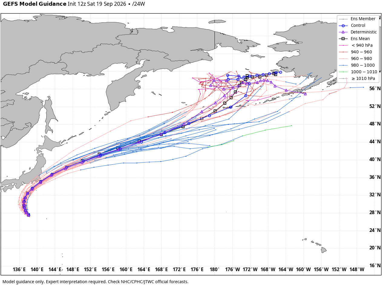
The teleconnection with that argues for an eastern US trough to develop in the means.
As always, I leave you with your daily storm tracking toys…






