Good Sunday to one and all. What else can I say about this amazing fall weather pattern? It rocks and it’s going to roll through the week ahead before big changes blow in at some point over our Halloween Weekend. Those changes lead us into a very active November with a change to winter showing up.
The weather through this Friday = Awesome. Enjoy!
While we are enjoying the good stuff, another system tries to develop off the southeastern seaboard. This map will show you if and when the National Hurricane Center starts watching it…

In the Pacific, we find Hurricane Vance is slowly rumbling toward Mexico. With the forward speed slowing so much, the forecast is for a weaker storm system…

That system just throws another monkey wrench into the forecast models, but they are active! This animation from the EURO starts on Halloween and runs through the first week of November…
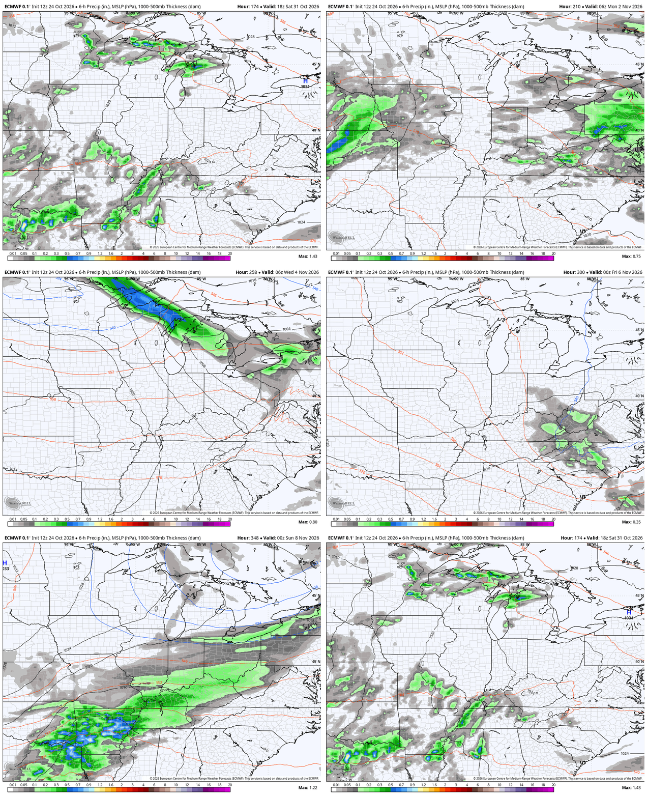
For the past few weeks, I’ve really zeroed in on what I believe is a very active month of November with above normal precipitation of both rain and snow. It’s a setup that has the chance to bring severe weather and snow into our region at different points in the month.
Obviously, the severe threat would be during the first half of the month with a change toward winter for the second half. That change would take us into the first week of December. The EURO Weeklies are not shy with this setup. Watch the animation below that starts in mid-November and runs through December 8th…
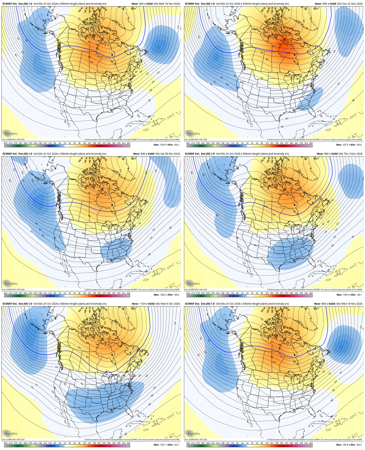
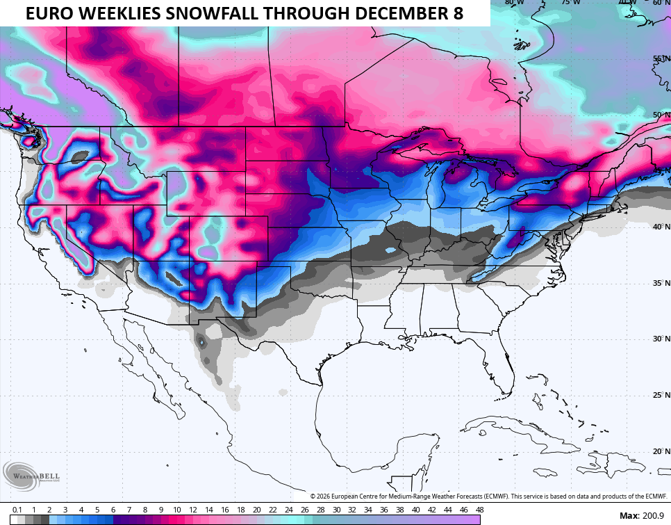
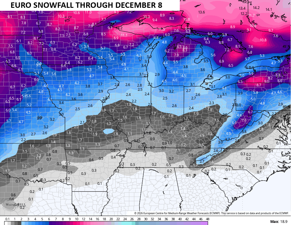
As I’ve been saying, that’s not an exceptionally cold pattern, but with an active setup, it can produce winter weather around here. The EURO Weeklies snowfall map isn’t meant to be taken literally, but that goes for any model snow map. That said, it’s usually good in giving us a general idea of where flakes can fly…
As you all know, we have the strongest El Nino on record going on right now. It’s stronger than the Super El Nino’s of 2015, 1997 and 1982 and the warmest anomalies are centered well to the east of those 3 years. Obviously, 3 years is a VERY small sample size, but those 3 years had a lot in common with one another in terms of the actual weather across the US. So far, this Super El Nino has produced nothing like what those 3 years did. So, there’s something different with this one.
Maybe it’s the warmer background state of the oceans and the climate? Maybe this El Nino is so extremely east based that it’s altered things beyond anything we’ve seen before? I suspect it’s both, to be honest.
I continue to watch the forecast from GFS Super Ensembles as they center on a specific date and find the 10 best analog matches from years past. The latest run is centered on November 4th. You can see the years and dates at the bottom right…
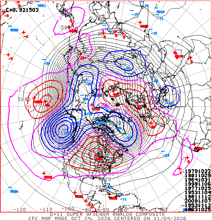
You notice the absence of any Super El Nino years on the list. As a matter of fact, only 2009 was even considered to be a moderate El Nino. The rest were weak El Ninos with a few La Nina years showing up, including one of the strongest ever in 1999.
If we just look at the above years collectively, we get this for temps in November…
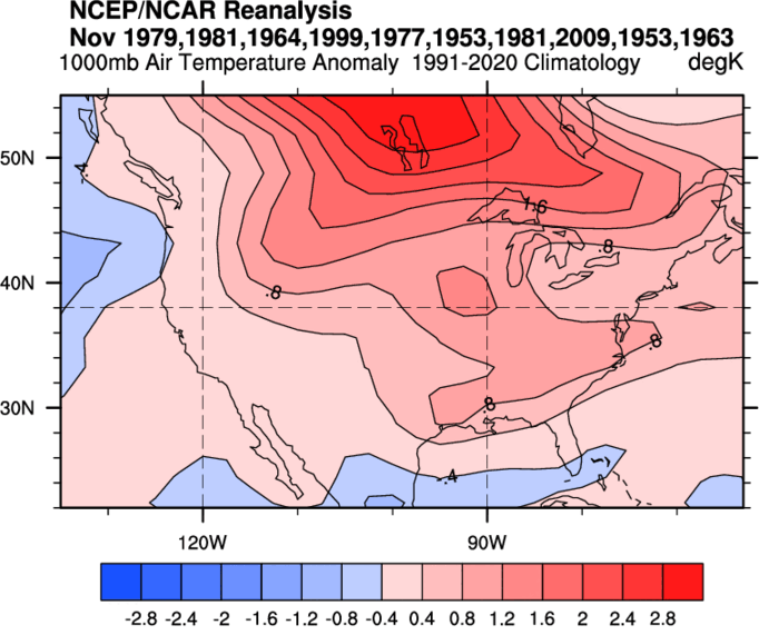
Slightly above normal for much of the country with the warmest anomalies in the north and into Canada.
If we fast-forward to December and use those same years, you get a different signal…
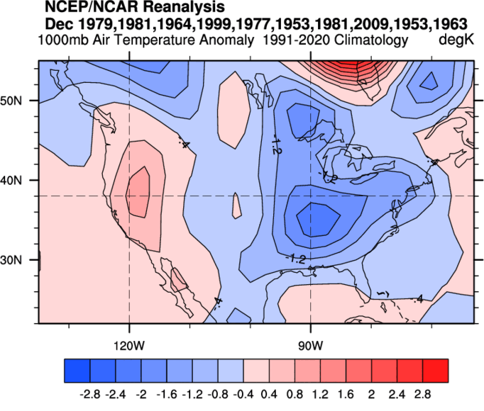
Again, it’s fun to play with analog years like that even as they change with time. You guys know I’m all about a common theme and the theme so far this fall is the weather is not behaving like a Super El Nino should. Given our small sample size, I’m not sure we should really be surprised by that.
Enjoy your Sunday and take care.
