Good Saturday to one and all. It’s the first weekend of November and we have a seasonable chill in the air. This is ahead of what looks to be a full-blown wintertime setup for a few days late next week into next weekend. This one has, at least, a small chance to bring the first flakes of the season in here.
Below normal temps are with us today with low 30s this morning and 50-55 this afternoon. Temps by Sunday morning drop into the 20s with another day in the 50s for highs.
Monday and Tuesday look awesome with low 60s and plenty of nice skies.
Things begin to change quickly by Wednesday and Thursday as a massive dip in the jet stream takes place overtop of us and into the eastern half of the country. This is pretty darn deep for this early in the season…
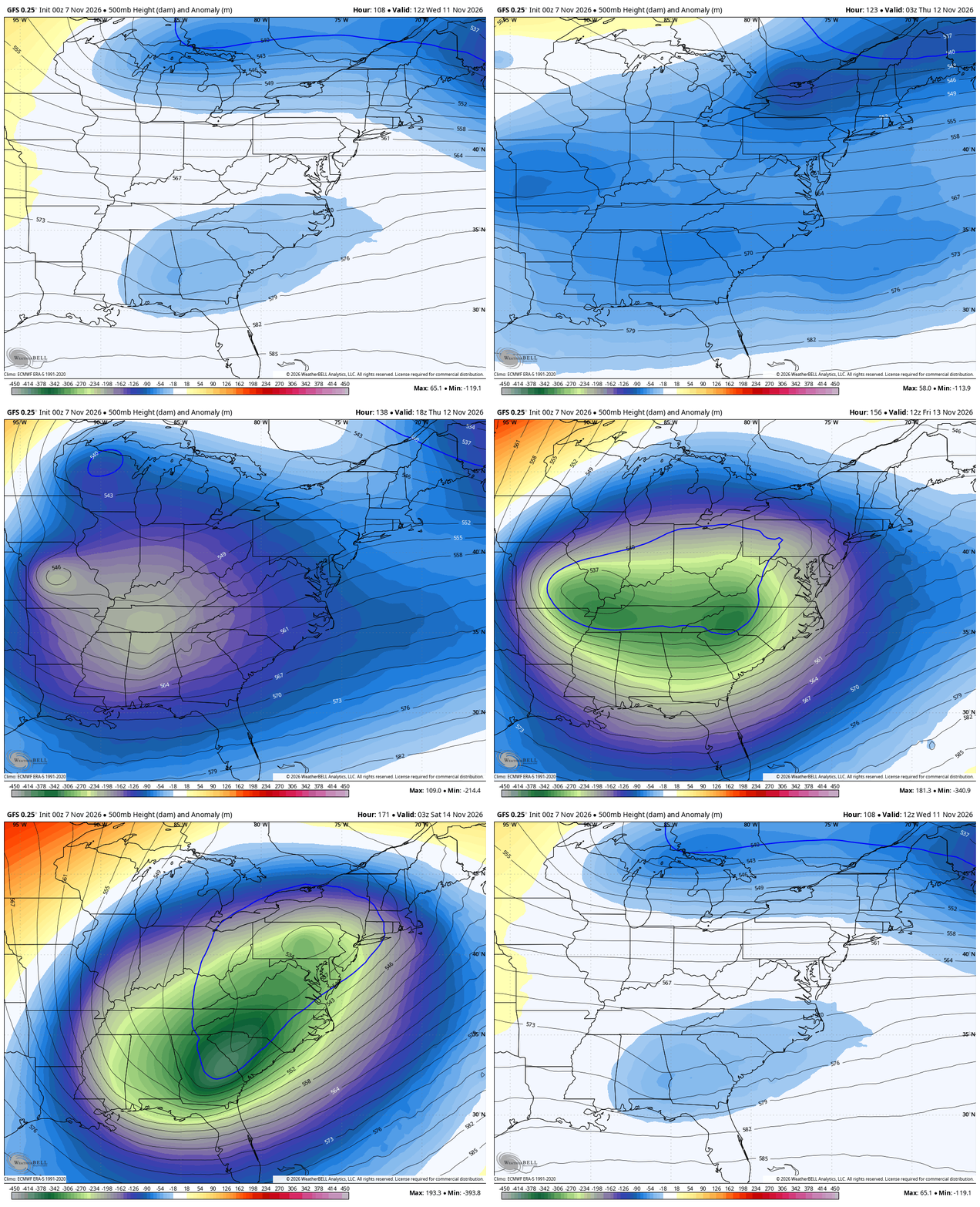
You can see how the upper system tries to become cutoff for a time. That could fire up a potent storm system somewhere in the east. If that happens, early season snows would fly for many, including in our region.
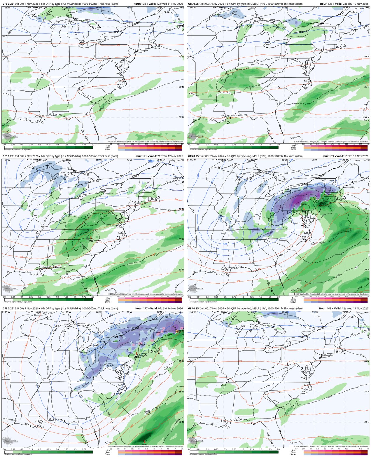
Here’s the GFS with a pretty potent storm…
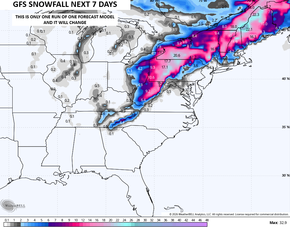
For fun, here’s what that run would look like for snow…
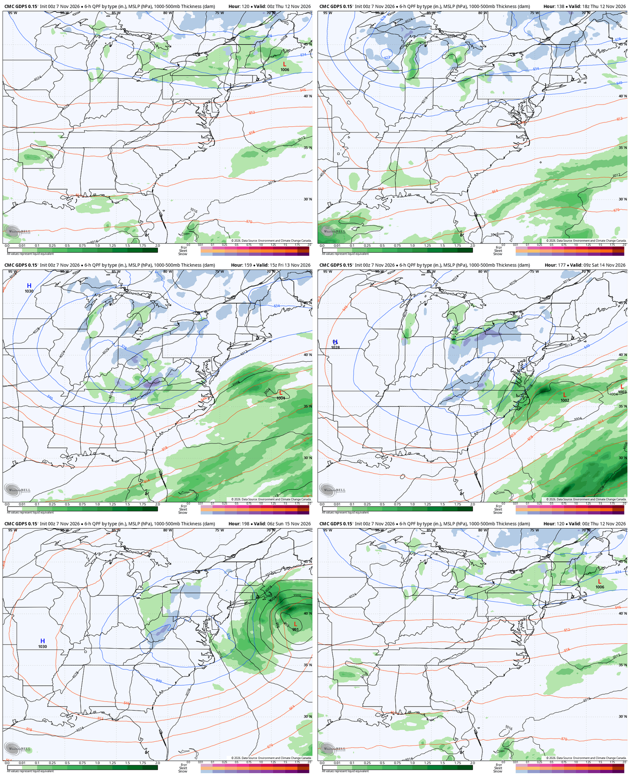
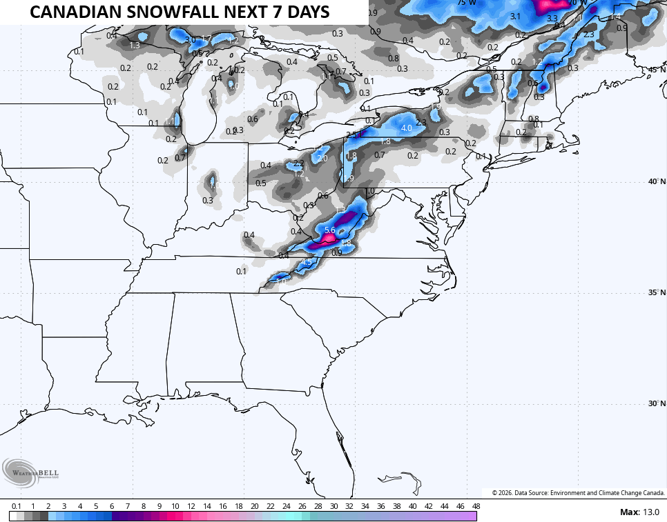
The Canadian Model is farther east and weaker with that low, but still spits out flakes around here and across many areas in the east…
Here’s the snow map from that run of the Canadian…
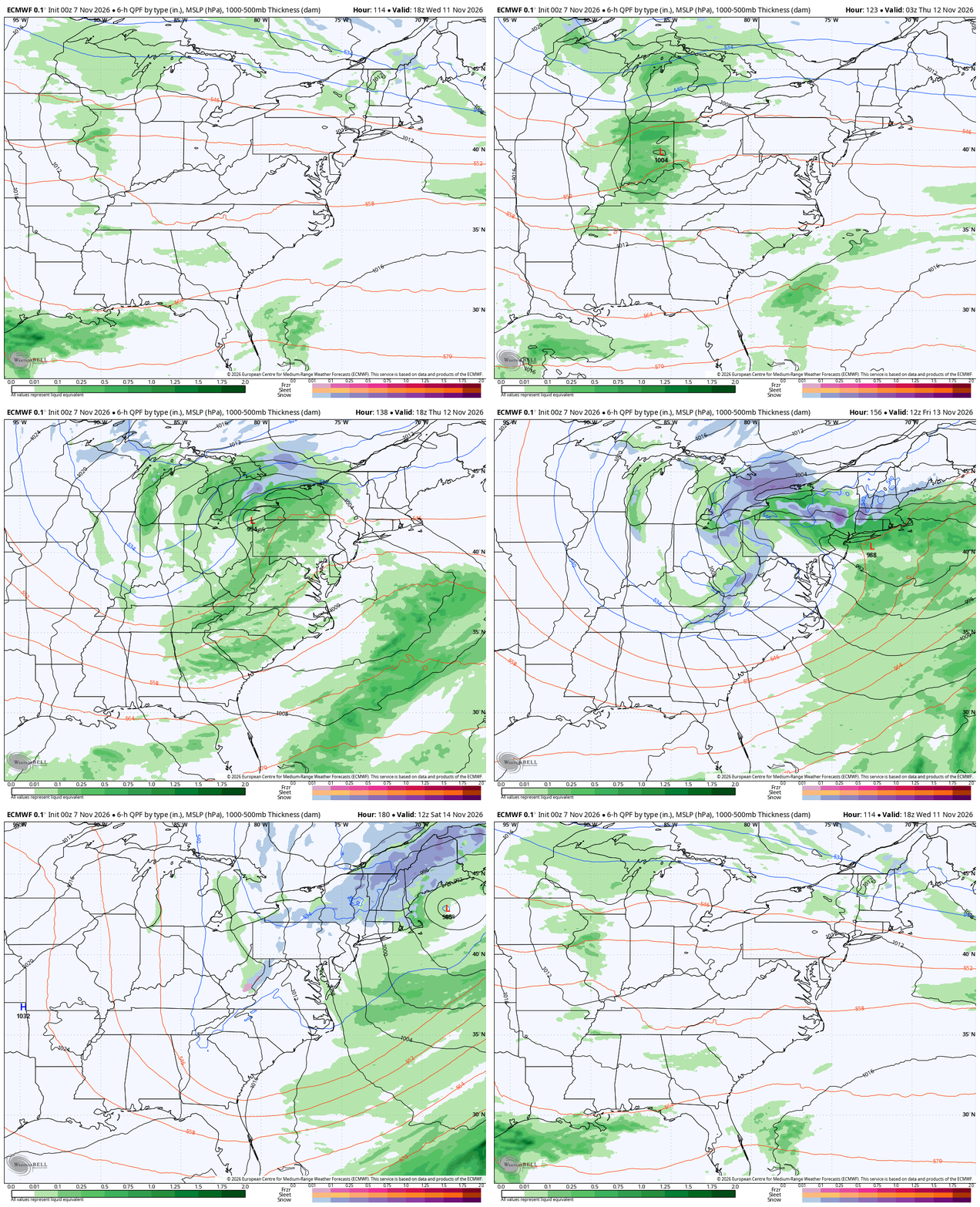
The EURO also has a pretty hefty storm in the east but doesn’t have much in the way of flake action back in these parts…
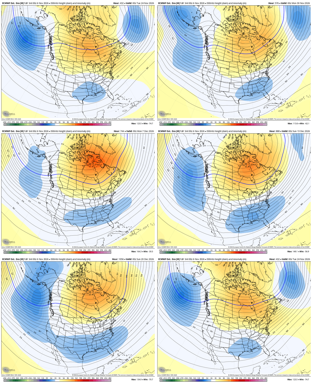
This shot of winter is likely a warning shot about the more sustained winter pattern developing late this month into December. The EURO Weeklies have not waivered with this setup. The new run goes all the way out to December 21st and you can clearly see the high heights up in Canada into the arctic with the trough underneath in our region…
I’ll drop by with another update later today as it’s time for two-a days here on KWC! That’s when you know winter is getting close!
Enjoy your day and take care.
