Good evening, gang. It’s a small taste of winter weather across Kentucky to start the weekend with some areas seeing graupel and the first flakes. This action slows down into the weekend as the colder air remains.
Graupel showed up for the second straight day in many different locations…
Graupel #KYWX https://t.co/oclzh46L0q
— Judge Jeremy Mattox (@MattoxJudge) November 13, 2026
Holy Graupel! LOL
IN Shelbyville Ky!
@Kentuckyweather @JudeRedfield
@BryceJonesWx @MarcWeinbergWX https://t.co/ETkwOSQG0n
— Dave-O (@BigBlueNationD1) November 13, 2026
The high mountains in the southeast will see the snow tonight with light accumulations.
Some leftover flake action can still show up from time to time this weekend across the east as clouds hang around. Temps are seasonable cold.
Next week looks really nice with moderating temps.
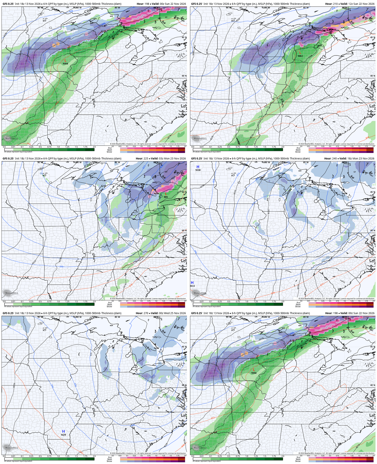
A big change continues to show up for Thanksgiving Week and is likely introduced by a big storm system. The forecast models all go back and forth on when and how, so we are just watching for the signal at this point.
Here’s the GFS bringing this system in next Sunday and Monday with cold behind it…
Barney!!!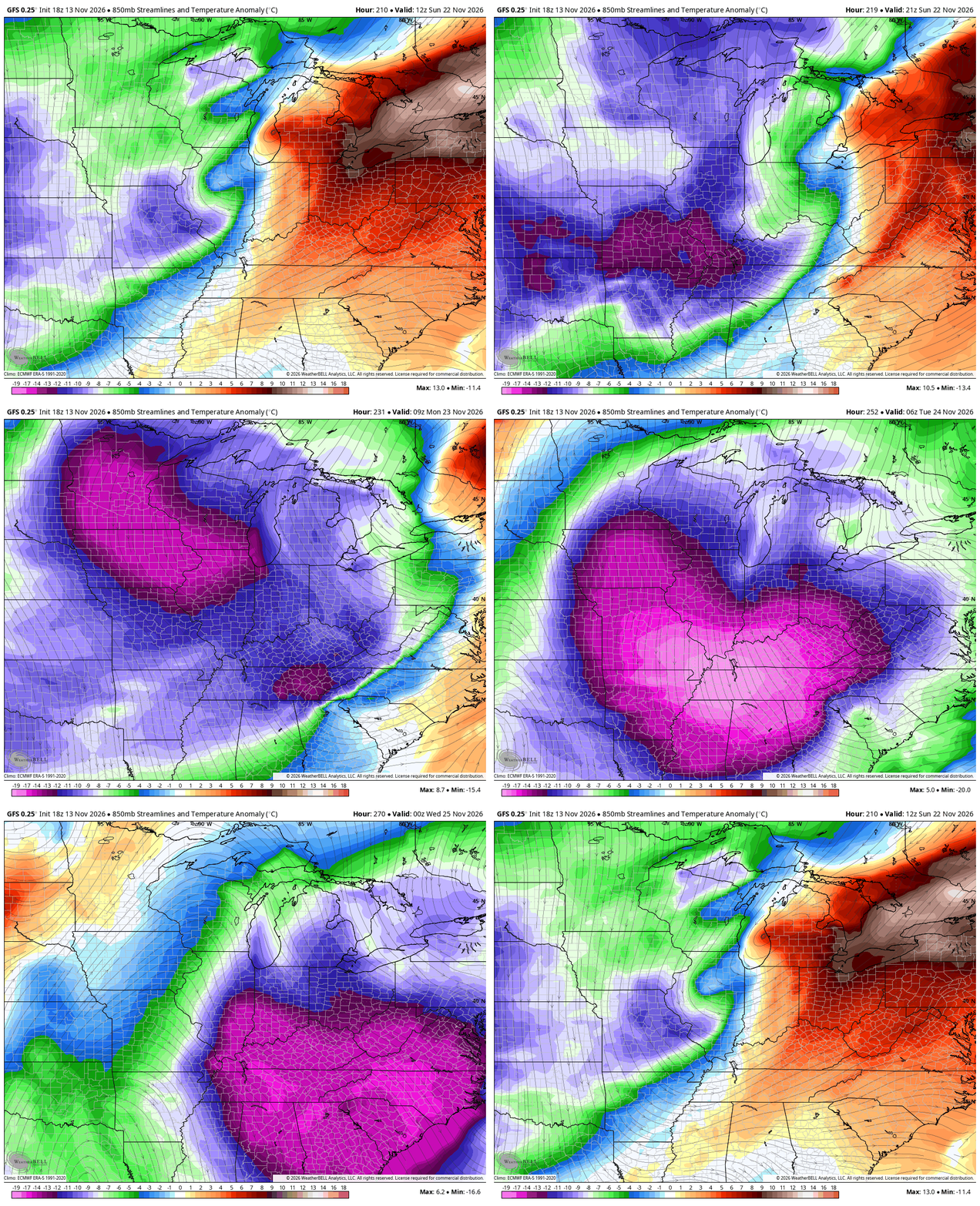
The full update comes your way later tonight. Until then, here are your chilly shower/snowflake tracking tools…

Make it a fantastic Friday evening and take care.
