Good Sunday to one and all. We are ready to wrap up a seasonably cold November weekend across Kentucky. A slow mild up is in store for the week ahead with bigger changes lurking for Thanksgiving week.
Temps today are mainly in the 40s with a mix of sun and clouds. Highs Monday through Wednesday will be back into the 50s with lows in the upper 20s.
Thermometers then climb toward the 60s for Thursday and Friday…
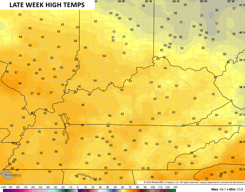
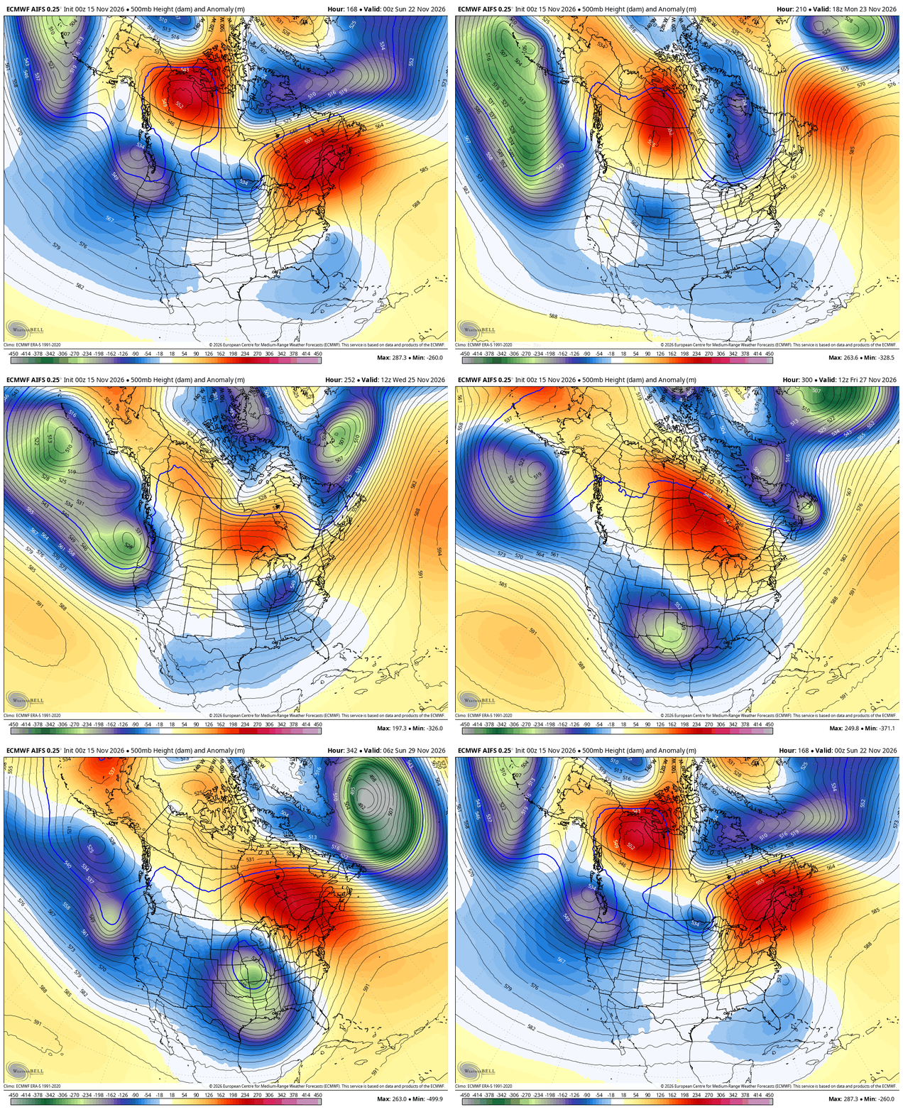
Temps stay mild into next weekend before the jet stream starts to buckle to start Thanksgiving week. This will feature several big systems rolling across the country, but it’s way too early to be more specific than that.
The EURO AI gives us a good look at these big systems…
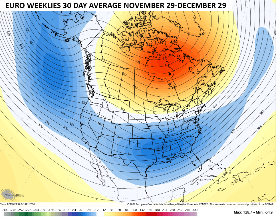
Thanksgiving Week is the time frame the EURO Weeklies have been pointing to for the change that takes us into a pretty good winter looking setup into December. That’s a massive block showing up in Canada in the 30 day mean that ends December 29th. Under that is also a nice trough the southern half of the US…
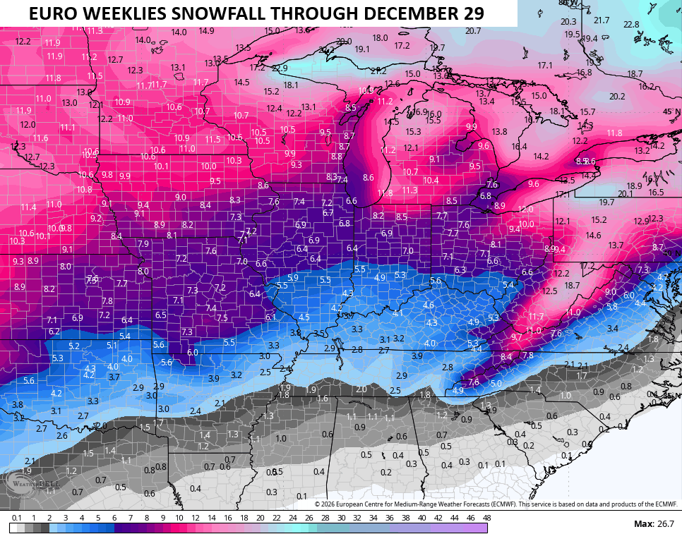
With a colder/stormy pattern likely in that scenario, snow chances show up and the EURO Weeklies continue to grow more emphatic with those…
Make it a sensational Sunday and take care.
