Good Tuesday to one and all. Our amazing week of November weather rolls on across the Commonwealth, but those changes are lurking for Thanksgiving Week. These changes will actually begin this weekend as a cold front moves into the region.
Before we get into the pattern that will lead us into an early start to winter, it’s a good time to get you guys ready for a big day coming this Thursday…
It will be fun giving that forecast with highs on that day in the 60s. Is that a sign of things to come?? Hmmm
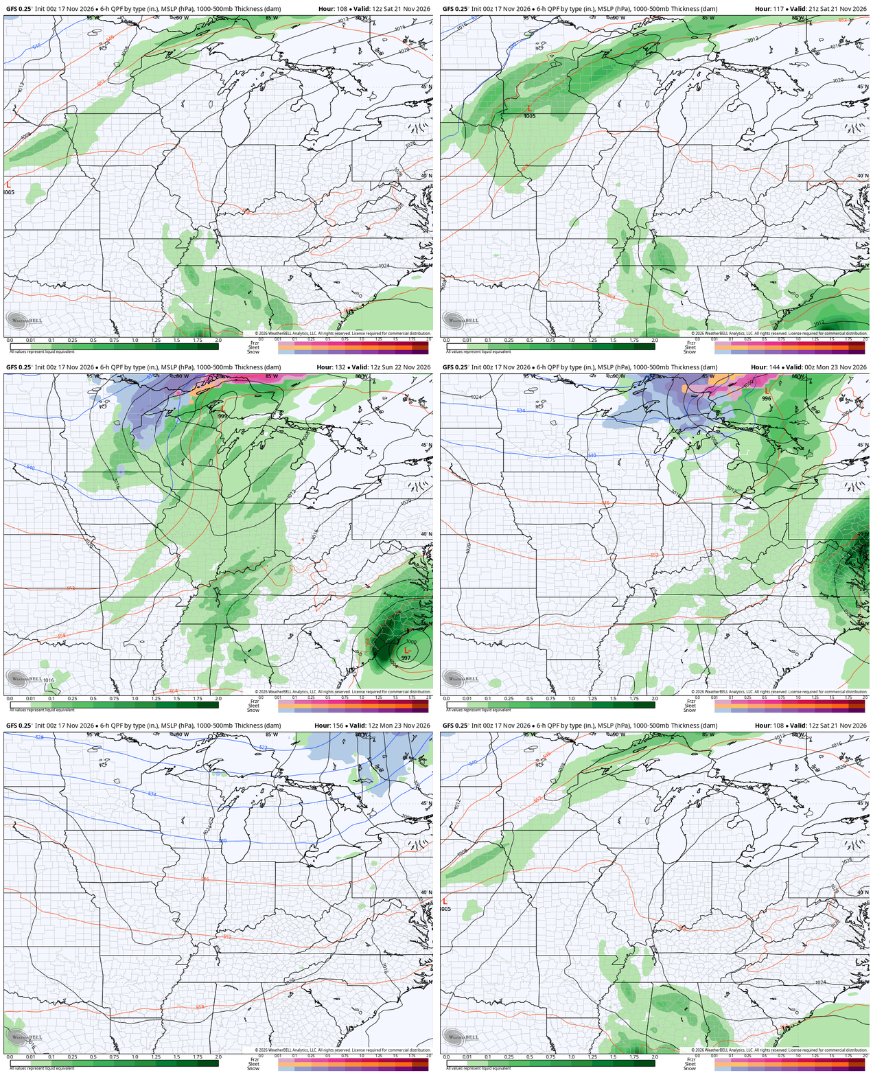
In terms of the weather around here, we watch those big changes start to show up with a cold front this weekend. That front brings gusty showers ahead of it from late Saturday into Sunday…
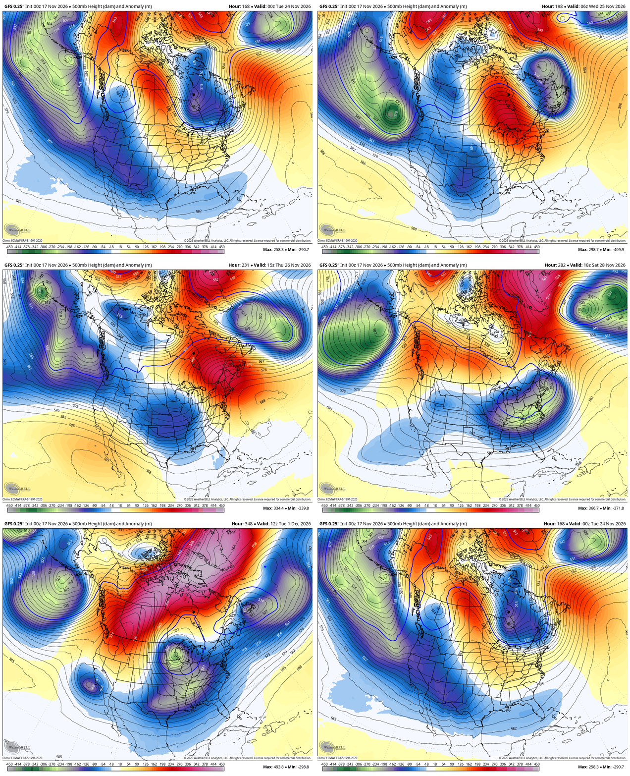
From there, we watch blocking really start to go up across Canada, extending into the arctic. This allows for a very active jet stream underneath it across the country, leading to more big storm systems. Watch these deepening troughs slide through here next week into the first few days of December…
The timing, track and intensity of these storm systems will be a work in progress, but the models have all been keying on the action for a while. One of these storm systems may very well impact the busy travel day Wednesday into Thanksgiving…
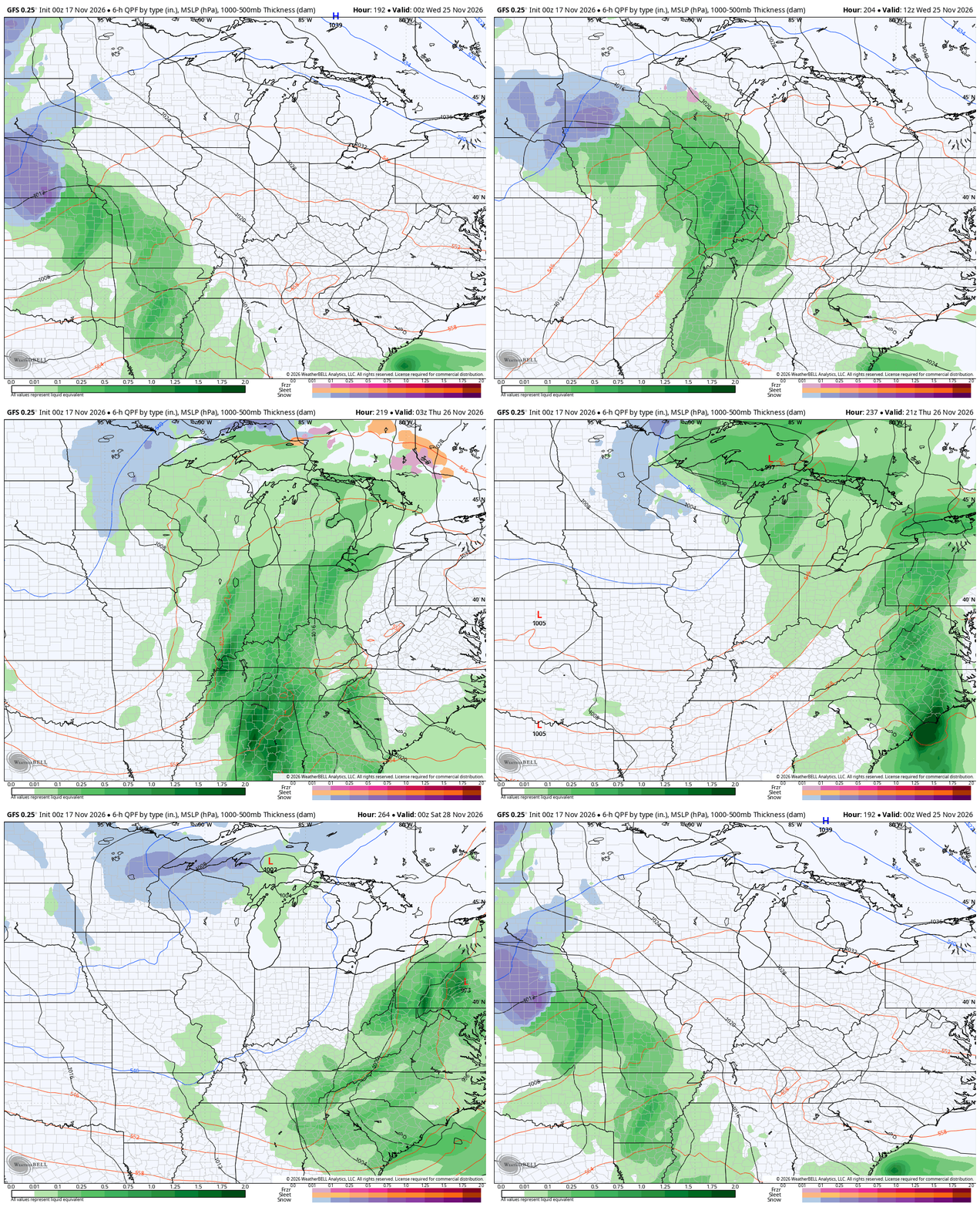
With each passing storm system, the air behind them grows colder with the GFS showing some winter weather late in the holiday weekend into early December…
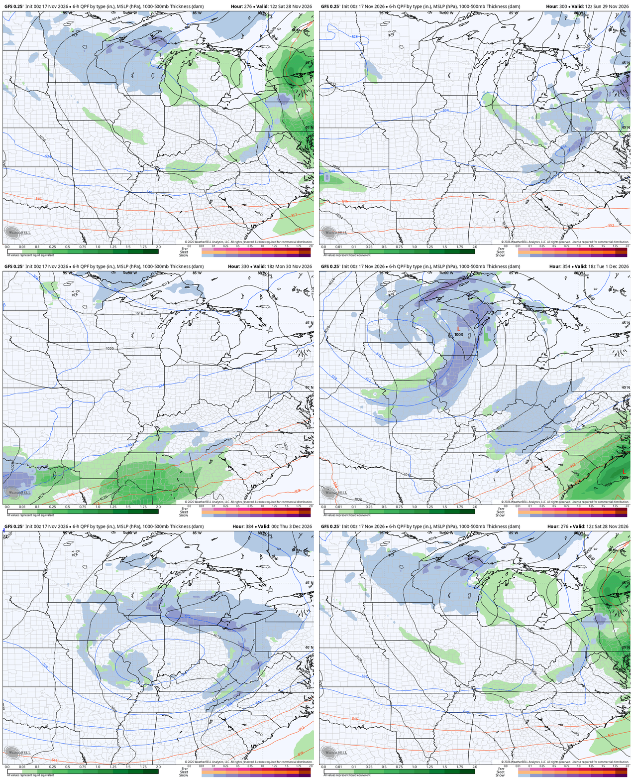
This actually aligns with when the various ensembles have been showing snow chances in our region and they continue to do so.
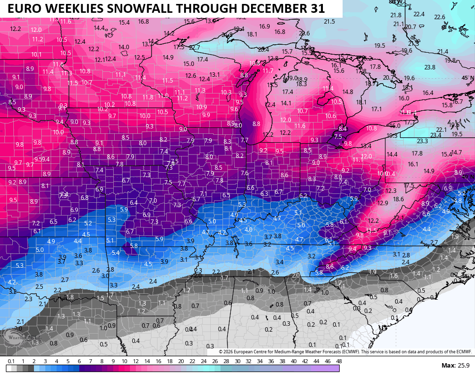
For weeks now, the EURO Weeklies have been all over this pattern change starting next week before really digging in for December. The EURO Weeklies have been as steady as ever and continue to be with this animation from December 1 through New Year’s Eve…
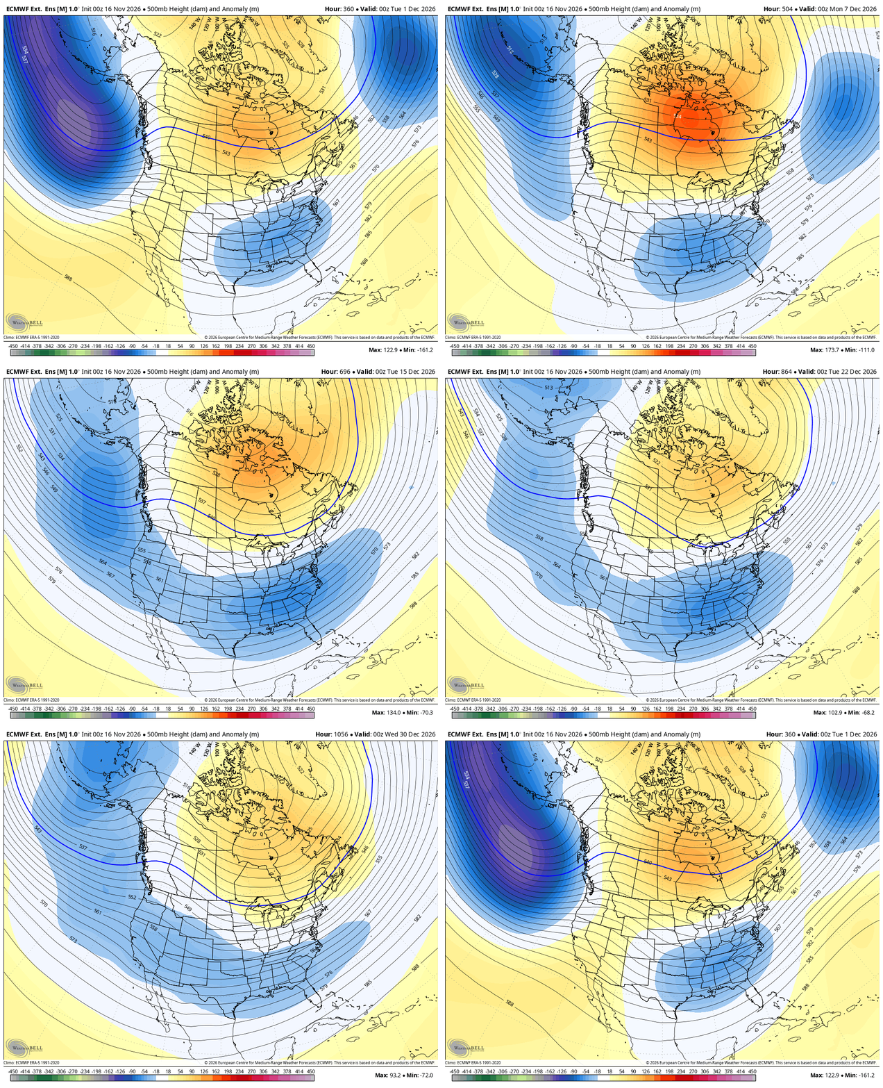
With these troughs sweeping across the country, it ups the ante on storm systems that can deliver snowfall to our part of the world. The Weeklies continue to show above normal snowfall through the end of the year…
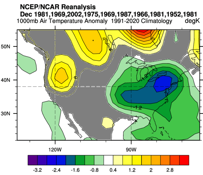
It’s still interesting to see the GFS SuperEnsembles centered on November 27th. The best match pattern years show up on the bottom right and we still have no Super El Nino among the group…
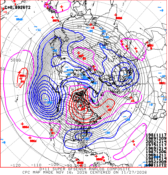
1981 is there 4 times, so the pattern obviously has a little bit of that year in it ha. Here’s what all those years together look like for December temps…
I’ll have another update later today. Make it a good one and take care.
