Good Monday, everyone. Warmer air continues to push into the bluegrass state today and this is a sign of things to come. The overall setup as we head toward the end of May into early June has a warmer than normal look to it. Your friendly weatherdude is ready for it… I’ve had my share of cool, chilly, cold, arctic cold… you get the idea.
Highs today return to the 70s for the first time in several days. That will put us squarely in the normal category for this time of year. A warm front looks to arrive overnight and early Tuesday and this may have a scattered shower or thunderstorm with it.
The NAM simulated radar is picking up on this…
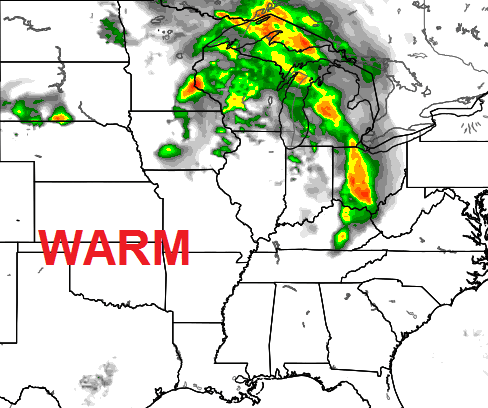
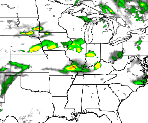
That action scoots away early Tuesday as warm temps take over. Highs make a run at 80 degrees on a gusty southwesterly wind. That warmer air takes us into Wednesday with temps into the 80-85 degree range. It’s looking more and more like some scattered storms will try to crank up late Wednesday. The NAM has a couple of boomers moving in…
 The threat for storms will then carry us into Thursday and Friday as a weak front hangs around the area. The flow aloft suggests we will have to watch the northwestern sky for scattered storms over the holiday weekend.
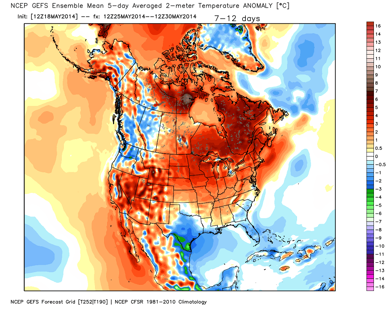
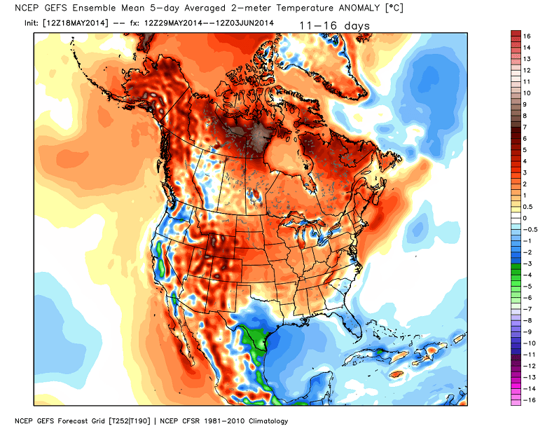
I mentioned a warmer pattern showing up. The GFS Ensembles are pretty enthusiastic on a warm pattern developing across much of the country…
 Have a great Monday and take care.

Right on cue with the warm weather this week leading into Memorial weekend.
Does anybody know why the islands of Jamaica and Hispanola are trending warmer than avg., but the surrounding seas are much cooler than avg?
I should have mentioned on the GFS maps…..
My hypothesis is that there will be little winds to push the cool ocean air over the island. The sun will warm the island up and will stay there and not be pushed out in the ocean. Land warms and cools much faster than water. Although I can’t say for sure because I’ll need to look at the wind fields from the GFS. (Idk where to access that info)
Somebody had asked the other day if it had gotten cold back in May 2002. Well today’s record low in Lexington dates back to 2002, when it hit 32 degrees, so somebody has a good memory. I think we tried to play golf in that stuff, if my fading memory serves.
Speaking of records, based on the GFS Ensembles that Chris posted, looks like record high temps are in order for Nunavut the next few weeks. 😉
Thanks Chris. Sir, you are not the only one who is ready for the warmer weather. I will welcome those temps with open arms. And a few scattered storms to go with it is not really bad, either. although yesterday was a gorgeous day, it was still a little bit cool. But still beautiful.
Happy Monday everyone! Have a great rest of your day!
Looking at those maps looks like the warmer air is ready to stay this time, if we get another big cool down it will be in June and those are rare events!