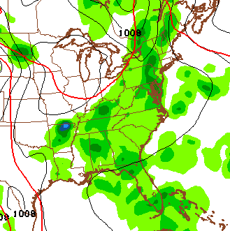
Good Wednesday, everyone. Thunderstorms rumbled across the state on Tuesday, causing significant wind damage and putting down torrential rainfall. Today won’t be as bad, but scattered showers and thunderstorms should blanket the bluegrass state.
The storms out there today still could pack a bit of a punch. A few strong storms will be possible in the north and east, especially. Any boomer that goes up may put down enough water to create some localized high water problems.

Current temperatures

A storm or two may linger into Thursday as temps hit the low 80s. A weak cold front moves our way on Friday and that may touch off a line of showers and thunderstorms…
That takes us into a weekend that will feature the threat for a shower or thunderstorm with temps beginning to warm. As a matter of fact, we may try to turn on the heat for a day or two early next week. The models have been overdoing the temps for the past month and that is certainly possible here. We may end up being on the cusp of some hotter weather and that’s where clusters of storms can sometimes roam.
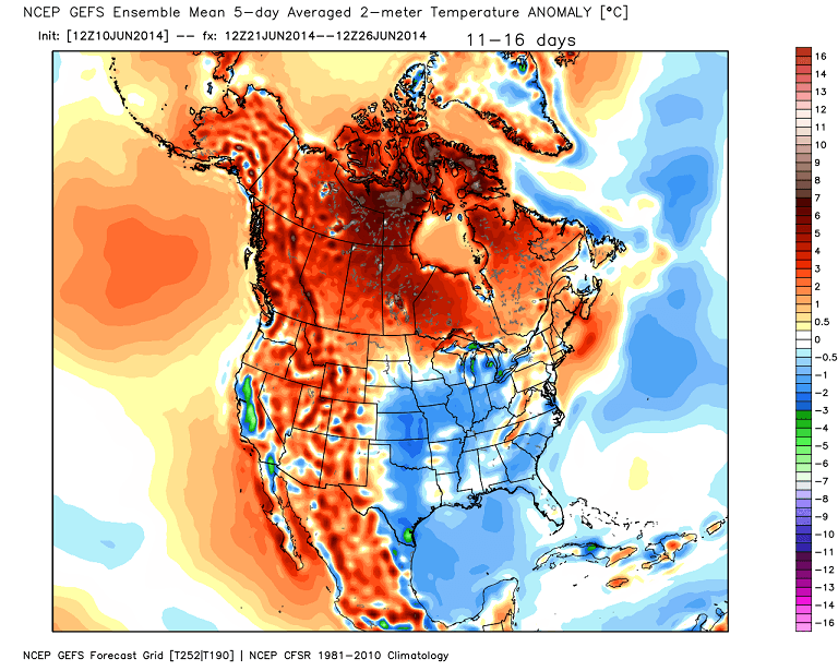
Regardless… the GFS Ensembles take our temps back to normal or below…
 Have a great day and take care.

Im glad I finally got a good rain yesterday, today’s rain chances looks few and far between, not looking forward to the 90 degree stuff but it is getting in that time frame for that to happen!