Good Wednesday to one and all. All is quiet on the weather front until we get into late this weekend and next week. That’s when the pattern really begins to revs up with some tropical moisture and big dips in the jet stream.
There is nothing more I can say about the weather we have through the start of the weekend. It’s awesome… enjoy!
Changes begin to show up by Sunday as moisture from the Gulf of Mexico works our way. The European Model continues to show a pretty amped up system…
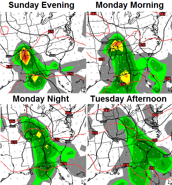 There are still some question marks about the evolution of that system, but some tropical rains remain very possible into early next week.
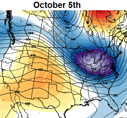
I mentioned the big dips in the jet stream showing up in early October. The European Ensembles shows a couple of pretty stout ones…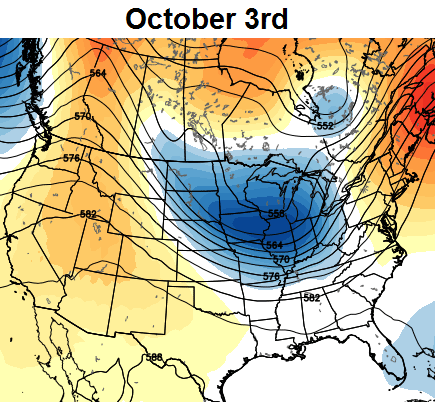
 Looks like a very active pattern is about to take shape. Have a great day and take care.

Thanks Chris. Hope the cool weather stays out of Florida for another two weeks. Too cool to sit out at night with an ocean breeze coming in. Our weather has been nothing short of amazing the past few days and I am not complaining. I’ll take it. Have a great Wednesday everyone.
OCTobER SNOW is acoming……………………..
Been following this possible early October chill now for a week using a 1987 analog, which that month was pretty cold for Louisville (6th coldest on record) and Lexington. It may end up not being as cold but frost could be on the pumpkins in about 10-14 days.
RYDER CUP WEEK!!!!!!!!!!
Has anyone heard that cutting open a persimmon and seeing the shape inside can tell
You about the winter ahead? A fork means a mild winter, a knife cold and windy and a spoon means shoveling snow
A persimmon seed that is
I have heard that and I cut two open yesterday and both had spoons , or shovels in them. Means a lot of shoveling snow.
I know many of the local mets are putting more stock into the GFS (which is suggesting less in the way of cooler temps & rainfall), regarding the weekend storm system. I would like to believe the ECMWF…since many areas in the KY/TN valleys could use the rain. But it’s hard to trust any model output that promotes a widespread rain producer during this time of year. At any rate, I’m ready for highs to cool back down into the 60’s again. I look forward to what October may bring…
Check back with them later because the GFS now looks just like the European Model. 🙂