Good Thursday, weather weenies. We must be living right here in the bluegrass state because the weather continues to be nothing short of fantastic. Let’s all get out and soak it up over the next few days because the pattern is about to kick it up a notch.
You know the forecast through Friday. I have nothing to add to it. I will make one very small change to Saturday as I can see isolated showers trying to pop across southern and western parts of the state.
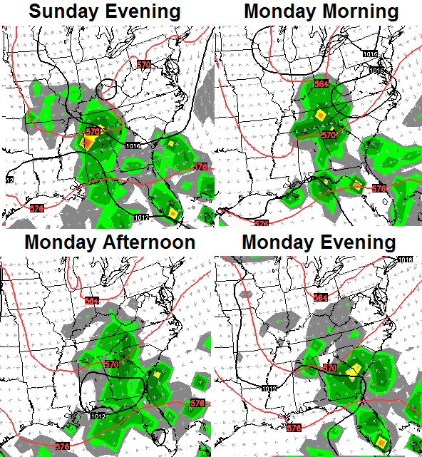
Those showers look to increase from the southwest late this weekend into early next week. The GFS has jumped on board the European Model rain train…
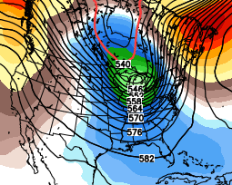
GFS
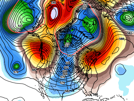
European

Both models bring the rain into our region then slowly slide it eastward into Tuesday. Locally heavy rains are possible if these runs end up verifying.
Another break in the action scoots in behind this as we say hello to October on Wednesday. This is when we see the overall pattern across North America start to get very active. We’re likely to make a transition into a much colder pattern late next week into the following weekend. We looked at the European Ensembles yesterday, and today, the GFS Ensembles show a similar look with a deep trough trying to dig in…
This is where the weather upstairs begins to take on a familiar look. Check out the blocking across western Canada into Alaska showing up by week 2 of October…
 That would certainly up the ante for some early season cold weather around here and for much of the country. I’m not sold on that as of yet as I see more of a back and forth battle. That said… some of my new analog years started winter pretty darn early. We did it last year. Can we make it two in a row? Time will tell.
Speaking of winter. I will share some interesting seasonal model forecasts in the coming days.
Have a great day and take care.

A mid October snow would certainly be crazy!
This is a great day to begin the World Chicken Festival in London!!! Come on down, Chris!!!
We had snow in October last year!
The Lady Bugs came out early this year which is supposed to be a sign of an early and hard winter.
I’ll be interested to see what tomorrows blog post has to say about the weekend. Here in Louisville, the forecast from every source has no more than a 10% chance of rain and that’s only for Sunday night. Mid 80’s and sunny thru at least next Thursday. We are in our longest stretch of dry weather this year and we really could use some rain. It’s just bone dry and dusty out there.