Good Saturday and welcome to the final weekend of September. Things are starting out on a warm note, but some showers may work in later Sunday into Monday. That looks to kick off a very busy weather pattern that will feature some big time dips in the jet stream into early October.
Temps today will range from the upper 70s to low 80s with a mix of sun and clouds. There is the smallest threat for a shower going up across the far south and west…
Current Temperatures


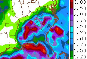
The threat for some showers will increase as we head into late Sunday and Monday. The greatest concentration of of rain should be across the south and east. After some waffling, the models are back to showing heavy rainfall in these areas…
Bigger changes blow in toward the end of next week. Winds will gust up as temps warm ahead of a cold front. That front will then sweep in with showers and thunderstorms…
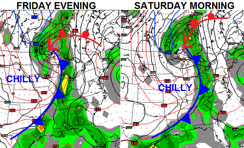
That’s a classic fall cold front with a big temperature behind it. The models are digging in a very impressive trough behind the boundary. Here’s the European Model…

The GFS Ensembles try to cut this system off right on top of us…

The first weekend of October should turn out very windy and chilly with the potential for lingering showers.
Have a great day and take care.
