Good Sunday evening, gang. Our big temperature plunge is just about here as the arctic front inches closer and closer. This will bring a 30+ degree temp drop in a matter of hours later tonight and Monday. This drop will also be accompanied by gusty winds and the potential for frozen precipitation.
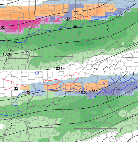
The 6pm temperature map shows the drop I’m talking about…

Yep… that’s impressive and low level cold air and computer models don’t mix well. Models don’t see the low levels of the atmosphere very well and you will likely see the numbers come in colder than the models suggest.
That colder air has been picked up very well by the European model which continues to suggest frozen precipitation developing in the afternoon and evening…
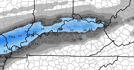
Again, think of that as showing the areas with the best potential to see a wintry mix of precipitation into Monday night. That is obviously along and north of the Interstate 64 corridor.
The front will then hang around our region through the rest of the week and that means some big temperature swings. Many of the latest model runs are finally sensing the dense air to the north and they’re coming in with colder temps.
The Canadian Model for Thursday afternoon…
 That matches up well with the Hi-Res GFS…

With a wave of low pressure around, that same run suggests the potential for another round of frozen stuff in the north Wednesday night and early Thursday…
That would likely lead us into a lot of wet weather from Friday into next weekend. Once into the following week, we should see the cold pattern begin to fight back in. The Canadian Model and its Ensembles have been very consistent in showing arctic air returning by early that week…
 Of course, it’s not like the upcoming week will be a warm one. The overall setup suggests this week should be much warmer than it’s actually going to be. Sprinkle in a couple of threats of wintry precipitation and… you get the idea.
I will have a full update later tonight. I leave you with some tracking toys…
Sustained Winds

Current temperatures


Take care.

Those dark pink colors on the Wed/Thurs map don’t look good. Hopefully the predictions are correct and KY stays on the warm side of that mess.