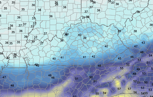
Good Tuesday, folks. We have a heck of a temperature swing taking shape across the state today and that fits in nicely with the overall setup I’ve been yapping about. It’s a pattern that will lead to a lot more rain in the coming days. We may also see Old Man Winter try to fight back once into next week.
A wave of low pressure will work northeastward along our stalled out front. That will bring a surge of milder air into the southeastern corner of the state. Temps in this region may hit 60 while areas of western and northern Kentucky stay in the upper 30s and low 40s.
Showers will also be common across the land. Track away…
Current temperatures


The chance for a shower or two will carry us into Wednesday as temps become more uniform with mid 40s to around 50.
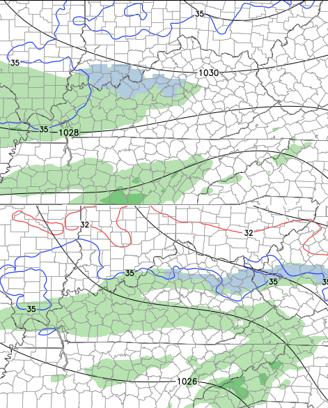
Colder air moves in for Thursday and could mean readings struggle to get to 40 in some areas. The Hi-Res GFS thinks that’s the case…
There may be a streak of light rain working in here during the afternoon and evening. That same run tries to have a bit of a mix in the north…
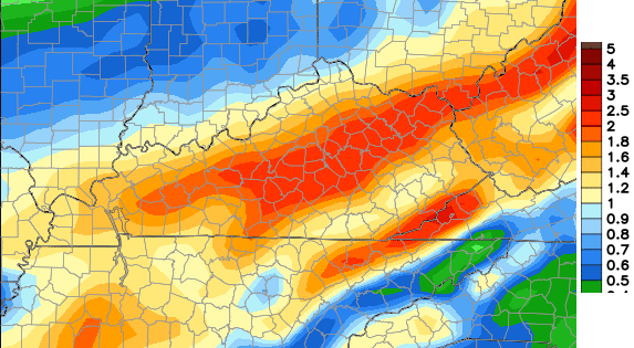
That sets the stage for a much bigger rain maker to work in for Friday and Saturday. These days have washout written all over them! A good 1″-3″ rainfall could be in the making…
That is just a nasty look through the first part of the weekend.
Sunday and early Monday may find us with a lull in the action and MIGHT turn out to be decent. That should all change by the middle of next week as the potential for true winter weather increases. The models have been trying to dig a trough into the east and develop some kind of storm system.
The Canadian Model has been leading the charge with this and spins up a snow maker from the Ohio Valley into New England…
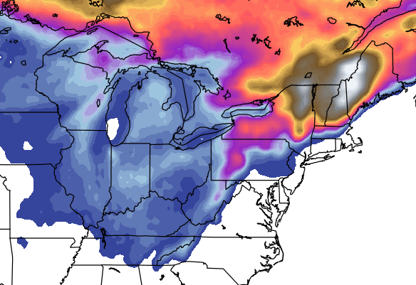
I’m not sold on anything close to that happening, but it’s something for us to watch.
I will have updates later today. Make it a good one and take care.

I see BORING BLAH weather in SE Ky. all week….rain, low to mid 50 s ….rinse and repeat lol…
Unfortunately, that’s all SE Kentucky will see for the duration of the winter with the exception of low to mid 50’s as we will certainly have quadruple our share of 33 degree rain. All the early talk of a correlation between this winter and the 76=77 winter was just that….talk. Now, that was a true winter….cold and snow from beginning to end with no low to mid 50’s at all….no correlation in the least between then and now.
Thunder. . In dec at 40 degrees. Only on ky! “
ty chris for all the info.
This mornings t-storm with temps at 40 degrees surprized me. Lot of lightning and thunder. Was hail on ground bout 2 miles south of me. Odd weather for dec.