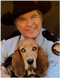
Good Wednesday everyone. We are just about to say “see ya later” to 2009 and then it’s all aboard the Roscoe P. “Coldtrain”. We will give the upcoming cold wave the nickname of one of the all time great TV Characters. Roscoe P Coltrane was a fixture on The Dukes Of Hazzard and is now headlining the blog. He has fallen on some hard times lately if this is the only gig he can get! 
The true cold wave comes this weekend and is likely to carry us through much of the month of January. More on that in a moment.
Let us get into the weather that will be with us to close out 2009.
The storm pattern over the next few days is convoluted as we have 3 systems that are all fighting for which one will be the dominant one. Because they are fighting it out… we wont see them getting together until they are well offshore of the New England states. This means we are going to see a weaker system affecting our weather today into Thursday and have to wait until later New Year’s Day into the weekend to get northwesterly flow even snows around here. Before then… some rain or a light rain/snow mix will be possible today and Thursday. Arctic air will then come pouring into the region and with a strong northwesterly flow… many, hard to time, disturbances will be pushing through here into early next week. These systems will unleash the lake effect moisture to aid in the snow showers and squalls. The arctic air would provide the high ratio snows.
Here is what the European Model shows how this all plays out…
Friday Evening
Saturday Evening
Sunday Evening
Man… that is some serious cold coming into the country. Brrrrrrrrr! Get ready for this 1976/1977 imitation of a pattern to continue well into 2010.
More updates will be coming your way as needed so check back. Have a great Wednesday and take care.
Select Page

thanks for the update CB the pattern looks like its getting ripe!
We can only hope to get the snow as well as the cold.
I thought they had a big meeting to fix this global warming, hummmmm?
Let’s hope we can harvest the fruit!
Going into hibernation…somebody wake me when we get real snow in Lexington or spring arrives! 🙂
Thanks, Chris. As Snowcat said, I hope we can get some snow to go with the cold! Surely we can manage something out of it, unless it gets too cold to snow….
Yep, Coldtrain is leaving the station, but the Duke brothers have all the water in the trunk of General Lee and heading in the opposite direction;)
We have as much chance of big snow around here this winter as us seeing a Duke’s of Hazard sequel released in theaters;)
Like our weather, that movie scarred my brain.
Happy New Year! We are going to go to a resort in January to see some REAL snow:) Then off to Minnesota during last week of January:(
Unfortunately in this barren snowless plain of central Ky the only chance we have of seeing real snow is to pack up and go to it. It’s not coming to us.
Thanks Chris for the update..
Taking Bubba’s Theory, when we are at 32=dry and 33=rain, that’s about the same theory as my continental shift theory, doesn’t explain why there is blizzards all around us, when they are 0-15 degree temps and getting blizzards as well. So back to the drawing board! 😉
So the next theory would be a broken jet stream, it’s like the General Lee jumps over Ky when it gets close!
My bet is after this winter, even Chris will jump on the snow dome bandwagon;)
Has the GFS lost its mind? See the last frame.
http://www.nco.ncep.noaa.gov/pmb/nwprod/analysis/namer//gfs/12/gfs_pcp000018_l.shtml
I don’t’ get it whats the issue other than it being the GFS
Okay! No big snow for December here in the central part of the state. On to January! I’ll keep my hopes up…maybe!
January is going to be fun, but with our luck it won’t snow til April! lol
Some of you guys kill me with the snow dome this, snow dome that… If you know it isn’t going to snow then why get on here?
For those of us who aren’t forecasters, he was simply asking what about the moisture forming in the gulf, how will that affect us? The ground is frozen much like it was last year when we got the ice storm, we still have some snow on the ground in east ky.
John Wall is forecasting lots of snow in January for all of Central and Eastern Kentucky.
Well its a done deal then.
Patty, you’ve got the right attitude minus the maybe part. Versailles is going to get its snow sooner rather than later, maybe.:)
I believe he said it would be raining 3’s.
I don’t know if its right, but the last frame down at the bottom right shows plenty of precip (dark green) and the zero degree line dipping right below central kentucky. I’m not a forecaster but wouldn’t that mean a lot of snow?
what i see is some light green and thats only from BG westward and as far as the 0 line on that frame i see that right above Lex
I don’t know, but on my PC the 12z run of the gfs has the zero line almost all the way down to south central kentucky.
http://www.nco.ncep.noaa.gov/pmb/nwprod/analysis/namer/gfs/12/images/gfs_pcp_018l.gif
I see the same thing as you, I live in east ky, so looks like I’m in great shape. I had 9″ on the ground just as CB predicted the last go round, so I’m being a little greedy. I want more snow.
Me thinks there is not a condition of “snow” being part posting here.
People joke and post because it is good therapy for the big snow deprived. Not one model in eleven years has played out for this area in regards to big snows from outlooks and some have even went bust in less than 24 hours out.
We have gotten a few over- performing clippers that gave us about 5″, but every gulf event is either rain, mix or lots of ice. Uncanny weather behavior in this regard.
Even CB has admitted amazement in this from time to time. He at least makes it fun to discuss here. Except the ice part.
As much as I wished that was the 2M temps, there would be so much excitement on this blog, it would probably crash the system! 😉
Here is the one you want to refer to.
http://www.nco.ncep.noaa.gov/pmb/nwprod/analysis/namer/gfs/12/images/gfs_ten_018m.gif
That means it melts as it hits the surface or ground temps and we end up with a COLD RAIN, unfortunately! 🙁
But on a side note.. It won’t get as cold as the models are suggesting, we are still in the ballgame for something to happen in Jan as I have been seeing a major blocking pattern, where it just feeds COLD and PRECIP from the NE. Maybe not Kentucky, but somebody near us is going to be measuring snow by feet, not inches!
20s for high temps in Ky is a very good recipe for snow.. but if you get 10s its too dry for anything major, other then a potent clipper from the lakes. I feel that Chris is going to be pumped within the next few weeks! 🙂
Hey all! Been reading your blogs all morning. I live in Murray, KY and am weather and especially snow enthusiast such as yourselves. When I moved to Nashville, TN in 2002 I remember Nashville getting six inches from the 2004 storm and three years later I moved to Evansville, IN and the last winter saw a six inch snow. Just moved back to Murray one month before that ice storm we got too, ouch. I am glad to see the colder air for bigger snows, but looks like the cold air dries the air and the jet stream keeps moisture to our south. Anyone know if and when the jet stream will move our way before Spring hits for a better setup? Thanks in advance!
we are not worried about people getting snow or not getting snow if they aren’t in KY Bernie 😉
hey fellow bloggers in a few days i should have some youtube footage of some real snow. I have got the stars aligned no work + heavy lake effect in northern indiana so i am headed up to get some footage and try out my new snow shoes!!! maybe if i am lucky i will see jeremiah johnson, and an insane amount of SNOW!!!!!
My wife’s family live on Lake Michigan and it freakin’ dumps up there! We just got back and had a very white Christmas! It was still snowing when we left! I was pumped! I’ve got the pics posted on my Facebook! Be safe up there… I’m headed to P.N.S. on Sunday!!!
sweetness! I am excited i plan on getting a campground i hope my tent can deal with all the pow! but i got these new snow shoes and really want to use them. right now the nws in southbend and grand rapids is still in watch mode as soon as the warnings are issued i’ll bite so for now i plan on heading up late tommorow nite but likely friday morning. Its been 12 years since i have seen any snow and i am free to take this trip. if i dont take it i may regret it big time! man i love snow! i think the campground has wireless so i’ll try to check into the blog from up there.
thomas, I wouldn’t bet on anything big with such a dominant northern jet but look at dec 2004 and jan 96 the northern and southern jet can get along ifn’ they want too!
Just trying to think positive… as I remember the big winters of ’77 and ’78 we didn’t get any real snow until after New Year’s. In fact I remember both years it started to snow the day before Christmas break was over, so we got an extended vacation from school(I was in Paducah back then).
Faye, in 76-77, we got a 5 inch snow Thanksgiving weekend. Then nothing else till after the new year, just barely. I remember getting out and going to work in that stuff!
I am really trying to think positive. I think we can see a good snow before the winter is over…..thing is, will we see it for real, or, as is more likely around here, on a you tube posted by Tommy, or on the news? Time will tell! But I am thinking we might just see some for real before this winter is over. (Hey, a positive attitude NEVER hurts! 😉 )
tommy, U Da Man, ain’tcha??!;) Other than myself, I’ve never seen ANYONE as crazy about snow and willing to just throw themselves OUT THERE in all Mama Nature has to offer?!:)
Send pix.
Yes, Coffeelady…Not sure about the Turkey Day snow in ’76(at least here in Nelson Co/Bardstown…I should remember it, but I had a “Heart Thingie” back in ’02 -shocked back 3 times…some things I recall vividly, some things not so much…?!)-, however, I am 99% sure of it being after Christmas Break ’77 when we got all that deep snow?! I know I went to school on Jan.2, 1977, it began snowing/sleeting about 20 min’s before I got on the bus home that day,(our bus driver got her “wife-beater hubby”..lol..to drive that afternoon..twin bro’s got into a bloody fist fight and he threw them off the bus on the side of the road about 15 miles from home after one of them took a swing @ HIM…remember that day fondly, as that man had those heathen kids FINALLY SETTLED DOWN!!!-whew!..lol!) and we didn’t go back to school here, except for a couple of days, between that day and the first part of March…?! We’d be off a few days, the roads would clear, “There WILL be SCHOOL in the Nelson County System TOMORROW!”, only to wake up the next morning around 6am, having had another snowstorm during the night…another 3-4+ days off…then ANOTHER storm!!!:)I remember an ice storm on a Thursday afternoon, too..reason being, my Mom worked @ the sewing factory here,and my grandpa had to pick her up that evening, take her to get her IRS taxes filled out, and it took a while…she brought me home the “Miss America BARBIE” that night!?:)My Grandma was the BIGGEST WORRIER, so she was at her rope’s end an hour before they finally made it home?!;)(In fact, I think the electricity had just slammed OFF about 5 min’s before they arrived home, too???! You could hear the ice hitting the roof of our old house and I remember looking out the window as it got dark, a little worried myself?!;(
Enough memories!:) I think we will see our SHARE of snowfall this year, too?!:) After all, we are BARELY INTO the Winter season right now…?! I never lose hope until after the end of March, as I’ve see some right NICE storms hit us just before then…?!:) We are just SOOOOO Anxious for the “BIG ONE”, snow-deprived…you live a bit South of me, your chances are a bit LESS than mine, but not so much. I’m pretty well “located”, but if there’s the “Donut Hole” to be had…it SURVIVES right over Bardstown!!!:( It’s like, the front bringing 2″/Hr. comes within a 5 mile radius of Bardstown, it’s like,”OOPPS!-Entering Nelson County…shifting to the NE/NW/gotta git OUTTA HERE!!!”(Sunday night, we had a GOOD band of Snow headed right for us…?! The nano-sec it hit the northern part of Nelson, it swung to the NE…I watched it on radar. We never got ONE FLAKE…?!
Enough! LOL! btw…I LOVE your blog/site!:)
Ah yes, I remember that winter of having weeks off from school with only a day or two here or there where you went back to school. I was taking a Home Ec class at the time (didn’t help me any, but that’s beside the point). We started on a two day project of cooking something. Did the first day’s work then more snow hit and it was two weeks before we came back to school. Talk about some nasty projects! I think it went from a home ec class to a bunch of biology experiments gone awry, lol! Amazing what colors of mold you can grow and the interesting smells…