Good Saturday and welcome to the weekend. The clouds are back in the bluegrass state to put a little dreary into the next several days. The clouds are the weekend star, but old man winter is trying to steal the staring role for the last few weeks of the year.
Let’s start with today and roll toward the holidays.
Clouds should be rather common today with temps hanging closer to 40 in the east with upper 40s in the west. We will need to watch some of the valleys in eastern Kentucky for the potential for a touch of frozen precipitation. The best chance for that would be tonight into early Sunday. The NAM is picking up on this…
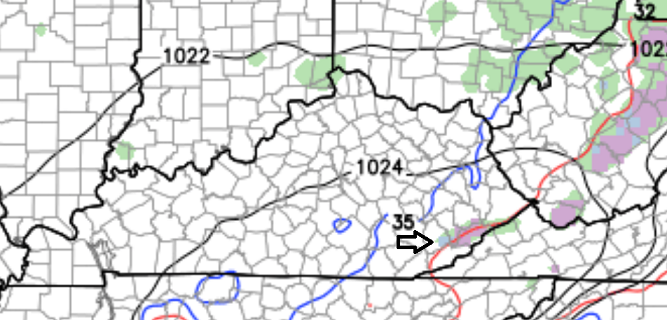
A greater chance for some freezing drizzle or freezing rain exists for our friends to our east in West Virginia.
The rest of the region could see some sprinkles or showers into Sunday with temps again closer to 40 in the east with 50 in the west.
Monday should find most areas close to 50 degrees as rain moves in from west to east. That’s ahead of a disturbance that scoots across the Ohio Valley on Tuesday. Much colder air comes in behind that for the middle and end of the week and we could see a few snowflakes fly by early Wednesday.
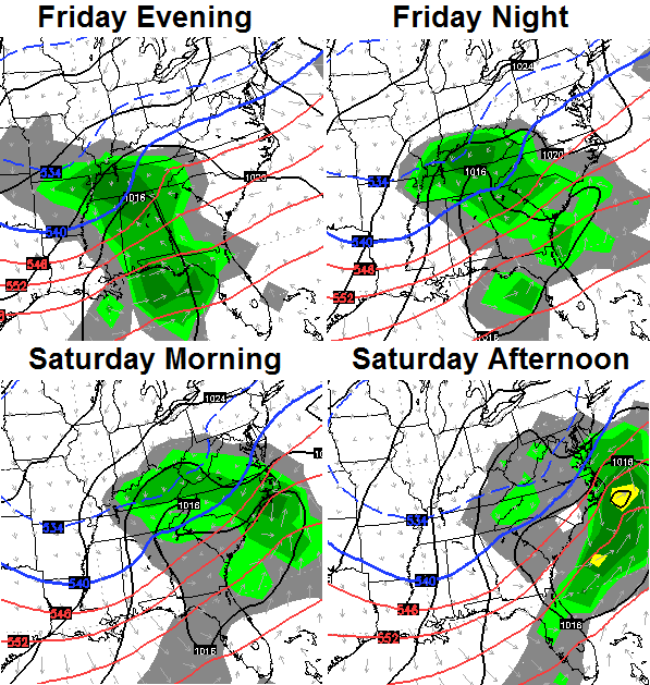
This is when things get a little more interesting. We’re likely to see one push of moisture heading our way by Thursday…
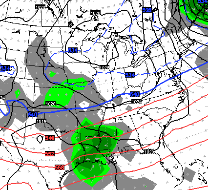
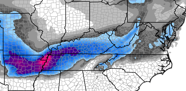
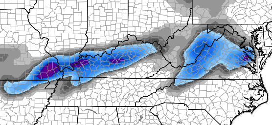
That could bring a touch of light snow into parts of the region before it diminishes. The bigger push of moisture comes from the end of the week storm. The models will continue to show different evolutions in the coming days, but the European and Canadian Models showed a similar trend on their last runs. A trend toward a farther south and less jacked up storm. The European…
Oh, Canada…
With a less amplified solution, it’s also a colder one that would have a much better chance at producing snow in our region…
That’s still a week away, so don’t get too cozy with any one model or any one model solution. Just know there is the potential for a storm system to impact our weather late next week into next weekend.
I would show the GFS but it continues to run in a different weather world. This model is about to be put out to pasture, but the “new” GFS hasn’t impressed me in the least. To those who insist on using this model as the sole reason to base their forecast on… How’d all the blowtorch warm forecasts work out for the past month?
Ok… off the soapbox. 🙂 I’m very pleased with the direction the pattern is going as it fits the ideas I put out before Thanksgiving. The setup is going to grow colder and colder and could go into the deep freeze by the time we hit early January. I’m worried this thing gets even colder than I was thinking before all is said and done.
The setup will also feature a hyper-active southern storm track that can bring a lot of white stuff to much of the country.
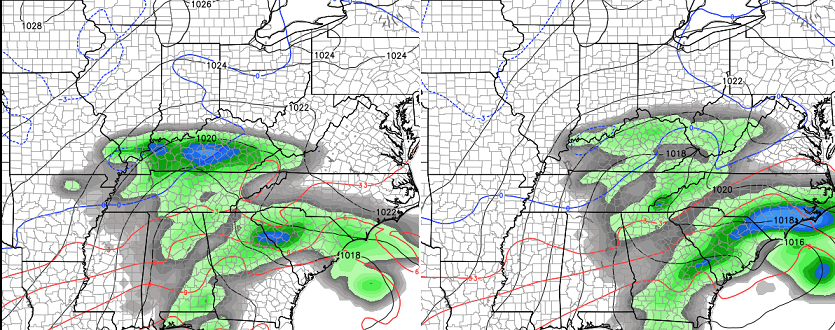
Christmas week has some pretty good potential for a couple of storms to impact our weather. Check out the threatening upper air chart from the European Model for the Monday of Christmas week…
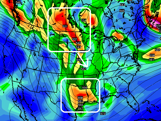
That is VERY interesting to see. If that is even close to being right… it would likely produce a big eastern US winter storm just before Christmas.
I will update things later today. Take care.

Thanks, Chris. Wishing for some SNOW with this run up to the Christmas holiday.
Go CATS!
Thanks Chris. Fingers crossed for a trend buster. A nice Christmas snow would be awesome.
Thanks Chris. Worked today so just getting a chance to read the update. Sounds like things could get interesting during Chrustmas week. Would be nice to see a white Christmas, but as you said that’s a long way away yet. Have a great rest of your Saturday everyone.