Good afternoon, gang. The snow showers and squalls kicked in right on cue last night and early this morning and caused some tricky travel times. We will still hold on to some snow showers and flakes in the southeast this afternoon, but the temps are stealing the show.
Midday temps are already down into the low teens in many areas with wind chills well below zero. Both of those numbers continue to drop this evening into early Thursday. Wind chill numbers will range from -10 to -20 and that’s in the danger category. Actual low temps should range from -5 to 5…

 Frozen pipes are a good bet with this kind of cold!
Another arctic front arrives late Thursday night into Friday and that may bring another round of snow showers and flurries…

The air behind that continues to show up colder and colder. Highs on Friday may not get out of the teens with low temps by Saturday morning dropping close to 0. Wind chills will be below zero again Friday into Saturday.
A messy system arrives late this weekend and early next week. That looks to be ahead of another plunge of very cold air that comes behind it and the models continue to suggest that may be accompanied by a storm system…
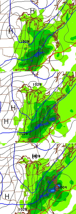
Another update comes your way later today. I leave you with some tracking toys for the rest of the day…


Make it a great day and take care.

Nice surprise with snow in the Chapmanville and Danville, WV area this morning. 1 to as much as 4″ in some isolated places.
CB, do you see any significant snow chances on the horizon, or is this the year of the festive flakes?
Messy means????
Wet burrito 🙂
that would make
messy jeans 😉
Confusous say don’t ask question when you already know answer. 😉
Festive flakes in Carrie of knott county not even a dusting. Been working outside all day ain’t so bad if you layer right
I placed my unprofessional response on the last post, concerning the system coming in Sunday night and Monday and I still feel that way. I`ve watched and closely followed weather, around here, for several years, since I was a teen (53 now).
The southern system will be a complete bust or a big snow system. The only problem with that is the warm air aloft. I believe Louisville will be on the freezing rain/snow line with all snow around seymour Indiana. E-Town and Lexington will be on the freezing rain/rain line and Bowling Green and Richmond will be all rain, then a small “wrap around snow”. Cold air is very hard to push out since its so dense, but it has very low dew points that has to rise before preciptation will start hitting the ground. We`ll see, but I would love 6 inches of snow or more with this system.
One more thing, our best case track would be for the low to track through Tennessee, then up the mountains, west side.
for you to get snow maybe but for the rest no
Sorry, I was being selfish, thinking only of the Louisville metro area. It would have to east of the mountains to include eastern Kentucky. But then the mountains would block it from going too far west. Predicting the weather, in this area, could leave meteorologists in a mental hospital. lol
Really don’t think there is anything to see Sun-Mon…Canadian still holding out but it’s pretty much on it’s on..Mid week is the one to watch..But we all know the drill..Will change 25 times between now and then..
agreed all I see is cold rain Especially the further east you live. If there is a shift then that changes things.
Wait! You mean it’s a “week away”?
Aren’t they all???..Believe this one is gonna deliver..Can feel it it my aching bones..
If the storm is to track through Georgia, and up the Carolinas, that track would bring ALL of Kentucky wintry weather.
Like!!!
wintry = mix
Richmond no freezing rain…. keep that thought! 🙂
Still, rain needs a frozen surface to kick butt with freezing rain. If temps are bumping up, maybe not an all out ice event for folks north.
This is a case where 33/32 is good! Catch is, big southern feds have not been kind to the area since 98. Been very cruel in fact.
We have had about an inch or more of snow here in my neighborhood since this morning. BUT, you can drive a mile down the road and find little or nothing in the way of an accumulation. School was cancelled today for the entire county and probably will be closed tomorrow as well, mostly because of the bitter cold. Yes, the frozen tundra has arrived.
Festive flakes at least are pretty to look at 🙂
I liked December’s weather better…..no frozen pipe possibilities.
Weather Channel forecast for Sunday and Monday has Louisville at upper 30’s with freezing rain. Praying that changes. The last 2 ice events have cost me a lot of money.
Upper 30s means not a lot of chance for sticking to the surface. It is when the surface is freezing when the rain becomes an issue….. Since rain needs freezing temps to cause havoc, how is freezing rain happening with upper 30s?
Good question, but they’ve been talking a lot about the weekend today. Obviously, many possible outcomes at this stage in the game.
http://www.weather.com/forecast/regional/news/ice-sleet-forecast-south-east-jan2015
Supercooling droplets Bubba.
I agree. I live in southern WV and “L” needs to track just east of the mountains…… best case for me. Through TN, then northeast is OK. West of mountains brings it right over my head. CB is correct though for the Lexington area.
Festive flakes here, festive flakes there, festive flakes everywhere, I like festive flakes, you like festive flakes, we all like festive flakes! Festive flakes, festive flakes, festive flakes, festive flakes, festive flakes, festive flakes!!!!!!!!
Brutally cold working outside this afternoon. You get used to the cold, but this is rough and getting rougher tonight. Stay warm all!
Festive Flakes is the new Polar Vortex.
Madison County folk and those using I 75…Clays Ferry bridge on the KY river: air: 10.7 Surface:31.5 Subsurface: 37.1 and the first two have dropped in the last 5 minutes….imagine what snow/rain ice would be like….BubbaG and I know~ not fun….festive flaking or not!
At least this isn’t as bad as last year when it was zero degrees for a daytime hi temp – UGH….But if there were more snow, it probably would be…..I think we had a snow pack then…
What’s a snow pack?
Pouring snow in Perry Co. Everything is white.. Half inch to an inch I would say. And I wasn’t expecting any accumulation today!
Not liking where the Sunday- Tuesday period appears to be heading for Central KY. The dreaded i*e word. The precipitation that shall not be named.
Ill take rain over ice. No ice please.