Good Friday to one and all and welcome to the weekend. It has been a long week for your friendly weatherdude. But it gets a whole lot better since I am on vacation all next week! ![]() Of course, the blog never takes a day off so no need to worry about that. Although some of you may need a vacation from me. haha
Of course, the blog never takes a day off so no need to worry about that. Although some of you may need a vacation from me. haha
The weather out there today will see a mix of sun and clouds that will lead to some scattered showers and thunderstorms. Temps will once again remain below normal for highs with upper 70s to low 80s. I have your usual cast of radars so you can track any boomer action…
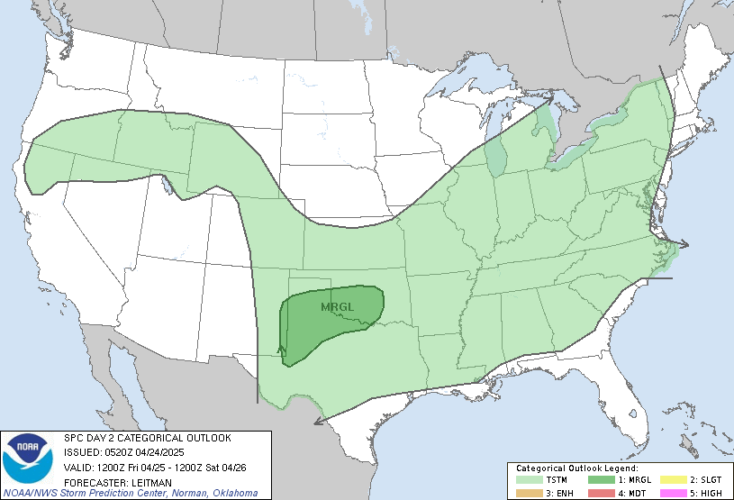
Saturday will see a cold front swinging into the area. Ahead of it… temps will warm into the low and mid 80s. IF the front is a bit later… that would mean we could make a run into the mid to upper 80s. The summer trend says that won’t happen. But… that’s about the only shot we have over the next several days for something like that to happen. That front will mean gusty winds and the chance for a line of showers and storms pushing in. The Storm Prediction Center has parts of the area under a risk for severe weather…
Some shower and storm action will hang tough into Sunday as well. I have mentioned for several days now that I thought we would be going into a very wet patter to close out July and start August. The models continue to jump on this scenario. Here is what the GFS is printing out over the next few weeks…
That’s a lot of water for a whole lot of the country!
Before I leave you… let’s have a little fun with a good Friday song…
Select Page
TGIF! 🙂
Good morning Chris and everyone. Have a great weekend. I’ll be checking back here regularly for your updates, Chris.
TGIF Indeed! Looking forward to what should be a pretty nice day.
MOrning Chris. Thanks for the update. So, your thinking is that we will get the rain before afternoon tomorrow, or late afternoon, depending on where you are in the state?
(Trying to make plans to mow tonight, or chance it until in the morning!) 😉
Either way, it looks like next week is going to be a wet one, for sure. We didn’t get as much out of the last system as others, so I am guessing we can use some rain, but, I am not sure we need four inches!
At any rate, have a good weekend!
Chris – I sent you an email yesterday afternoon – if you get a chance please read it and see if you can answer my weather phenom question! THANKS!
Everybody who gets their warning/radar data from the NWS web site, go to this page and leave your comments:
http://radar.srh.noaa.gov/
I personally think this site is terrible. It is far too slow to load for me and the overlying radar information is not detailed enough. And if there is a flood warning out for an area seeing the radar data is nearly impossible.
If the NWS thinks partnering with Google is the wave of the future, they have a LONG way to go.
well deserved vacation chris!!!!
squall line taking nosedive se toward ky from the chicago area, numerous severe thunderstorm warnings from this.
Do you know that it is the best time to get the home loans, which would realize your dreams.
Thanks for sharing this information. Keep up the good work.