Good Friday, folks. We have another steamy weather day taking shape across the bluegrass state. The steam looks to carry us into the coming weekend as our storm chances slowly climb. This will be ahead of a cold front marching in here early next week.
The amount of cool behind that front is in question… More on that in a bit.
Let’s start with the weather we have ahead of us. Highs today will reach the mid and upper 80s for much of the commonwealth. The sweat factor will be way up there and the only relief would come from some isolated showers and storms developing.


Temps for Saturday should be in similar territory, but some of the models are spitting out a slightly better chance at some storms.
The NAM is the most generous…

Storm chances go up from there as we head into late Sunday and Monday. That’s when a cold front moves into our region and that could touch off some strong or severe storms.
The air behind that will turn much cooler than what we currently have. The GFS and European Models are at odds on just how cool. The GFS suggests a decent dip in the jet stream with below normal temps…
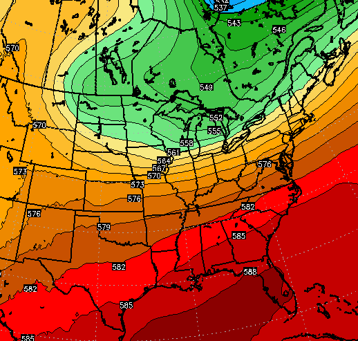
The European Model keeps much more ridging in place…
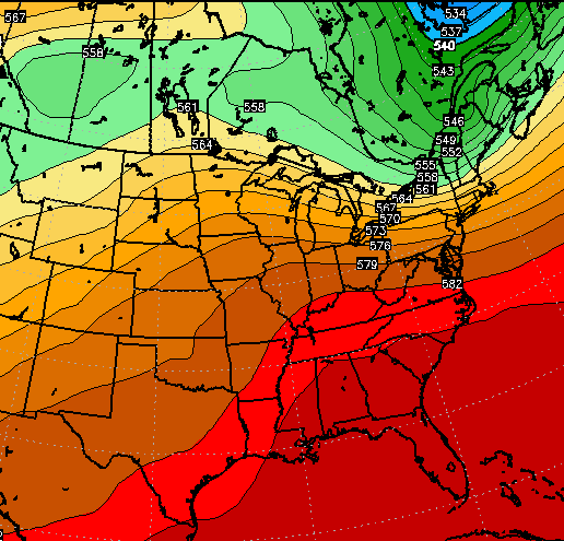
That would keep temps closer to normal with a quicker return to above normal readings.
On a wet weather note… the GFS has increased the 2 week rain totals around here…
 That’s a lot of the country with wet and stormy weather.
Make it a great day and take care.

Thanks Chris. We could probably use some rain now, as we’ve had several days of nice, dey weather. Pollen is getting pretty thick and could use a wet down. As for me, I’m watching it all from a hospital bed. Enjoy the weather! Have a fabulous Friday!
I figured the expected cool down next week was in a state of flux when I noticed on my local TV station last night they were predicting 75 for Thursday and this morning the call was 67.
After this run of 80’s I don’t want to put on a jacket again until October.