Good Saturday afternoon, folks. It’s another day of steamy air leading to, at least, scattered showers and thunderstorms. These storms will continue to develop through the evening and we will have to watch for a cluster of strong storms diving in from the north and northwest.
Those types of clusters will be possible through Sunday and that could lead to local high water issues. Damaging winds will also be possible.
A cold front moves in on Monday and slams the brakes on. That allows for waves of low pressure to develop along it…
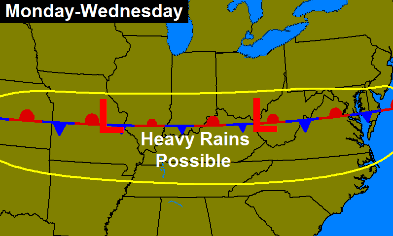
Strong storms and torrential rains will be possible through the first half of next week. That could lead to additional flooding problems for some areas.
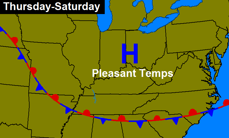
That boundary will then try to slip to our south for the second half of the week into next weekend. If that’s the case, some nice air should move back in…
If that front doesn’t push as far south and hangs around here even longer… Nothing good could come from that scenario.
I will have another update later tonight. Here are your tracking tools for the day…
Today’s risk area

Current watches

Possible watch areas 


Enjoy the day and take care.

Chris, I think that front will push south like you say by mid week. They always seem to go south eventually – at least I hope so……We do not need any more rain at all it’s ridiculous…Things couldn’t be any more green than they are now and usually its brown this time of year. I think it feels just awful outside right now…….Please mid 60s for highs and sunshine…
Man it feels 110 here in Corbin LOL…..MUGGY
Holy moly, it’s hot.
My new sod enjoys the rain very much…
Mother Nature can dump it all in my area and take away from anybody who doesn’t want anymore.
Well if nothing else at least parts of Southern California are seeing some rain today. There’s even a Severe Thunderstorm Watch out that way.
San Diego so far has received 1.03 inches of rain, the wettest July day on record there! Los Angeles has light rain. Crazy!
Thanks to moisture from what is left of Hurricane Dolores.