Good Sunday, everyone. Hot weather and scattered storms have taken up residence across the bluegrass state over the Labor Day Weekend. While this setup continues for a few more days, fall tries to throw a knockout punch to summer over the next week.
If you’re a regular reader of the blog, you may recall a declaration I made back in July. I said then that a post Labor Day hot spell would likely show up this year. While this is technically a littler earlier than what I said… it makes me feel like I have a pretty good handle on how the overall seasonal pattern is unfolding.
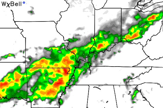
This hot pattern is about to get crushed as much cooler air moves in later in the week ahead. A cold front moves our way later Tuesday into Wednesday with showers and thunderstorms increasing. Here’s the simulated radar from the NAM on Wednesday morning…
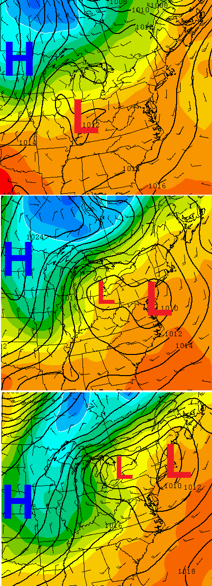
That front slows down across the region into Thursday as low pressure develops along it. The European Model slowly works that system through here into Friday. That would mean some more showers and storms hang around as the cool air blows in…
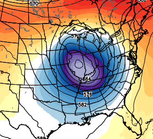
That kinda looks like something you would see in the winter months. You typically get that kind of look with a massive cutoff upper low like the European is showing…
That would certainly give us some nice fall temps for late week into next weekend.
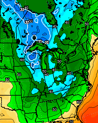
Beyond that, there’s an increasing signal for another big push of chilly air diving into the central and eastern part of the country. The GFS, which saw next week’s shot before any other model, is going bonkers late the following week. For good old fashioned “purely entertainment” files, here’s the morning of the 17th on the GFS…
Maybe the site of that will help you stay cool on this steamy day. Ok, probably not, but maybe a stray storm will. Track away…


Enjoy your sizzler of a Sunday and take care.

This is what I love about fall. Tracking the first cool fronts from a normally hot and humid summer. Patchy frost in KY late next week? Who knows, but unlikely anyway. I believe after this hot stretch ends this week, we will have one more decently warm stretch withing the next month. So all you summer fans, better enjoy the last few days to enjoy the pool and such. Winter is coming…..
Chris, now that it’s September. Is your winter forecast coming into better view? I’m still curious to see how it all unfolds with the El Niño and the warm waters off the west coast and Gulf of Alaska. Just wonder if one system will overpower the other…..
North Madison just got about twenty minutes of light and medium showers. Yeah! Plants say thanks 🙂
It’s not all that often you see t-storms doing what they are doing today in our area…….moving to the west!