Happy Halloween, everyone. Scattered showers and sprinkles are wandering across much of Kentucky. This action will carry us through the overnight before tapering off early Sunday. After that… another round of rain moves into parts of central and, especially, eastern Kentucky.
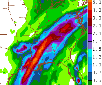
The NAM rainfall map through Tuesday shows some hefty totals in the southeast…
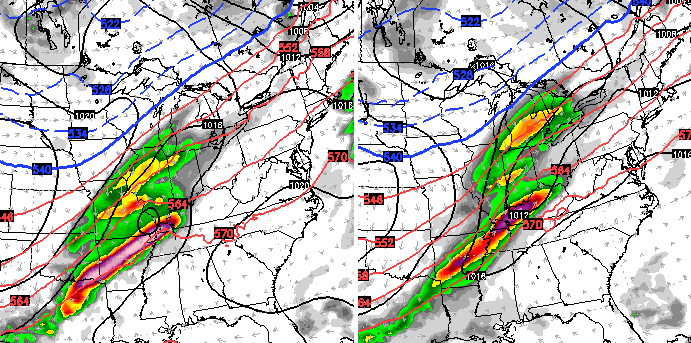
The European Model matches that scenario.
Temps really take off behind the rains with 70s for highs from Tuesday through Thursday. Showers and storms may increase as early as Thursday, but most of the action comes by Friday as a strong cold front moves in…
That could produce some decent showers and storms around here before much colder air comes in behind that for the weekend.
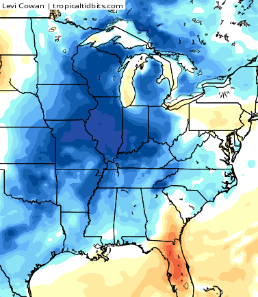
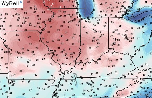
The Canadian Model shows some pretty chilly numbers…
The models continue to point toward a bigger amplification late in the following week. That’s something we will look at in greater detail later tonight.
Until then, let your friendly radars help you track the showers through the evening…

Happy Halloween and take care.

No offense but I wished you’d take the new map you’re using off. It jams up my computer and smart phone any time I load it anymore. Sometimes change isn’t good.
I like the new radar. I have zero issues with it change is good. PS not everyone is experiencing issues.
Agree with Joe
Site no longer works on iPhone or iPad – constant reloading issue.
Mayne not everyone is trying to access from a mobile device, prelude.