Good Tuesday. Our Election Day weather continues to look great and the weather for the next few days looks equally as nice. Mild and breezy weather will carry us through Friday before colder changes move in for the weekend. Get used to this back and forth setup.
Highs today will be in the 70-75 degree range under partly sunny skies. GO VOTE!
Low level moisture will be around Wednesday into Thursday with more in the way of some clouds and just the smallest threat for isolated showers.
Showers and storms will increase ahead of a cold front on Friday. That front sweeps through the region late in the day with gusty winds and a big temperature drop for the weekend.
Readings will rebound quickly into early next week as this fast moving pattern keeps rocking it. Another system approaches our region by the end of next week with a likely deeper amplification of the jet stream.
The European long range for the rest of November shows more of the same with some wild swings in just a few days time span…
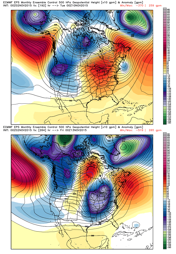
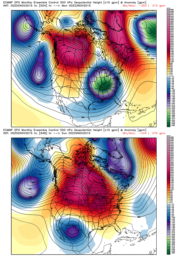 Check the dates on the above maps and you will see just how quickly we go from mild to cold and vice versa. All of this leads into an increasing potential for winter weather across the country over the next month. Snow totals from the European Ensembles and Control run…
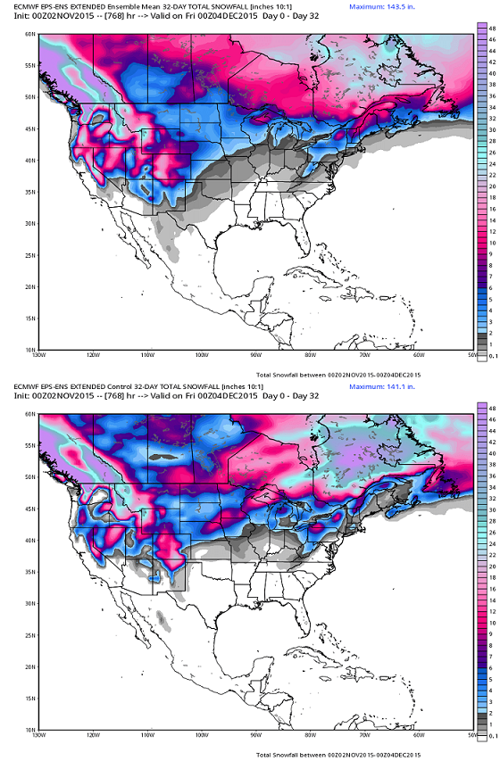 A big old grain of salt comes along with those maps, but gives you an indication the model thinks we have our chances later in November.
I will update things later today. Enjoy your Tuesday and take care.

Even though the map shows less than an inch, you never know…could get our first wet snow before December. The current November trend is definitely 180 degrees different from the record cold November we had last year. We had a few warm days last year, but not the back and forth that is predicted this November. Also, last November was mostly dry with no real measurable snow….just very cold. I remember recording 12 degrees at the house with some high single digits in the high elevations.
I ended up recording almost 1/2 inch of snow in Harlan for last November. We did not get the mesonet total nor do we ever as it is on top of Black Mt. Everyone tries to give Harlan the mesonet temps and precip, but at 4,000 ft+, there is virtually no population and no real similarity in weather compared to valley and lower elevation locations!!!
Wow!!!! Surprised to see a few locations hit 80 degrees today.
Upper 70s while working in Hazard today, verified by bank readings only though.
Currently, it is 69F at my house with an incredibly high November dew point of 62F! It should be a warm night for late fall standards…
I loved the weather out there today, but I am looking forward to some good accumulating snows.