Good Wednesday, everyone. Mild weather rolls on for the next couple of days, but a strong cold front is ready to put an end to that. That front arrives in town on Friday with gusty showers and thunderstorms and a seasonal brand of chilly air behind it.
There is still the chance to squeeze out an isolated shower or two today or Thursday. A mix of sun and clouds will be noted with temps back in the 70s.
A strong line of thunderstorms sweeps into western Kentucky Thursday night. Some of those storms could actually be severe with high winds the main threat. That line will then weaken as it works across the state on Friday…
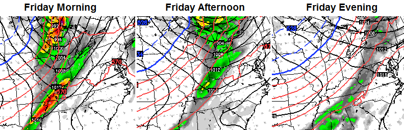
Winds will be very gusty as colder air sweeps in behind this slow moving front. That front may be just slow enough to keep a few showers going into Saturday morning…
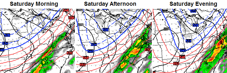
That’s a seasonal blast of cold air coming in for the weekend with highs generally in the low and mid 50s. Lows by Sunday and Monday may drop into the upper 20s.
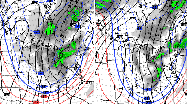
Temps will only slowly recover into early next week before another system works in by the second half of the week. The models continue to show another significant system…
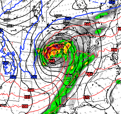
The GFS has another seasonal chill coming in behind that, but the Canadian Model is much colder with some nearby flakes flying…

The new European Model also shows a potent storm system leading to a bit of a wintry look…
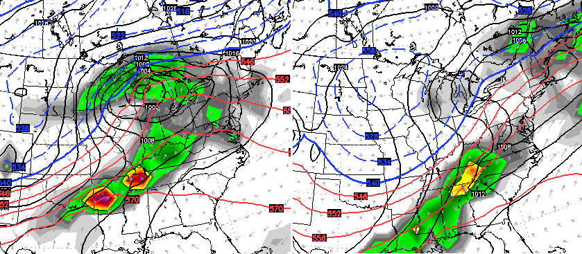
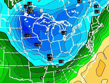
That’s some pretty good cold air swinging in behind that. Check out the 850mb temps diving in from the northwest…
The GFS continues to see a major amplification of the jet stream a few days after that…
You now have a few models suggesting our first chance for flakes coming sometime around the middle of the month. That fits well with the time I’ve been saying to watch for such a setup. One of my flaws early in the cold weather season is to see where a pattern is going, but rushing it along a little too quickly. See, I can admit I have a flaw…. But just that one! 🙂
See you later today for an update. Take care.

“One of my flaws early in the cold weather season is to see where a pattern is going, but rushing it along a little too quickly. See, I can admit I have a flaw…. But just that one! :)”
Replace “cold weather season” with bar, and “pattern” with redhead, and I’m right there with yah!
It will be interesting to see how far removed we’ll end up being on the first non-duster compared to the last 5 years.
I like to tinker with some of the older climate modeling software sometimes to see how they hold up today. I decided to spin one up last night, some of you old timers may remember, the Wilkinson 2.0 (from Wallace Industries). I really hope it’s not accurate because it seems to paint a gloomy climate picture going forward for the state.
Sort of like our current pattern of instability and back and forth swings in temps. Interestingly enough, it showed a pretty bleh picture for us no matter which different set of current conditions I put into it. ‘Course that thing was coded by people who thought their other dubious programming successes could be transferred to forecasting, so I don’t know if that makes it worse at looking that far forward or perhaps perfectly suited for it. 😉
Will CB’s winter forecast be locked and loaded anytime soon?
It usually comes out around Thanksgiving.
I don’t think Chris is going to give a lot of us what we want to hear about us having a snowy cold winter he’s just not throwing much out there he’s not throwing many hints and that’s just not looking good because when he see cold and snowy conditions he just can’t help but give us hints I hope I’m wrong