Good Saturday, everyone. A cold front continues to slowly work to our south and east today and it’s slowly taking the showers and clouds with it. This introduces a typical November brand of chill for the weekend. While this comes with drying conditions, a busy pattern kicks in next week with shades of winter showing up the week after.
Today starts with showers across southeastern Kentucky and low clouds for the rest of the area.

Skies will slowly clear up from northwest to southeast this afternoon into the evening as colder temps take over. Overnight lows drop into the frosty low and middle 30s with Sunday highs of 50-55. Skies should be mainly sunny.
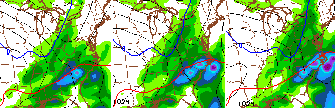
There is a disturbance in the Gulf of Mexico that has a low chance of becoming tropical over the next few days. Whatever it decides, that system works up the east coast later Monday and Tuesday and helps push some showers into central and eastern Kentucky…
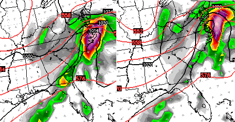
As that moves away, our focus turns to a deepening storm in the plains states. That system rolls into the Great Lakes Wednesday and Thursday and could make for a BIG wind maker all the way into our region…
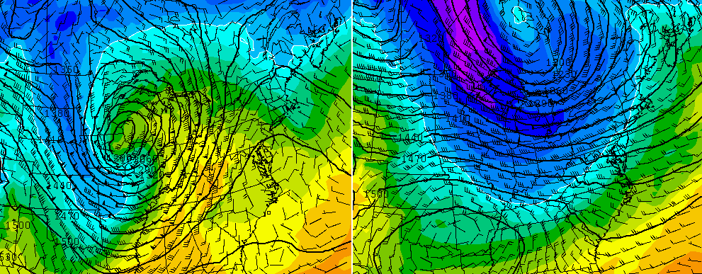
Much colder air comes in behind that system as it wraps up across southern Canada. In addition to the wind threat, showers and a few thunderstorms are a good bet.
The GFS shows another, colder system following that up a few days later…
With such a fast and chaotic flow right now, I suspect the models are rushing all this a little bit. As always, we shall see.
I will have another update later today. Enjoy the day and take care.

Thanks Chris. Thinking it may be time to drag out some of my long sleeved stuff for work the way this sounds. Curious to see if we get one more brief break around Thanksgiving or just a bit before. That in itself will go a long way toward deciding if I put up any outside decorations or not. If not, I’ll back up ten yards and punt. In any event it’s going to get interesting. Have a great Saturday everyone, and go CATS.
Thats when the weather will get possibly interesting (wintry) around Thanksgiving week.
I’m getting in the excited mode! Remembering when I was a little girl and seeing a few snow flakes on Thanksgiving day ☺️Thanks Chris ! Looking forward for the excitement on the blog … Have a great day folks…