Good evening, folks. The models continue to point toward the upcoming pattern we’ve been talking about for the rest of November. It’s a very active one that will take on more of a wintry look as we get deeper into the month.
After a chilly, but nice weekend, things change quickly on Monday. A system in the Gulf works up the east coast and throws rain into our region…
That’s from the European Model and it has the Canadian in line with it. The American Models appear to be playing catch up on that one.
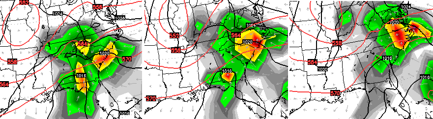
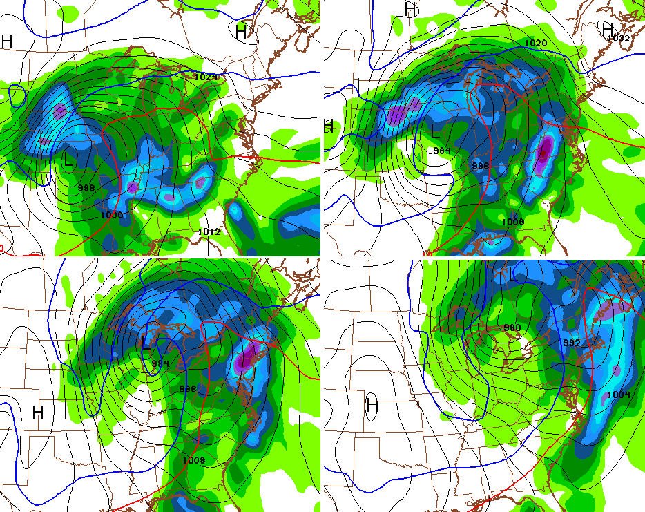
The storm system that follows that up for the second half of next week continues to look potent. A deepening area of low pressure swings from the plains states into the Great Lakes. This could bring us the potential for high winds and severe storms…
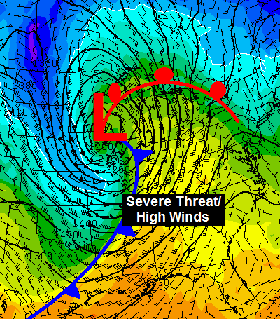
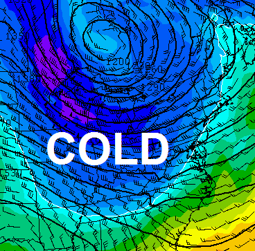
The air coming in behind that storm continues to look colder and colder…
Another deep storm system should follow that up a few days later. Here’s the morning run of the GFS with that system…
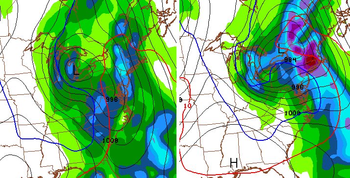
The afternoon run of the GFS went coo coo for cocoa puffs with that same system…
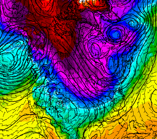
Overall, the models continue to point toward a colder pattern taking shape for the middle and end of November. Interestingly, the GFS is adamant on a very cold look across North America the week before Thanksgiving…
I want to repeat something I’ve been saying since the summer… there is NO true analog for the current El Nino and overall Ocean temp anomalies. None. If someone says this just like year XXXX… either stop reading or turn them off because they haven’t done their homework.
I will see you later tonight for the full update. Take care.

This winter is expected to create a new analog for an El Niño this winter. I’m so curious to what is going to happen this year, because this winter, most winter forecasts for any given location is unique. (Though, some aren’t forecasting and are just following a typical El Niño.)
Will be interesting this winter..We may scorch or have a epic winter or in between..As Chris said no analogs..Strong basin wide El Nino with heat all around the pacific..Never has happen before..Indian ocean has had several TC in a week..MJO has a wave that usually don’t happen in strong El Nino yrs..Indian ocean is hot..Interesting times indeed ..Regardless, snow or no snow will be interesting to see how things unfold..Any kind of blocking with a STJ could be epic or overwhelm with warm air..Uncharted waters this set up..