Good Sunday, everyone. The super active November pattern I’ve been talking about is just about upon us, and it’s looking pretty darn wild. Some major amplifications in the jet stream are on the way for the rest of the month. Buckle up for a bumpy ride.
The first system to impact our weather comes Monday into Tuesday. As expected, the American models are now on board for a decent slug of rain coming through here. Funny how that happens. 😉 The latest rainfall from the NAM is probably a little overboard, but you get the idea…

That’s a couple of chilly and nasty days showing up.
A much bigger storm develops in the plains and rolls into the Great Lakes Wednesday into Thursday. This is a big ticket event with the threat for high winds and severe weather ahead of it…

We really have to watch that setup late Wednesday into Wednesday night. There’s a lot of wind just waiting to be transported down to the ground.
The cold air behind that waits to really surge in here Friday and Saturday…

You’ve heard me talking about a “strong signal” for some huge storm systems around the middle of the month. The above system fits that, but the pattern may top that with a few more behind it.
The GFS continues to go wild with that next system…
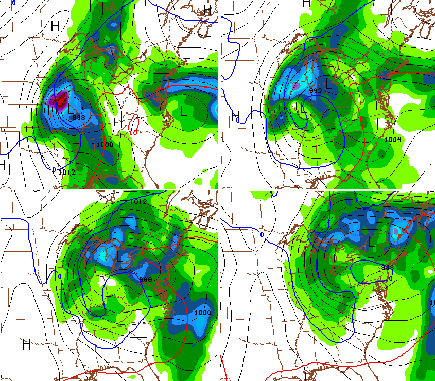
The Canadian Model is certainly in agreement…

Look at the 500mb forecast map with this bad boy…
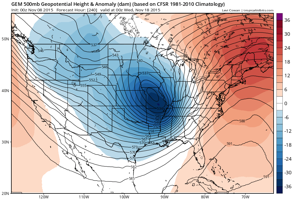 That could get really, really wild across much of the country. And, I don’t think it ends there. This is a pattern growing colder with ample storm systems for fun and games through the rest of the month and into December.
I will have another update later today. Enjoy it and take care.

I can’t wait for all of the fun to begin! My two year old has been asking, “When is it going to snow?” As a teacher we have been learning about weather and looking at some of your blog posts to discuss weather models and the role of a true meteorologist vs. someone just reporting the current model data.
Thanks, Chris!
Bring the roller coaster. I always like this transitional time of year and it looks to start firing soon!
Let’s get this “NINO” party started
Bring on the snow!!