Good Thursday, everyone. Windy and chilly weather will dominate the day across the bluegrass state of Kentucky. Our strong front continues to push well to our east and now we focus on some colder air moving in for the weekend. While the weekend looks calm, don’t let it fool you. This pattern continues to run in supercharged mode.
I have a lot to show you, so let’s get after it.
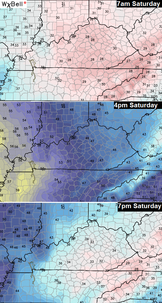
Highs for many Friday into Saturday will stay in the 40s with breezy weather remaining. It’s one of those temp setups that will feature rapid drops after sunset. Watch the temperature progression on Saturday…
Skies will be mainly clear through Sunday. That’s when we focus on another massive storm system slowly rolling across the southern plains. This one gets cut off from the main flow and that puts our region in the line of fire from rounds of rain with some storms possible. Winds should also be gusty as this system wraps up and lifts northward…
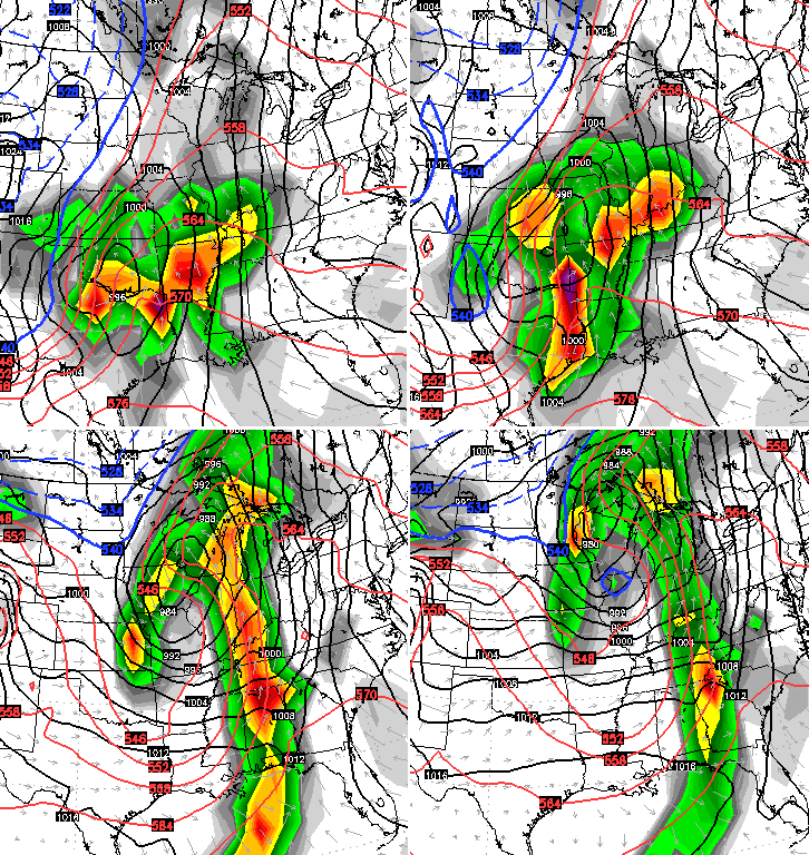
We will have to watch and see where the upper level low with that storm tracks. Wherever that tracks will likely see snow. Right now, that appears to be to our west.
That low then helps carve out a deep trough across the plains states next weekend. Very cold air with that then works eastward toward our region and we will have to see if that trough can crank out another potent storm system. The European Model continues to advertise that possibility…

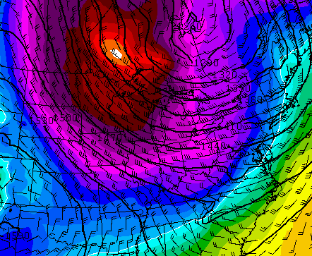
A developing low across the southern Appalachians with cold air diving into the region from the northwest. That would certainly be fun to track if it’s real.
At that same time, the GFS has the cold but not the storm…
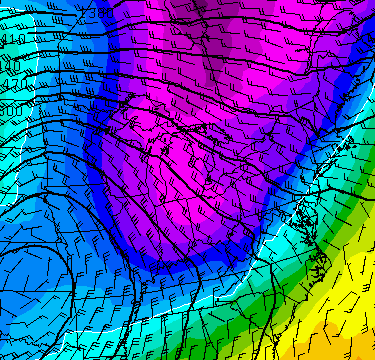 That takes us to the start of Thanksgiving week. The GFS is the only main operational model that goes out that far. Obviously, the farther out in time, the less reliable. That said, the model can give hints and trends. Right now, it’s hinting at a wintry look across much of the country…
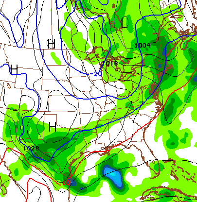
The final winter forecast from the JAMSTEC is out and continues to show the same thing it’s been showing for the past several months…
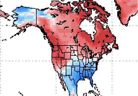
That seasonal model shows areas from the plains to the mid-atlantic and points south with a colder than normal winter ahead. If you look closely, you can almost see how it tries to connect the colder plains anomalies to the colder anomalies in northwestern Canada and Alaska. That’s a new wrinkle from previous runs and may be the model upping the ante on a few arctic shots getting involved in the pattern.
I will update the active pattern ahead of us a little later today. Enjoy your Thursday and take care.

That rain event last night completely fell apart for us. Aside from a few drops on the windshield, you wouldn’t even have known it had rained.
Another testament to the power of Rain-X. Apply it when anticipating rain and poof, no rain.
https://kyweathercenter.com/wp-content/uploads/2015/11/JMA-1.png
Man, that is not a good look if you’re needing snowfall to repair the dwindling snow pack in the Sierra Nevada as your major water resource.
Even as a snow lover, I’m still not wanting it yet. Let’s hold off until Dec. Snow during Thanksgiving just doesn’t look right.
Snow looks good any time of the year. 🙂
63 and sunny here in Williamsburg
Just a few drops of rain here in Knott co this morning. Sunny and 64 now. I’ll take all the nice days we can get this time of the year
Weather nation posted domething about el nino being strong this winter still, showed our area as dry. They had us in warmer then normal earlier on a map they showed. Blowtorch is coming i guess , according to them
Blowtorch…..let’s not go there. LOL
*something, not domething. Typo
Dry in Harlan…0.00 no measurable precip today from that lousy wind maker. I hate this current weather pattern and am ready for some changes before we get a lot of forest fires.