Good Friday, friends and neighbors. We’re wrapping up the work week with a seasonal chill in the air across the commonwealth. This chill grows a little colder tonight into the start of our very nice weather weekend. Soak that up because another big storm system rolls in here early next week. That may be the one to finally get the winter ball rolling.
Highs today will reach the upper 40s to low 50s across many areas as gusty winds continue. Skies will stay partly to mostly sunny. Expect a quick temp drop into the 30s this evening with mid and upper 20s later tonight.
Saturday and Sunday will feature mainly clear skies with temps in upper 20s to start and upper 40s and low 50s to end.
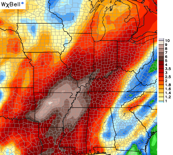
A big storm system then gathers steam across the Mississippi Valley on Monday. That’s going to be a monster of a storm that SLOWLY works across the region from late Monday through Thursday. Rounds of showers and storms will be common, but it’s not going to rain the entire time. Some periods of mild and windy weather will show up between the rains.
Rainfall totals could be excessive…
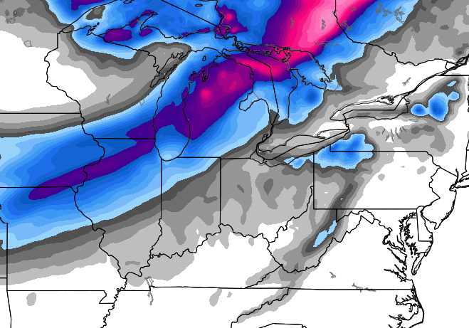
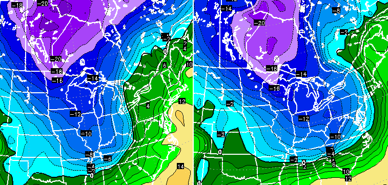
Colder air comes in behind that departing beast. The Canadian Model is brining a second system through here next Friday and Saturday and shows some Ohio Valley snows…
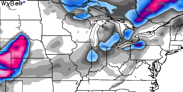
The European Model is doing the same, but is stronger with this potential system…
That’s certainly an interesting look that wouldn’t have to correct too far east to give us more than just the first flakes.
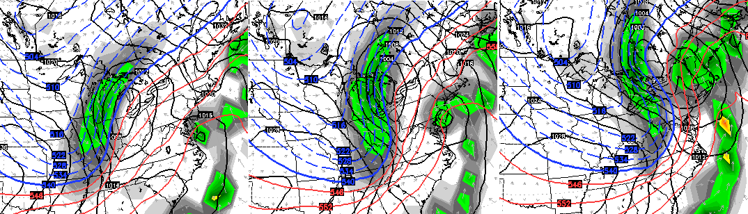
Check out the cold air with that bad boy…
That would lead us into Thanksgiving week and the potential for another winter weather system sweeping across the country.
The final winter forecast from the NASA seasonal model is out and shows a colder than normal winter around here. Watch how the cold anomalies grow with each passing month…
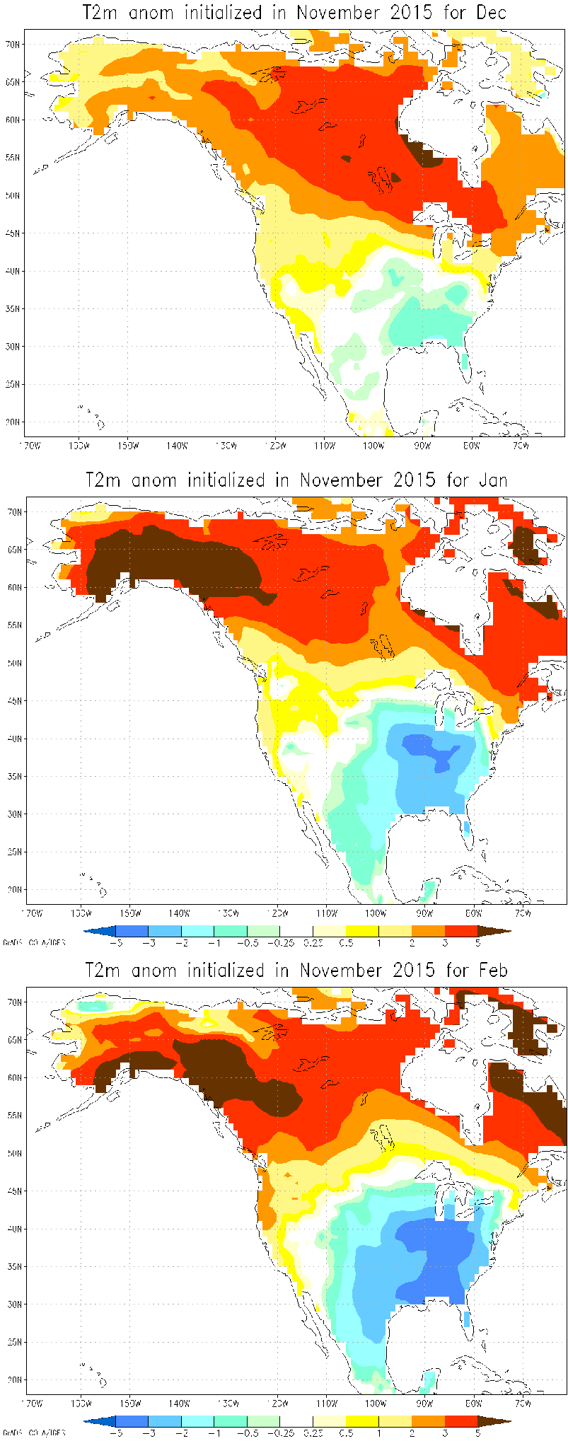
Throw in an active southern storm track and things could be fun this winter for a lot of folks.
I will have another update coming your way later today. Enjoy the day and take care.

It’s hard for me to get overly excited with the SE ridge still forecast to be somewhat entrenched for the next few weeks. The quicker the SE ridge breaks down the happier us snow lovers will be.
You will like what the Euro is spitting out today..Big Greenland block around the corner..
Wow!!! Looks pretty wild. Thanks, Chris.
It would be nice have snow on thanksgiving day.
Speaking of snow on Thanksgiving, who remembers watching this wintery Thanksgiving back in 1993……in Dallas Texas of all places?! 😉
http://www.youtube.com/watch?v=OriB0ihBedY
Everyone knows that it is not going to snow until which point in time Rolo and his Goat say it is going to. And that is all I got to say about that!
Looks pretty wild except for the rainfall projections in far Eastern KY where we (specifically I) have only recorded .62 for the month of November thus far:(
Only predicting less than an inch next week stinks!!!
Hoping for some cold and snowy changes soon:)
The last two systems have been weaker than expected, so maybe we will go three for three 🙂