Good Saturday, everyone. We’ve set the stage all week for the possibility of some big time warmth this weekend. That weekend is here and record highs could get smacked around today and Sunday. This will be followed by high winds with some winter lurking late next week.
Highs today and Sunday will range from the upper 60s to low 70s in many areas of the state. I can see some areas nearing 75 with enough sun. Bye- bye records!
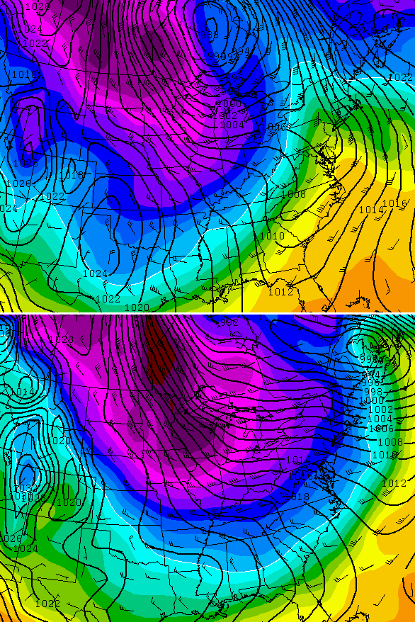
Our big storm system works in from the west late Sunday into Monday. Check out the structure of this thing…

Showers and some thunder work across the state during this time with heavy rains. Winds are the main player with this bad boy. 40mph to 50mph gusts will be possible. It might be a good time to secure those Christmas lights and displays. 😉
A wintertime cold front arrives late Wednesday into Thursday. This is likely to produce some kind of wave of low pressure along it, but we won’t know much about that for a few more days. This is a deep trough digging into the eastern part of the country…
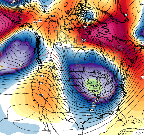
That trough is filled with some very cold air engulfing the central and eastern parts of the country…
 The flow alone with this should be able to touch off some snow flurries and snow showers by Friday or Saturday.
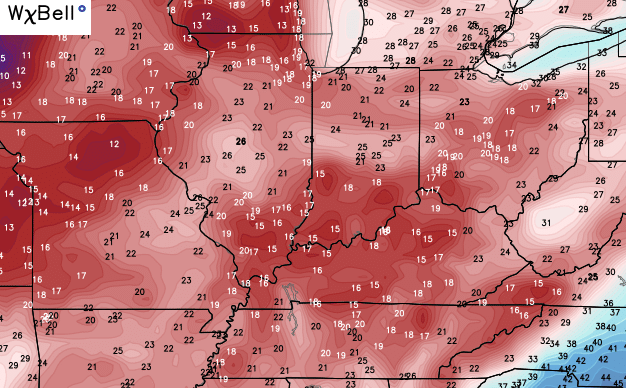
Temps on any given morning will be dependent on the amount of clearing, but we could see some pretty cold numbers show up. The Canadian Model is deep into the teens…
You gotta love the extreme swings over the next week. Record highs in the 70s with teens possible less than a week later. On a related note… I’m kicking myself over my WKYT bold call for the winter. I’m two for two over the past few winters and was THISCLOSE to putting a record high temp as the bold prediction for this winter. Grr!
I guess we will just have to settle for the wind driven winter storm later this winter. 😉
Another update comes your way later today. Enjoy the warmth and take care.

Chris, do you feel now that this winter isn’t going to be much of a repeat of the last couple of ones?if so what has changed? Really enjoy the blog keep up the killer work you do for us
Do you think there is a possibility of a derecho with this storm system?
Thanks Chris. Looks like we transition from fall to winter in a hurry! its good get these heads up days ( and sometimes weeks) ahead. Sure does make planning things a bit easier. Already put extra tape on the decorations outside. Hope everyone has a great Saturday! Go Cats!
Looks like winter, feels like a balmy spring day. Freakish for sure.
I’ll enjoy this anomaly and hope for some cold stuff down the pike.
Thanks Chris and all who visit the blog.
It’s nice to have morning low temps in the upper 60’s nice August morning were having in December.
“Windows driven winter storm” = Blizzard. (OR catastrophic ice storm, which we DO NOT WANT.) At least that is how I interpret that line.
I’m.in Ashland and its 75 degrees already!
The damage has already been done for the monthly December average. Even if we get back below average beyond next weekend, I don’t think even a couple of zero degree nights would be enough to bring the monthly average back to normal. At best, the colder weather lurking MIGHT keep us from having a top 10 warmest December, but I still think we will land in the top 10!!!
Already topping 70 in Harlan before noon!