Good evening, everyone. We have a busy few weeks of weather ahead of us, and it all starts with the possibility of strong or severe thunderstorms for Groundhog Day Tuesday. From there, it’s all about the potential for harsh winter weather.
I really have no changes on the overall progression of the severe weather potential for Tuesday. The Storm Prediction Center has much of the state in the risk area…

In looking at the latest data, I’m wondering if that shouldn’t be moved a little farther east. A line of thunderstorms will explode Tuesday afternoon into the evening and race eastward across our region. Damaging winds continue to be the primary player, with isolated tornadoes also a threat.
Colder temps slide in for the rest of the week with the potential for a harsh winter pattern to take over from there. A system will dig in over the weekend and could bring arctic air and some snow. You can see the big trough showing up on the GFS by Sunday…
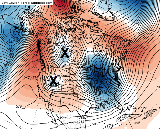
Notice the two spots I’ve marked with an X diving in behind that trough. This is the setup I’ve been saying we need to watch for in the February 7-11 time frame. The weather pattern across North America is skewed toward the extreme. That point is hard to argue given the record warm December followed by a record snowstorm and the upcoming severe weather threat.
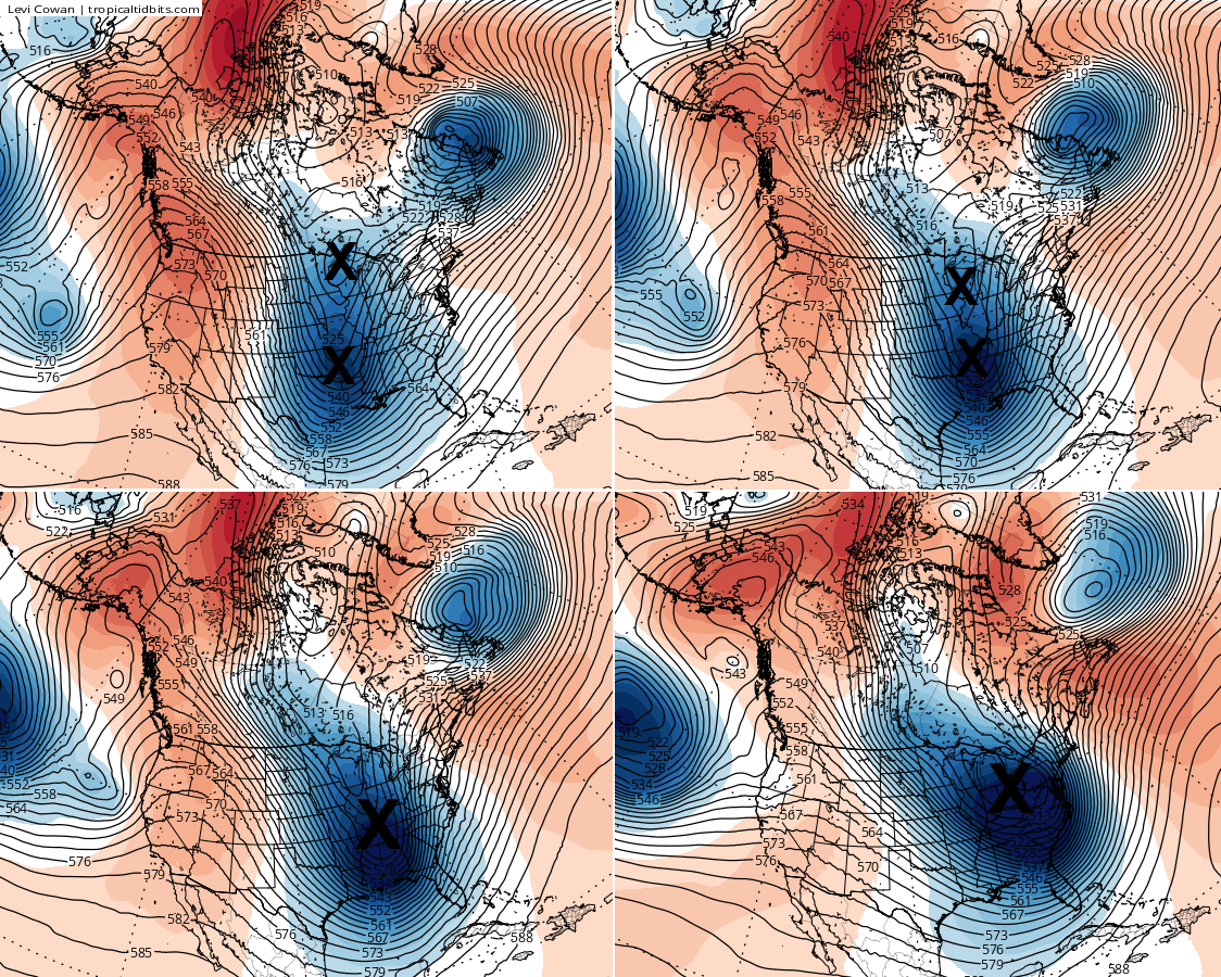
The early morning run from the GFS shows a very extreme winter weather solution. Watch how those two pieces of energy merge into a monster…
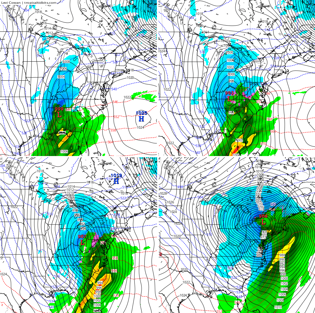
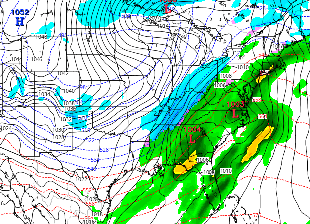
Here’s the surface from that particular run…
Granted, I am showing the most extreme solution from the GFS. Other runs have not been nearly as extreme, but it isn’t like that option is totally crazy given the signal showing up.
Do other models have the same signal? Yep.
The European Model…
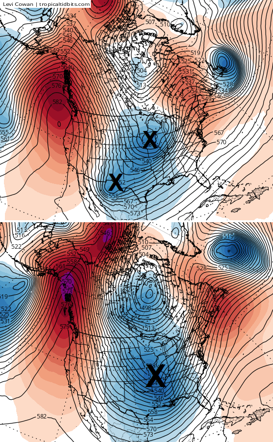
The Canadian Model…
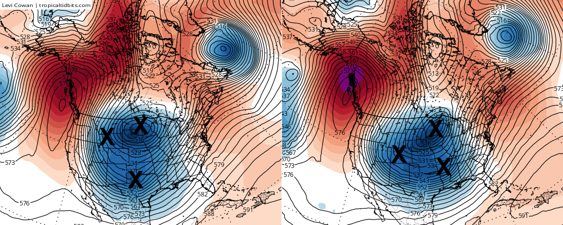
Now, we’re talking about a signal from the models that’s a little over a week away. Don’t take any one model solution or setup and run with it. That’s why I keep focusing more on the 500mb plots… That’s much more valuable in picking up on something from this far out than looking at surface maps. I included a few just to illustrate what the models are seeing.
All of this may turn out to be nothing, but the force is strong with that setup from more than a week away.
I leave you with your tracking toys for tonight’s shower(maybe thunder?) action…

I’ll see you tonight for the full update. Enjoy the evening and take care.

Thanks Chris for all that you do! You da-Man!!!
When I see those Harsh Winter Maps I hear Karen Carpenter Sing…”It’s Only Just Begunnnnnn.”
CB…you hit the last one a week away, actually two weeks, so why not this one. Bring it.
Thanks for the update and the model explanation with the Xs. That really helps us laypeople understand more of what you weather experts are talking about. Pretty neat stuff.
And, as has been mentioned on here before, you’ve got a great track record at sniffing these out.
Winter super storm X – I like it! Well, maybe not – but anyway…
Thanks Chris. Appreciate all you do. Do I want to see more snow? That would be dandy. But we are at least a week away, so, let’s just wait and see what the models tell you as the time frame gets closer. Have a great Sunday evening all.