Good Monday afternoon gang. Torrential rain producing thunderstorms caused all kinds of problems across parts of eastern and southeastern Kentucky this morning. 3″-5″ of rain feel in some areas creating serious flooding for some.
Middlesboro in Bell County was especially hard hit with some of the worst flooding they have seen in the past 20 years…
Many other areas were hit just as hard. The good news is the rains have now ended across the bluegrass state. The bad news… showers and thunderstorms will return later Tuesday into Wednesday and Thursday.
This happens as a very strong cold front swings toward the state from the west. Severe thunderstorms and more torrential rains will be possible around here as this active pattern rolls on.
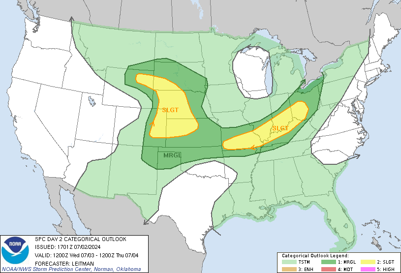
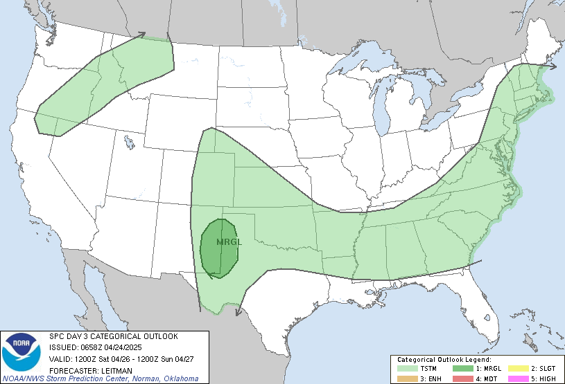
Here is the latest severe weather threat from the Storm Prediction Center…
Tuesday
Wednesday
Before the week is over… most areas should pick up another 1″-2″ of rain with locally higher amounts. In retrospect… the dry spell over the past few weeks wasn’t such a bad thing, was it? It gave us a nice drying out period from the record setting soggy spring we had.
Either way… this ain’t last summer folks. ![]()
Have a great rest of your day and take care.
Select Page
We didnt get hit as bad as some but we did get 2 inches of rain today. Water is standing in the garden and washed some of our driveway but those things can be fixed. Praying for all of those affected by the severe flooding today.
Do you think July is going to be this wet and stormy? We can’t seem to get several dry days in a row.
Nope, it ain’t last Summer at all. Last June brought 5.52″ of rain here in the LEX area and July brought 5.56″. We’re not even close to that kind of rainfall yet. It’s DRY around here compared to this time last year. 😉
I agree 100%. SOME areas have had ample rainfall but the LEX metro area is running behind for June compared to normal and last year. Chris is only presenting one side of the story. Just because it rained hard in Northern, Eastern, and Southeastern KY doesn’t mean the entire state saw ample rainfall.
If we don’t get more rain in the LEX area soon, it WILL be last summer all over again.
This isn’t the “Kentucky” Weather Center and not the Lex Metro Weather Center. 😉 The entire state saw ample rain over the past few days!
As far as presenting one side of the story… not sure what you are getting at here. Are you suggesting I am skewing the data? Lexington is more than a foot above normal for the year to date and is a half inch below normal for June.
Those are the facts and simply cannot be disputed. Just because we go two weeks without much rain doesn’t mean we are turning into dust.
The pattern is TOTALLY opposite of last summer and I expect it to stay that way. My summer forecast hopes it does too. 😉
Things here in Middlesboro got bad today. Since last Oct we have seen 2 floods and 3 funnel clouds with one touching down. It rained 5.7″ here from 3am to 7am this morning and 8.5″ since Sat night.
Were you not in the state from the end of May until this week. It was super dry for like 3 weeks.
Jake