Good Saturday, folks. It’s a very active weather day across Kentucky as rounds of showers and thunderstorms push across the region. This setup is bringing the increased threat for flash flooding, flooding, high winds and even a few severe thunderstorms.
This is a three-pronged attack:
Flooding: Rounds of heavy rain and thunderstorms will cause flooding and flash flooding issues to develop through tonight. A general 1″-3″ of rain will show up, with thunderstorms potentially producing higher amounts. There is the potential for significant flooding to develop within those thunderstorms.
High Winds: With or without thunderstorms, high winds will become an issue this evening into tonight. Gusts may reach 50mph at times, leading to some issues. With the wet ground, trees may be uprooted.
Severe Storms: The greatest threat for severe storms is across the western half of the state from late today into tonight. Damaging winds are the main threat, but the amount of shear suggests the potential for a few tornadoes to spin up.
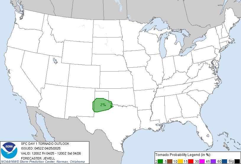
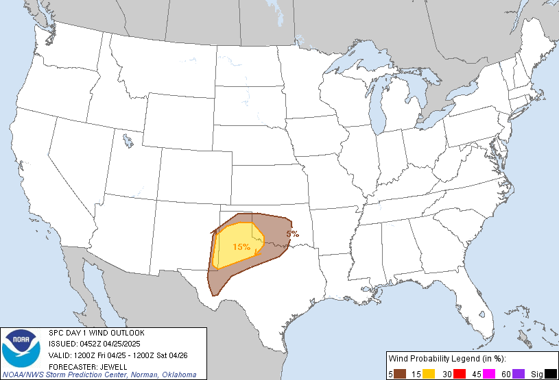
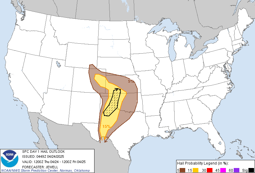
Here’s the current Severe Weather Outlook from the Storm Prediction Center:

Tornado Outlook

Damaging Wind Outlook

Large Hail Outlook

I will have updates later today. Until then, here are your tracking tools for the day…


Have a good one and take care.


Now the wicked rain arrives! So far, I am only at 1 inch even for the entire event but heavy rain is just starting to move into Harlan and the true warm front is slowly exploding with heavy rain/t-storms to my SW. I could easily get a quick 1 or more inches out of this as rainfall rates are high. Here comes the flooding!
WPC has highlighted most of Central/East TN and far SE/Southern KY for life threatening flash flooding through noon. HRRR is going nuts with several inches of rain.
Andy, Bobt, Coffeelady, Troy and any other regular SE KY/TN viewers need to stay safe today as I expect severe flooding issues to develop from this mess!
Terry it is absolutely pouring the rain here and that is not a good thing. It wasn’t a wash out yesterday but if did rain all day so the ground did not get to dry out any. Ive never seen as much rain as ive had over the past 1.5 years. This is misery.
I’ve already had as much rain since midnight than the entire day yesterday.
Dang, Knox is getting creamed right now. Looks like rainfall rate is over an inch per hour….hope that batch moves out quickly! I am almost at 2 inches for the event now but an inch plus has fallen since midnight and mostly after 3 AM. Water is rapidly rising now. I bet we at least hit moderate flood stage on the Cumberland by tomorrow morning, you may hit major!
Gosh Terry, I hope that MAJOR FLOODING doesn’t happen on the Cumberland River. You all stay safe. Storm rain total so far 2.45 inches here at my place in Taylor county, not that far from Harlan. Take care all.
At this rate and unless the pattern changes significantly in spring, we may reach our annual average rainfall by the 4th of July. I am close to 17 inch mark year-to-date; can you believe it?
You can’t talk about snow much in Kentucky, but it would sure be an active board if people were interested in floods. Not hearing CB talk much about any chances of snow and time is running out.
Seems we be done this winter.
Thanks Chris. Already shaping up to be a very wet and interesting day weather wise. We’ve had quite a bit of rain overnight but I’m not sure how much. I’d wager about an inch or so. And we had rain before that but it was just steady and not a downpour. Reading the blog and looking at the radar are about as depressing as it gets. 😉 Everyone stay safe and dry today. Be careful for deep water and for rockslides. Have a great Saturday.
LOL! I think CB meant 24 to 30″ of rain and not snow this winter. He’d be a genius then 🙂 Richmond has about 5″ total. Trying to see if that would be the lowest snow for a winter….
I am still within range of a record low total snow season here in the valley of Harlan. Only 3 inches for season-to-date. Last year, I ended up with 8 inches total. 2016-2017 was only 5.5 total and was one of the top least snowiest. At least we had decent 2014 through 2016 winters for snow:)
2012 is still the least I can remember in my lifetime and I was right at 4.5 inches!
Terrible winter bust but life goes on. Let’s hope spring is a little less rainy but current outlook looks to keep flood threats a coming!
The river is on the up. speaking of snow I have yet to receive an inch for the entire season.
It looks like a major flood event for us Andy. I could see us both easily topping 3 to 4 inches of rain total, especially tonight.
Stay safe!
Is the system flow more south now? Seems the storm threat contracted some. Also went from 2 to 4 to 1 to 3 for rain. Are my comprehensive reading skills off? Looks like Richmond is not as wet expected….. If my reading is not off.
Streams are running a good amount higher this morning compared to 24 hours ago here in Pike County…let’s hope we get thru this weekend without significant area wide flooding.
Where’s Russell??? Tell em Russell haha… where are the GFS models that showed winter for the end of Feb, beginning of March?? Haha
Been fooled too many times this winter already so it’s not just Russell…..no one bought that scenario.
Models have been horrible with the cold all year. It’s been showing two weeks out since mid-December and never shows up. Outside of those three cold days in January winter has been missing. I think it might of even hit the 60s only a few days after the almighty “Polar Vortex”
Polar Vortex never reached SE KY. I only reached one night at 13 degrees. It was a joke south of Lexington.
Some would say it wasn’t a polar vortex but that’s another discussion that I don’t have enough knowledge about to have.
What ever entity it was, it was still brutally cold (if for a relatively short time) for the northern plains of the USA and central Canada. Brutal even by the standards of these areas, with a few all time records that were broken.
I’ve have not heard any word of the second wave of bitter cold/snow being a polar vortex or not. This second cold wave has of course really been clamping down on the western US with the rare snows in Seattle, Portland OR, Las Vegas, Scottsdale AZ, Pasadena CA, etc.
That’s okay, you can ride something just as serious at Kings Island 😉
Hey Jim B I’m present and accounted for LOL I think everyone knows the snow is likely gone for good….in its place is the rain train ….Paducah has to keep installing more flood gates in the floodwall as the Ohio Crest keeps getting revised upward. Everyone be safe today…turn around dont drown…and since it’s been a few soggy days since I said it.. “RIP WINTER”
If anyone can do so safely get out and snap some pics of your area flooding. I did Wednesday.
I guess if there’s any good news it looks like a lot of northern Kentucky won’t see nearly as much rain as was forecast.
So far I have had 0.95 before that small hole appeared over Knox County.
I gave up on Winter and snow comments a few weeks ago. But have viewed the blog some. I feel bad for folks in southern WV and KY. With all the rain, the rain seems to be training over the same areas. However I have lucked out in the tri-state with only a small amount of light rain, just enough to keep everything wet. My rain chance today has now been lowered to 50% today. I wish this 15 month rain pattern would break down.
I am closing in on 12 inches of ALL rain for February Jimbo! This may be the first time in my life with not even a trace of snow within the month of February! I should have my wettest month ever by this evening or overnight.
Event total is 2.07, but most has fallen since this morning out of the total. Still raining and I believe tonight does SE KY in with at least moderate flooding, if not major.
Unbelievable! It’s amazing there has’nt been any major flooding. The same goes for my area although you are way ahead of me this year. The rain for me has been constant but spaced out just enough to avoid flooding. I think this has been the most pathetic dismal Winter of my lifetime even worse than the last two. I was going to say the only way to go is up with snowfall next year but I could still get less than 4 inches next year and I probably will which would be worse.
Yeah, if we get a quick 1 to 2 inches tonight with the front real quick, I expect at least a moderate flood event here. That is a scary look out to the west but at least it will be fast moving. Just depends on how much we get tonight as we are near flood stage here now but already above flood stage on down stream of me towards Williamsburg.
The flooding will be minor especially compared to what Knoxville Tennessee is presently experiencing. You guys have been thinking worse case scenario for weeks y’all going to have panic attack’s. Flooding has been a concern it seems like for months. I get the rivers are swollen and in minor flood stage and some maybe in or bordering moderate flood stage but in general most have fair well.
You said it right. 15 months of soaking rain. Didn’t even get a real summer last year. I’ve got some plants starting to come up now but I think all the rain last year may of rotted out some of the spring blooming ones that came up last year. Will have to wait and see but they looked done for by last fall with all the rain.
We had a lot of rain here in Nelson Co. too last year, and looking at my garden, I’m going to need a good load of fill dirt-it had one low place that held water (but made my big tomatoes kick butt, for once! lol!), but now it looks like I have a pond back there. No rain this morning, but looking to the west/sw right now, it’s coming!
This rain event hasn’t fully stopped here for more than a few minutes at a time since 36 hours ago when it started, all be it, the rain was light yesterday but steady to a little heavy today.
Nashville has finally been getting a little break from the rain, at least for the short term.
Skies remain cloudy, but in one sense that’s a good thing. Sunshine could really create more instability and further fuel the severe t-storm/tornado risk.
The SPC just issued a new update for today. Roughly the same as before.
The highest tornado and damaging wind threats continue to be in western Tennessee (and northern Mississippi). The Tornado Watch currently over much of western Tennessee includes the possibility of some stronger tornadoes and some stronger straight line wind gusts
Instability and shear continue to be more limited across most of Kentucky (the closest exception may be the general area over I-65 near the Tennessee line) and over eastern Tennessee thus a lower threat. Still, the tornado/damaging t-storm wind threats are by no means zero in these areas.